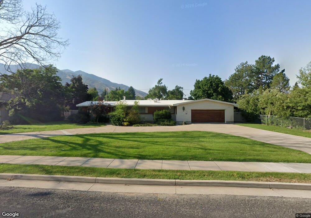
1636 E 1030 N Logan, UT 84341
Hillcrest NeighborhoodEstimated Value: $496,000 - $554,375
Studio
--
Bath
1,624
Sq Ft
$330/Sq Ft
Est. Value
About This Home
This home is located at 1636 E 1030 N, Logan, UT 84341 and is currently estimated at $535,844, approximately $329 per square foot. 1636 E 1030 N is a home with nearby schools including Hillcrest Elementary School, Mount Logan Middle School, and Logan High School.
Ownership History
Date
Name
Owned For
Owner Type
Purchase Details
Closed on
Aug 1, 2025
Sold by
Wolf Creek Capital Llc
Bought by
Pope John
Current Estimated Value
Home Financials for this Owner
Home Financials are based on the most recent Mortgage that was taken out on this home.
Original Mortgage
$416,000
Outstanding Balance
$413,480
Interest Rate
6.81%
Mortgage Type
New Conventional
Estimated Equity
$122,364
Purchase Details
Closed on
Nov 8, 2024
Sold by
Wayne And Gene Rich Revocable Trust and Rich Jeffrey Scott
Bought by
Wolf Creek Capital Llc
Purchase Details
Closed on
May 17, 2010
Sold by
Rich Wayne R
Bought by
Rich Wayne R and Rich Gene M
Create a Home Valuation Report for This Property
The Home Valuation Report is an in-depth analysis detailing your home's value as well as a comparison with similar homes in the area
Home Values in the Area
Average Home Value in this Area
Purchase History
| Date | Buyer | Sale Price | Title Company |
|---|---|---|---|
| Pope John | -- | Hickman Land Title | |
| Pope John | -- | Hickman Land Title | |
| Wolf Creek Capital Llc | -- | Hickman Land Title | |
| Wolf Creek Capital Llc | -- | Hickman Land Title | |
| Rich Wayne R | -- | None Available |
Source: Public Records
Mortgage History
| Date | Status | Borrower | Loan Amount |
|---|---|---|---|
| Open | Pope John | $416,000 | |
| Closed | Pope John | $416,000 |
Source: Public Records
Tax History
| Year | Tax Paid | Tax Assessment Tax Assessment Total Assessment is a certain percentage of the fair market value that is determined by local assessors to be the total taxable value of land and additions on the property. | Land | Improvement |
|---|---|---|---|---|
| 2025 | $2,272 | $293,900 | $0 | $0 |
| 2024 | $235 | $293,900 | $0 | $0 |
| 2023 | $2,448 | $292,250 | $0 | $0 |
| 2022 | $2,251 | $251,000 | $0 | $0 |
| 2021 | $2,075 | $357,490 | $75,000 | $282,490 |
| 2020 | $1,885 | $292,300 | $75,000 | $217,300 |
| 2019 | $1,971 | $292,300 | $75,000 | $217,300 |
| 2018 | $1,673 | $226,536 | $75,000 | $151,536 |
| 2017 | $1,462 | $104,665 | $0 | $0 |
| 2016 | $1,516 | $104,665 | $0 | $0 |
| 2015 | $1,517 | $104,665 | $0 | $0 |
| 2014 | $1,372 | $104,665 | $0 | $0 |
| 2013 | -- | $99,945 | $0 | $0 |
Source: Public Records
Map
Nearby Homes
- 1133 N 1520 E
- 1512 E 1260 N
- 1782 E 1250 N
- 825 N 1400 E
- 866 Hillcrest Ave
- 1357 E 1220 N
- 1374 Maple Dr
- 1535 E 1385 N
- 1440 N 1600 E
- 1450 N 1525 E
- 1405 N Aspen Dr
- 1454 N 1400 E
- 1354 N 1250 E Unit 46
- 1341 N 1250 E Unit 41
- 1451 N Aspen Dr
- 1336 E Talmage Ln Unit 38
- 1374 N 1250 E Unit 48
- 1535 Sumac Dr
- 1475 N Aspen Dr Unit 16
- 1902 E 1500 N
- 1656 E 1030 N
- 1014 N 1600 E
- 1621 Saddle Hill Dr
- 1639 Saddle Hill Dr
- 1631 E 1030 N
- 1621 E 1030 N
- 1672 E 1030 N
- 1607 Saddle Hill Dr
- 1651 E 1030 N
- 1651 Saddle Hill Dr
- 1665 E 1030 N
- 1676 E 1030 N
- 1675 Saddle Hill Dr
- 1642 Saddle Hill Dr
- 1675 E University Dr
- 1019 N 1600 E
- 1638 E 1080 N
- 1622 E 1080 N
- 1626 Saddle Hill Dr
- 1652 E 1080 N
Your Personal Tour Guide
Ask me questions while you tour the home.