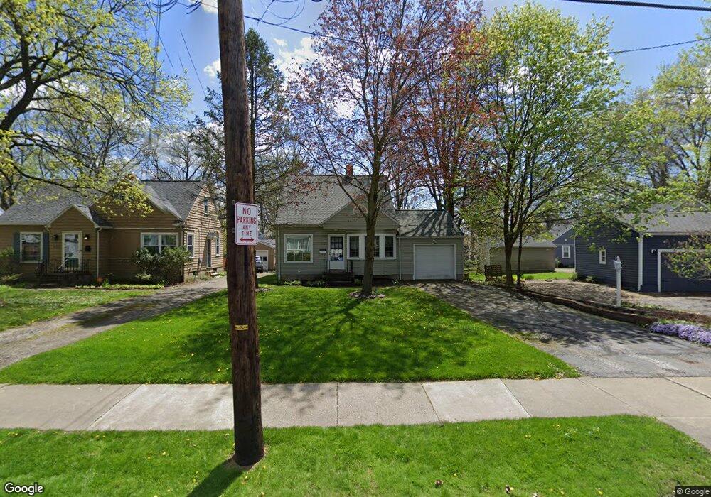
1636 Fairfax Rd Akron, OH 44313
Northwest Akron NeighborhoodEstimated Value: $170,624 - $178,000
3
Beds
2
Baths
792
Sq Ft
$220/Sq Ft
Est. Value
About This Home
This home is located at 1636 Fairfax Rd, Akron, OH 44313 and is currently estimated at $174,156, approximately $219 per square foot. 1636 Fairfax Rd is a home located in Summit County with nearby schools including Case Community Learning Center, Summit Academy School, and Our Lady Of The Elms Elementary School.
Ownership History
Date
Name
Owned For
Owner Type
Purchase Details
Closed on
Aug 27, 1998
Sold by
Lipkin David S
Bought by
Miller Karen M
Current Estimated Value
Home Financials for this Owner
Home Financials are based on the most recent Mortgage that was taken out on this home.
Original Mortgage
$70,000
Outstanding Balance
$15,122
Interest Rate
7.03%
Mortgage Type
New Conventional
Estimated Equity
$159,034
Create a Home Valuation Report for This Property
The Home Valuation Report is an in-depth analysis detailing your home's value as well as a comparison with similar homes in the area
Home Values in the Area
Average Home Value in this Area
Purchase History
| Date | Buyer | Sale Price | Title Company |
|---|---|---|---|
| Miller Karen M | $87,500 | -- |
Source: Public Records
Mortgage History
| Date | Status | Borrower | Loan Amount |
|---|---|---|---|
| Open | Miller Karen M | $70,000 |
Source: Public Records
Tax History Compared to Growth
Tax History
| Year | Tax Paid | Tax Assessment Tax Assessment Total Assessment is a certain percentage of the fair market value that is determined by local assessors to be the total taxable value of land and additions on the property. | Land | Improvement |
|---|---|---|---|---|
| 2025 | $2,402 | $44,174 | $10,105 | $34,069 |
| 2024 | $2,402 | $44,174 | $10,105 | $34,069 |
| 2023 | $2,402 | $44,174 | $10,105 | $34,069 |
| 2022 | $2,146 | $30,892 | $7,067 | $23,825 |
| 2021 | $2,148 | $30,892 | $7,067 | $23,825 |
| 2020 | $2,116 | $30,900 | $7,070 | $23,830 |
| 2019 | $2,134 | $28,300 | $8,530 | $19,770 |
| 2018 | $2,106 | $28,300 | $8,530 | $19,770 |
| 2017 | $2,139 | $28,300 | $8,530 | $19,770 |
| 2016 | $2,141 | $28,300 | $8,530 | $19,770 |
| 2015 | $2,139 | $28,300 | $8,530 | $19,770 |
| 2014 | $2,123 | $28,300 | $8,530 | $19,770 |
| 2013 | $2,316 | $31,660 | $8,530 | $23,130 |
Source: Public Records
Map
Nearby Homes
- 1623 Liberty Dr Unit 1625
- 1633-1635 Liberty Dr
- 1688 Tanglewood Dr Unit 1690
- 2040 Thurmont Rd
- 242 N Hawkins Ave
- 1725 Liberty Dr Unit 1727
- 297 Harcourt Dr
- 590 N Hawkins Ave
- 1785 Fairlawn Knolls Dr
- 607 Treeside Dr
- 101 N Hawkins Ave
- 100 N Hawkins Ave
- 635 N Hawkins Ave
- 637 Treeside Dr
- 746 Newcastle Dr
- 254 Castle Blvd
- 1883 Larchmont Rd
- 1804-1808 Cromwell Dr
- 284 Kenilworth Dr
- 423 Foursome Ave
- 1632 Fairfax Rd
- 347 N Hawkins Ave
- 341 N Hawkins Ave
- 1626 Fairfax Rd
- 337 N Hawkins Ave
- 1597 Bond St
- 1593 Bond St
- 1639 Fairfax Rd
- 1635 Fairfax Rd
- 1589 Bond St
- 1647 Fairfax Rd
- 1631 Fairfax Rd
- 1607 Bond St
- 1618 Fairfax Rd
- 1627 Fairfax Rd
- 1583 Bond St
- 363 N Hawkins Ave
- 1621 Fairfax Rd
- 1612 Fairfax Rd
- 1577 Bond St