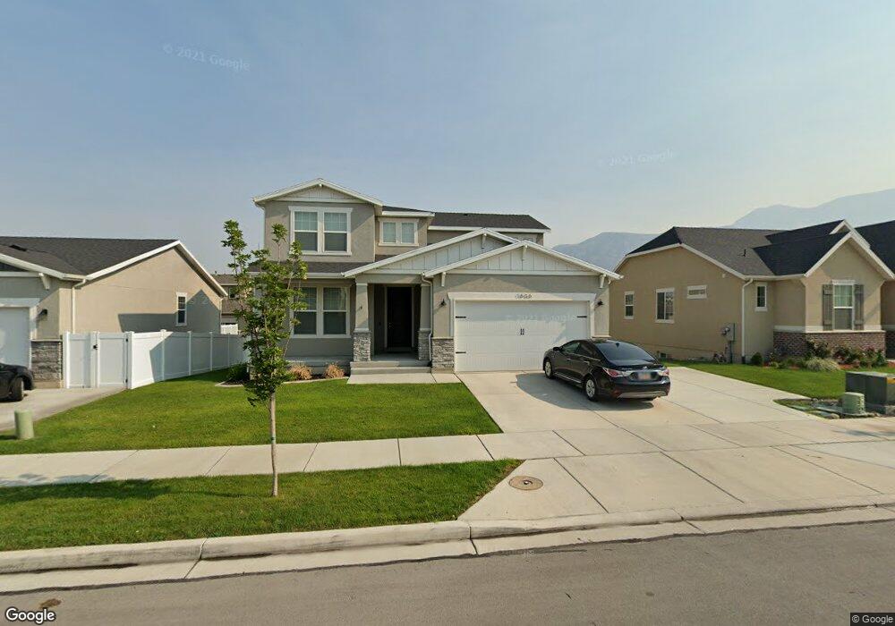
1636 W Brookview Dr Lindon, UT 84042
Estimated Value: $661,000 - $798,000
5
Beds
4
Baths
3,308
Sq Ft
$219/Sq Ft
Est. Value
About This Home
This home is located at 1636 W Brookview Dr, Lindon, UT 84042 and is currently estimated at $722,977, approximately $218 per square foot. 1636 W Brookview Dr is a home located in Utah County with nearby schools including Aspen Elementary School, Oak Canyon Junior High School, and Pleasant Grove High School.
Ownership History
Date
Name
Owned For
Owner Type
Purchase Details
Closed on
Feb 19, 2021
Sold by
Pope Kaden and Pope Brianna
Bought by
Ball Daryl Andrew and Ball Jacky R
Current Estimated Value
Home Financials for this Owner
Home Financials are based on the most recent Mortgage that was taken out on this home.
Original Mortgage
$382,080
Outstanding Balance
$311,465
Interest Rate
2.65%
Mortgage Type
New Conventional
Estimated Equity
$411,512
Purchase Details
Closed on
Oct 11, 2018
Sold by
Ivory Homes Ltd
Bought by
Pope Kaden and Pope Brianna
Home Financials for this Owner
Home Financials are based on the most recent Mortgage that was taken out on this home.
Original Mortgage
$350,800
Interest Rate
4.5%
Mortgage Type
New Conventional
Create a Home Valuation Report for This Property
The Home Valuation Report is an in-depth analysis detailing your home's value as well as a comparison with similar homes in the area
Home Values in the Area
Average Home Value in this Area
Purchase History
| Date | Buyer | Sale Price | Title Company |
|---|---|---|---|
| Ball Daryl Andrew | -- | Real Advantage Title Ins Age | |
| Pope Kaden | -- | Cottonwood Title Ins Agency | |
| Ivory Homes Ltd | -- | Cottonwood Title Ins Agency |
Source: Public Records
Mortgage History
| Date | Status | Borrower | Loan Amount |
|---|---|---|---|
| Open | Ball Daryl Andrew | $382,080 | |
| Previous Owner | Pope Kaden | $350,800 |
Source: Public Records
Tax History Compared to Growth
Tax History
| Year | Tax Paid | Tax Assessment Tax Assessment Total Assessment is a certain percentage of the fair market value that is determined by local assessors to be the total taxable value of land and additions on the property. | Land | Improvement |
|---|---|---|---|---|
| 2025 | $2,567 | $355,355 | $221,700 | $424,400 |
| 2024 | $2,567 | $315,920 | $0 | $0 |
| 2023 | $2,391 | $316,085 | $0 | $0 |
| 2022 | $2,611 | $333,465 | $0 | $0 |
| 2021 | $2,291 | $441,200 | $139,100 | $302,100 |
| 2020 | $2,159 | $409,200 | $124,200 | $285,000 |
| 2019 | $1,857 | $367,100 | $111,200 | $255,900 |
| 2018 | $893 | $91,500 | $91,500 | $0 |
Source: Public Records
Map
Nearby Homes
- 337 N Brookview Dr
- 556 N Buffalo Grass Ln
- 566 N Buffalo Grass Ln
- 554 N Buffalo Grass Ln
- 570 N Buffalo Grass Ln
- 564 N Buffalo Grass Ln
- 564 N Buffalo Grass Ln Unit 1250
- 558 N Buffalo Grass Ln
- 575 N Buffalo Grass Ln
- 574 N Cornstalk Ln
- 582 N Cornstalk Ln
- 568 N Buffalo Grass Ln
- 560 N Buffalo Grass Ln
- 605 N Buffalo Grass Ln
- 600 N Cornstalk Ln
- 572 N Buffalo Grass Ln
- 1362 W Valley Dr
- 611 N Briarwood Ln
- 1309 W Sweet Corn Ln
- Kirkwood Farmhouse Plan at Anderson Farms
- 1648 W Brookview Dr
- 1624 W Brookview Dr
- 1615 W 430 N Unit 24
- 1615 W 430 N
- 1603 W 430 N
- 1627 W 430 N Unit 25
- 1627 W 430 N Unit 26
- 1627 W 430 N
- 1612 W Brookview Dr
- 1662 W Brookview Dr
- 1587 W 430 N
- 1587 W 430 N Unit 22
- 1633 W Brookview Dr
- 1575 W 430 N
- 1655 W Brookview Dr
- 1657 W 430 N
- 1621 W Brookview Dr
- 1674 W Brookview Dr
- 362 N Maple Shade Ln
- 1667 W 430 N