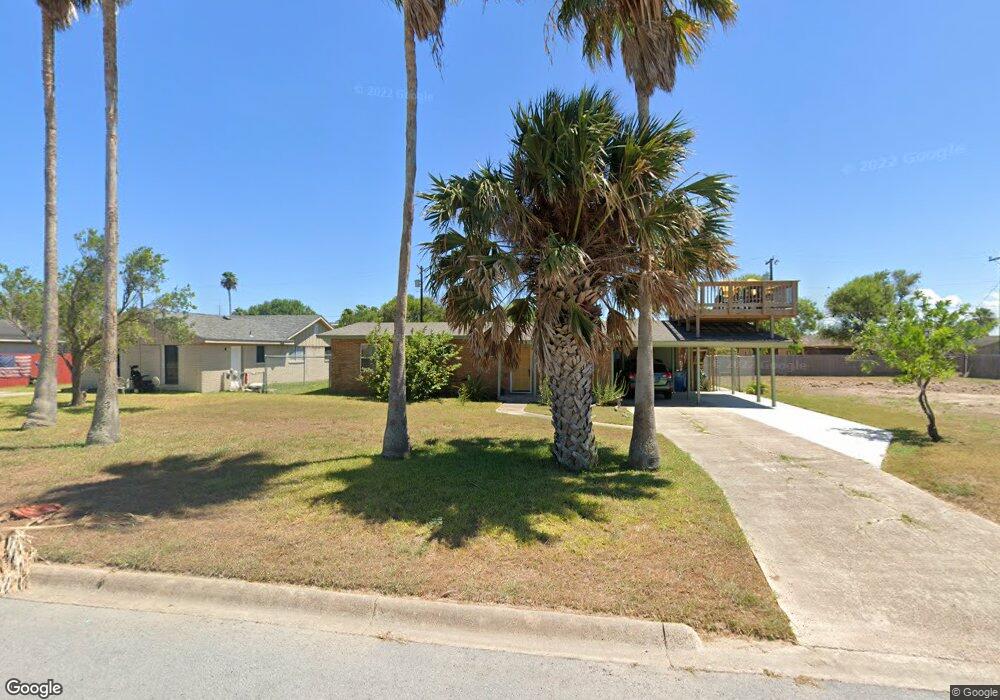
1637 N Shore Dr Port Isabel, TX 78578
Estimated Value: $254,055 - $380,000
--
Bed
--
Bath
1,145
Sq Ft
$254/Sq Ft
Est. Value
About This Home
This home is located at 1637 N Shore Dr, Port Isabel, TX 78578 and is currently estimated at $290,764, approximately $253 per square foot. 1637 N Shore Dr is a home located in Cameron County with nearby schools including Derry Elementary School, Garriga Elementary School, and Port Isabel Junior High School.
Ownership History
Date
Name
Owned For
Owner Type
Purchase Details
Closed on
Nov 27, 2018
Sold by
Villarreal Francisco Javier
Bought by
Walker Lenore M and The Lmw Realty Trust
Current Estimated Value
Purchase Details
Closed on
Sep 18, 2018
Sold by
Villarreal Everardo
Bought by
Villarreal Francisco Javier
Home Financials for this Owner
Home Financials are based on the most recent Mortgage that was taken out on this home.
Original Mortgage
$60,700
Interest Rate
4.5%
Mortgage Type
New Conventional
Create a Home Valuation Report for This Property
The Home Valuation Report is an in-depth analysis detailing your home's value as well as a comparison with similar homes in the area
Home Values in the Area
Average Home Value in this Area
Purchase History
| Date | Buyer | Sale Price | Title Company |
|---|---|---|---|
| Walker Lenore M | -- | Edwards Abstract And Title C | |
| Villarreal Francisco Javier | -- | First American Title Insuran |
Source: Public Records
Mortgage History
| Date | Status | Borrower | Loan Amount |
|---|---|---|---|
| Previous Owner | Villarreal Francisco Javier | $60,700 |
Source: Public Records
Tax History Compared to Growth
Tax History
| Year | Tax Paid | Tax Assessment Tax Assessment Total Assessment is a certain percentage of the fair market value that is determined by local assessors to be the total taxable value of land and additions on the property. | Land | Improvement |
|---|---|---|---|---|
| 2025 | $5,099 | $235,983 | $74,700 | $161,283 |
| 2024 | $5,099 | $235,983 | $74,700 | $161,283 |
| 2023 | $5,126 | $235,983 | $74,700 | $161,283 |
| 2022 | $2,923 | $126,904 | $61,200 | $65,704 |
| 2021 | $3,043 | $126,904 | $61,200 | $65,704 |
| 2020 | $2,997 | $124,324 | $61,200 | $63,124 |
| 2019 | $2,377 | $100,059 | $29,970 | $70,089 |
| 2018 | $2,094 | $88,194 | $29,970 | $58,224 |
| 2017 | $2,089 | $88,194 | $29,970 | $58,224 |
| 2016 | $2,033 | $85,839 | $29,970 | $55,869 |
| 2015 | $1,597 | $85,839 | $29,970 | $55,869 |
Source: Public Records
Map
Nearby Homes
- 1626 N Shore Dr
- TBD South Shore Unit 1
- 1302 Harbor Island Dr
- 1302 Harbor Island Dr Unit 1302
- 1323 Harbor Island Dr Unit 138
- 1814 N Shore Dr
- 1313 Harbor Island Dr Unit 139
- 61&62 Tarpon Ave
- 1208 N Shore Dr
- 1814 Oklahoma Ave
- 1218 Bass Ave
- 1842 S North Shore Unit 11
- 1118 Pompano Ave
- 1201 N Shore Dr
- 1113 Pompano Ave
- Lot 23 Bass Ave
- 0 Bass Ave Unit 467130
- 0 Bass Ave Unit 38 100189
- 1108 Bass Ave
- 1013 Tarpon Ave
- 1637 N North Shore
- 1633 N Shore Dr
- 1629 N Shore Dr
- Lot 5 N Shore Dr Unit 5
- Lot 5 N Shore Dr
- 1636 Michigan Ave
- 1640 Michigan Ave
- 1625 N Shore Dr
- 1649 N Shore Dr
- 1644 Michigan Ave
- 1632 Michigan Ave
- 1638 N Shore Dr
- 1634 N Shore Dr
- 1648 Michigan Ave
- 1621 N Shore Dr
- 1624 Michigan Ave
- 1652 Michigan Ave
- 1657 N Shore Dr
- 1626 N Shore Dr Unit LOT 7 BLK
- 1654 N Shore Dr