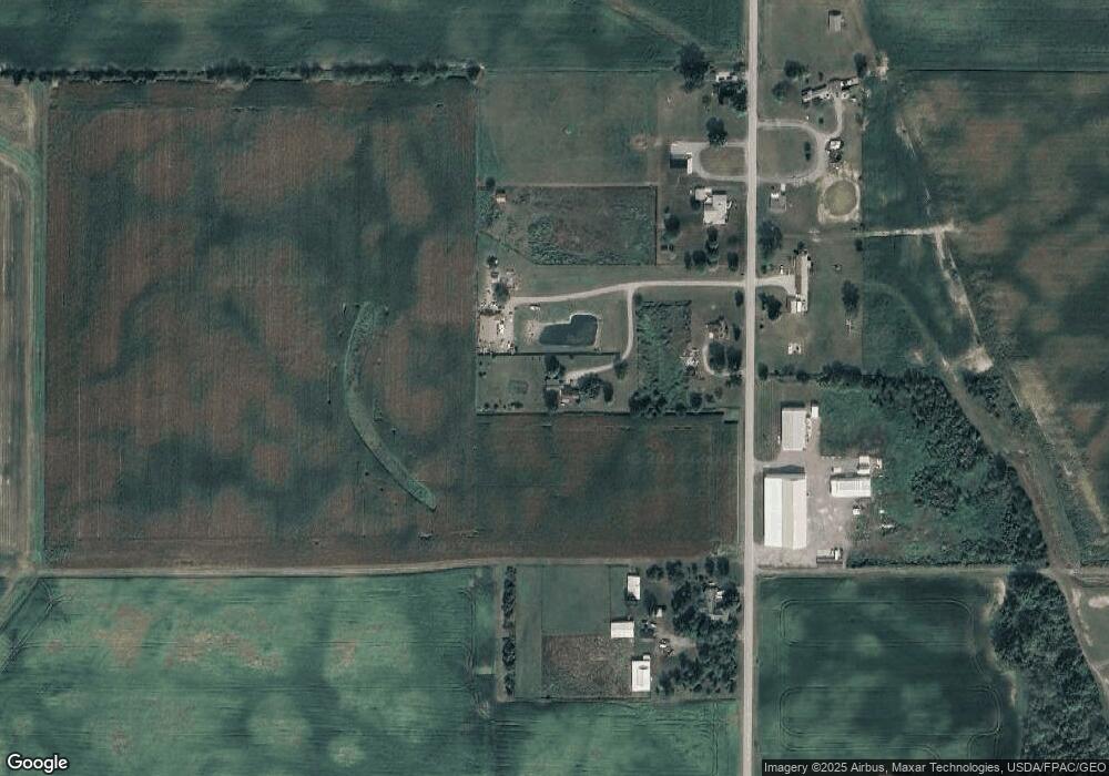
16375 State Route 196 Waynesfield, OH 45896
Estimated Value: $116,000 - $209,000
2
Beds
1
Bath
768
Sq Ft
$198/Sq Ft
Est. Value
About This Home
This home is located at 16375 State Route 196, Waynesfield, OH 45896 and is currently estimated at $152,113, approximately $198 per square foot. 16375 State Route 196 is a home located in Auglaize County with nearby schools including Waynesfield-Goshen Local Elementary School and Waynesfield-Goshen Local High School.
Ownership History
Date
Name
Owned For
Owner Type
Purchase Details
Closed on
Oct 29, 2012
Sold by
Smith William R and Smith Diane M
Bought by
Morris James A and Morris Haroldeen K
Current Estimated Value
Home Financials for this Owner
Home Financials are based on the most recent Mortgage that was taken out on this home.
Original Mortgage
$53,600
Outstanding Balance
$23,678
Interest Rate
3.55%
Mortgage Type
Purchase Money Mortgage
Estimated Equity
$128,435
Purchase Details
Closed on
Nov 7, 2005
Sold by
Smith Anna Lou
Bought by
Smith William R and Smith Diane M
Purchase Details
Closed on
Jun 16, 2000
Sold by
Smith William C
Bought by
Smith Anna Lou
Purchase Details
Closed on
Oct 1, 1989
Create a Home Valuation Report for This Property
The Home Valuation Report is an in-depth analysis detailing your home's value as well as a comparison with similar homes in the area
Home Values in the Area
Average Home Value in this Area
Purchase History
| Date | Buyer | Sale Price | Title Company |
|---|---|---|---|
| Morris James A | $67,000 | Attorney | |
| Smith William R | -- | None Available | |
| Smith Anna Lou | -- | -- | |
| -- | $50,000 | -- |
Source: Public Records
Mortgage History
| Date | Status | Borrower | Loan Amount |
|---|---|---|---|
| Open | Morris James A | $53,600 |
Source: Public Records
Tax History Compared to Growth
Tax History
| Year | Tax Paid | Tax Assessment Tax Assessment Total Assessment is a certain percentage of the fair market value that is determined by local assessors to be the total taxable value of land and additions on the property. | Land | Improvement |
|---|---|---|---|---|
| 2024 | $2,513 | $39,950 | $7,430 | $32,520 |
| 2023 | $1,406 | $39,950 | $7,430 | $32,520 |
| 2022 | $1,321 | $31,520 | $6,830 | $24,690 |
| 2021 | $1,302 | $31,520 | $6,830 | $24,690 |
| 2020 | $1,283 | $31,525 | $6,832 | $24,693 |
| 2019 | $1,045 | $26,268 | $5,691 | $20,577 |
| 2018 | $1,018 | $26,268 | $5,691 | $20,577 |
| 2017 | $1,014 | $26,268 | $5,691 | $20,577 |
| 2016 | $910 | $24,375 | $5,422 | $18,953 |
| 2015 | $466 | $24,375 | $5,422 | $18,953 |
| 2014 | $934 | $24,375 | $5,422 | $18,953 |
| 2013 | $517 | $24,375 | $5,422 | $18,953 |
Source: Public Records
Map
Nearby Homes
- 25836 Ohio 67
- 202 W Mulberry St
- 202 Karen St
- 18258 Graham Rd
- 21015 Fairmount Rd
- 20630 State Route 67
- 8150 Amherst Rd
- 5065 Amherst Rd
- 4850 Bowdle Rd
- 17 E Walnut St
- 80 Main St
- 37 N Main St
- 0 Ohio 67
- 0 Cherokee Path Unit 1039741
- 11352 N Township Road 88
- 12030 Holly Dr Unit 31
- 12015 Holly Dr
- 11762 Sunview Ave
- 12007 Holly Dr
- 11579 Cooper Ave
- 16379 State Route 196
- 16381 Waynesfield Rd
- 16379 Waynesfield Rd
- 16357 Waynesfield Rd
- 16431 Waynesfield Rd
- 16449 Waynesfield Rd
- 16390 Waynesfield Rd
- 16330 Waynesfield Rd
- 16215 Waynesfield Rd
- 16477 Waynesfield Rd
- 16470 Waynesfield Rd
- 16538 Waynesfield Rd
- 16108 Waynesfield Rd
- 16120 Waynesfield Rd
- 27251 Waynesfield Rd
- 29965 Waynesfield Rd
- 26101 Waynesfield Rd
- 29988 Waynesfield Rd
