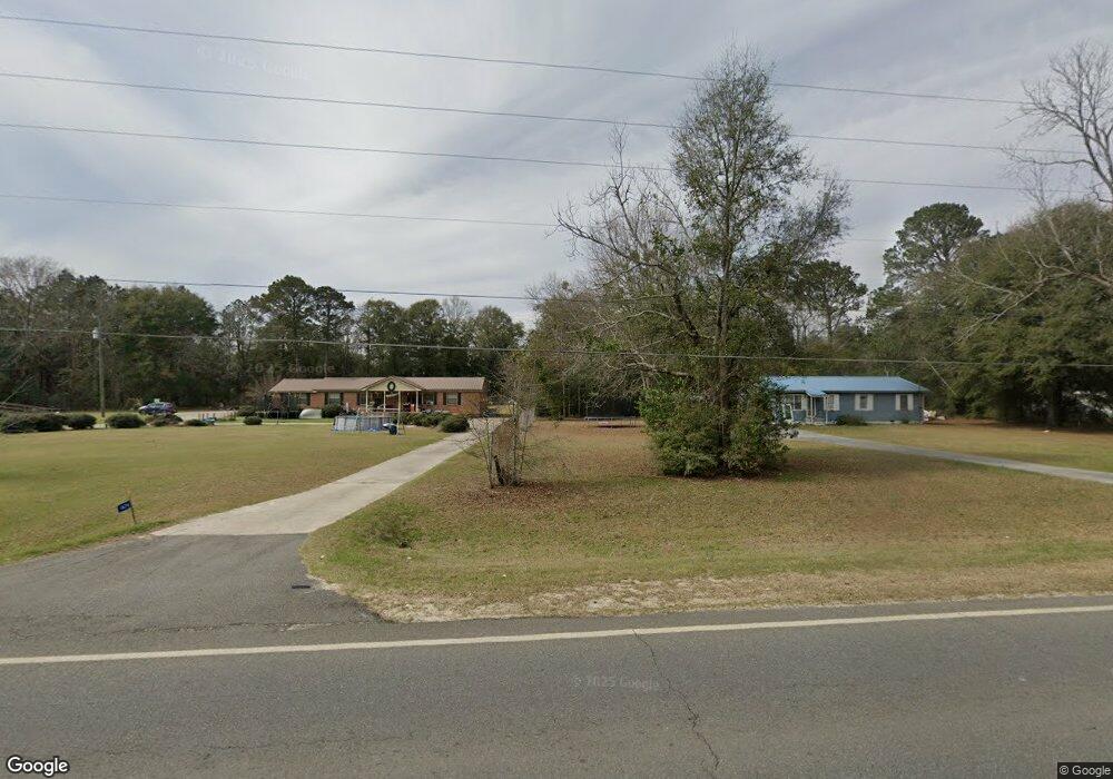
1638 Ga Highway 49 S Oglethorpe, GA 31068
Estimated Value: $65,000 - $123,076
3
Beds
2
Baths
1,200
Sq Ft
$74/Sq Ft
Est. Value
About This Home
This home is located at 1638 Ga Highway 49 S, Oglethorpe, GA 31068 and is currently estimated at $88,269, approximately $73 per square foot. 1638 Ga Highway 49 S is a home with nearby schools including Macon County Elementary School, Macon County Middle School, and Macon County High School.
Ownership History
Date
Name
Owned For
Owner Type
Purchase Details
Closed on
May 27, 2021
Sold by
Brown Mary F
Bought by
Ragusa Caitlin
Current Estimated Value
Home Financials for this Owner
Home Financials are based on the most recent Mortgage that was taken out on this home.
Original Mortgage
$44,184
Outstanding Balance
$38,492
Interest Rate
2.9%
Mortgage Type
FHA
Estimated Equity
$49,777
Purchase Details
Closed on
Apr 4, 1978
Sold by
Wilson Joe R
Bought by
Brown Johnny C and Brown Fr
Purchase Details
Closed on
May 23, 1975
Bought by
Wilson Joe R
Create a Home Valuation Report for This Property
The Home Valuation Report is an in-depth analysis detailing your home's value as well as a comparison with similar homes in the area
Home Values in the Area
Average Home Value in this Area
Purchase History
| Date | Buyer | Sale Price | Title Company |
|---|---|---|---|
| Ragusa Caitlin | $45,000 | -- | |
| Brown Johnny C | $21,000 | -- | |
| Wilson Joe R | $28,200 | -- |
Source: Public Records
Mortgage History
| Date | Status | Borrower | Loan Amount |
|---|---|---|---|
| Open | Ragusa Caitlin | $44,184 |
Source: Public Records
Tax History Compared to Growth
Tax History
| Year | Tax Paid | Tax Assessment Tax Assessment Total Assessment is a certain percentage of the fair market value that is determined by local assessors to be the total taxable value of land and additions on the property. | Land | Improvement |
|---|---|---|---|---|
| 2024 | $839 | $29,884 | $2,800 | $27,084 |
| 2023 | $839 | $29,884 | $2,800 | $27,084 |
| 2022 | $505 | $18,000 | $2,240 | $15,760 |
| 2021 | $498 | $17,190 | $3,600 | $13,590 |
| 2020 | $498 | $17,190 | $3,600 | $13,590 |
| 2019 | $498 | $17,190 | $3,600 | $13,590 |
| 2018 | $273 | $17,190 | $3,600 | $13,590 |
| 2017 | $276 | $17,190 | $3,600 | $13,590 |
| 2016 | $276 | $17,190 | $3,600 | $13,590 |
| 2015 | -- | $18,282 | $3,600 | $14,682 |
| 2014 | -- | $18,282 | $3,600 | $14,682 |
| 2013 | -- | $18,282 | $3,600 | $14,682 |
Source: Public Records
Map
Nearby Homes
- 562 W Anderson St
- 432 Clifton Bradley Dr
- Whitewater Rd
- Whitewater Rd
- 0 Georgia 49
- 204 Jordan St
- 45 Oakwood Dr
- 4265 Georgia 49
- 110 Head Rd Unit LotWP001
- 2668 Coogle Rd
- 511 Forsyth St
- 326 N Dooly St
- 399 Travelers Rest Rd
- 103 E Artesian Ave
- 100 Minor Ave
- 514 Patricia Dr
- 504 Patricia Dr
- 510 Patricia Dr
- 416 Engram St
- 202 Minor Ave
- 1674 Ga Highway 49 S
- 1564 S Ga Highway 49 Rd S
- 1784 Ga Highway 49 S
- 116 Brookstone Dr
- 1781 Ga Highway 49 S
- 1826 Ga Highway 49 S
- 1877 Ga Highway 49 S
- 1590 Ga Highway 26 W
- 1846 Ga Highway 49 S
- 1951 Ga Highway 49 S
- 249 Brookstone Dr
- 1451 Ga Highway 26 W
- 1535 Ga Highway 26 W
- 1298 Ga Highway 49 S
- 323 Brookstone Dr
- 1489 Ga Highway 26 W
- 1696 Ga Highway 26 W
- 1766 Ga Highway 26 W
- 1755 Ga Highway 26 W
- 1766 Georgia 26