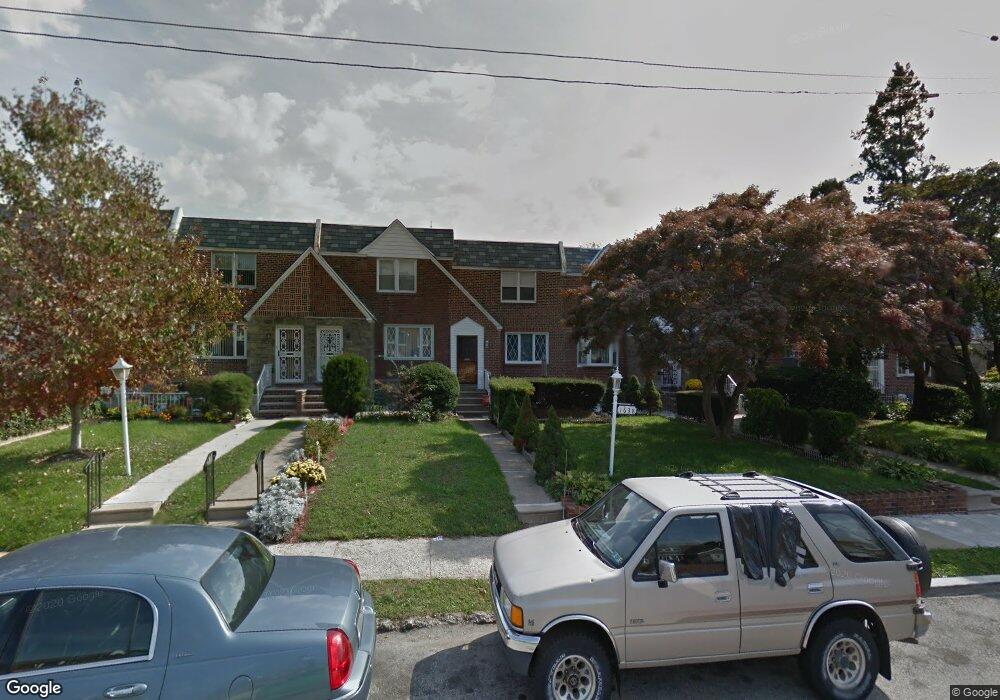
1638 Middleton St Philadelphia, PA 19138
West Oak Lane NeighborhoodEstimated Value: $216,176 - $246,000
3
Beds
1
Bath
1,314
Sq Ft
$177/Sq Ft
Est. Value
About This Home
This home is located at 1638 Middleton St, Philadelphia, PA 19138 and is currently estimated at $232,544, approximately $176 per square foot. 1638 Middleton St is a home located in Philadelphia County with nearby schools including Pennypacker Samuel School, Martin Luther King High School, and West Oak Lane Charter School.
Ownership History
Date
Name
Owned For
Owner Type
Purchase Details
Closed on
Oct 31, 2005
Sold by
Vaughn Althea
Bought by
Vaughan Kirk A
Current Estimated Value
Home Financials for this Owner
Home Financials are based on the most recent Mortgage that was taken out on this home.
Original Mortgage
$108,000
Outstanding Balance
$64,737
Interest Rate
7.62%
Mortgage Type
New Conventional
Estimated Equity
$167,807
Purchase Details
Closed on
Jun 20, 1997
Sold by
Enty Ronald
Bought by
Vaughn Althea
Create a Home Valuation Report for This Property
The Home Valuation Report is an in-depth analysis detailing your home's value as well as a comparison with similar homes in the area
Home Values in the Area
Average Home Value in this Area
Purchase History
| Date | Buyer | Sale Price | Title Company |
|---|---|---|---|
| Vaughan Kirk A | $135,000 | None Available | |
| Vaughn Althea | $69,900 | -- |
Source: Public Records
Mortgage History
| Date | Status | Borrower | Loan Amount |
|---|---|---|---|
| Open | Vaughan Kirk A | $108,000 |
Source: Public Records
Tax History Compared to Growth
Tax History
| Year | Tax Paid | Tax Assessment Tax Assessment Total Assessment is a certain percentage of the fair market value that is determined by local assessors to be the total taxable value of land and additions on the property. | Land | Improvement |
|---|---|---|---|---|
| 2025 | $2,557 | $226,500 | $45,300 | $181,200 |
| 2024 | $2,557 | $226,500 | $45,300 | $181,200 |
| 2023 | $2,557 | $182,700 | $36,540 | $146,160 |
| 2022 | $1,928 | $137,700 | $36,540 | $101,160 |
| 2021 | $1,923 | $0 | $0 | $0 |
| 2020 | $1,923 | $0 | $0 | $0 |
| 2019 | $2,007 | $0 | $0 | $0 |
| 2018 | $1,370 | $0 | $0 | $0 |
| 2017 | $1,790 | $0 | $0 | $0 |
| 2016 | $1,370 | $0 | $0 | $0 |
| 2015 | $1,312 | $0 | $0 | $0 |
| 2014 | -- | $127,900 | $13,660 | $114,240 |
| 2012 | -- | $17,920 | $2,554 | $15,366 |
Source: Public Records
Map
Nearby Homes
- 7349 E Walnut Ln
- 7277 E Walnut Ln
- 1544 Beverly Rd
- 7001 Limekiln Pike
- 1521 E Walnut Ln
- 2070 E Haines St
- 1520 Beverly Rd
- 6635 Hollis St
- 1559 E Pastorius St
- 1537 Beverly Rd
- 6824 Rodney St
- 1536 E Pastorius St
- 2029 Eastburn Ave
- 6313 E Wister St
- 6332 E Wister St
- 6661 Cornelius St
- 2056 Eastburn Ave
- 1505 Beverly Rd
- 6733 N Woodstock St
- 6620 Cornelius St
- 1636 Middleton St
- 1640 Middleton St
- 1634 Middleton St
- 1642 Middleton St
- 1632 Middleton St
- 1644 Middleton St
- 1630 Middleton St
- 1646 Middleton St
- 1628 Middleton St
- 1626 Middleton St
- 1624 Middleton St
- 1629 Andrews Ave
- 1625 Andrews Ave
- 1631 Andrews Ave
- 1623 Andrews Ave
- 1633 Andrews Ave
- 1621 Andrews Ave
- 7018 Woolston Ave
- 7020 Woolston Ave
- 7022 Woolston Ave