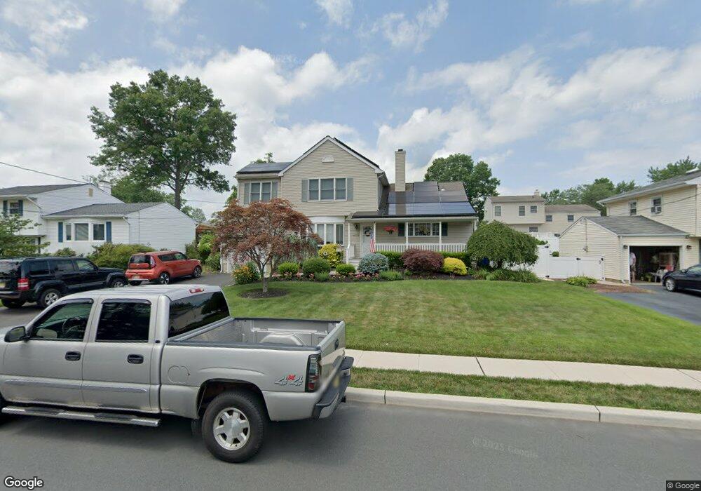
1639 Axel Ave North Brunswick, NJ 08902
Estimated Value: $621,120 - $723,000
--
Bed
--
Bath
2,511
Sq Ft
$270/Sq Ft
Est. Value
About This Home
This home is located at 1639 Axel Ave, North Brunswick, NJ 08902 and is currently estimated at $677,530, approximately $269 per square foot. 1639 Axel Ave is a home located in Middlesex County with nearby schools including John Adams Elementary School, Linwood Middle School, and North Brunswick Twp High School.
Ownership History
Date
Name
Owned For
Owner Type
Purchase Details
Closed on
Feb 6, 2003
Sold by
Marrone Frank
Bought by
Marrone Frank and Marrone Theresa
Current Estimated Value
Home Financials for this Owner
Home Financials are based on the most recent Mortgage that was taken out on this home.
Original Mortgage
$136,500
Interest Rate
5.91%
Purchase Details
Closed on
Jun 26, 1998
Sold by
Kohutanycz John
Bought by
Marrone Frank
Home Financials for this Owner
Home Financials are based on the most recent Mortgage that was taken out on this home.
Original Mortgage
$129,000
Interest Rate
6.94%
Purchase Details
Closed on
Feb 18, 1994
Sold by
Wu Cliff
Bought by
Kohutanycz John and Kohutanycz Sharon
Home Financials for this Owner
Home Financials are based on the most recent Mortgage that was taken out on this home.
Original Mortgage
$142,000
Interest Rate
6.96%
Create a Home Valuation Report for This Property
The Home Valuation Report is an in-depth analysis detailing your home's value as well as a comparison with similar homes in the area
Home Values in the Area
Average Home Value in this Area
Purchase History
| Date | Buyer | Sale Price | Title Company |
|---|---|---|---|
| Marrone Frank | -- | -- | |
| Marrone Frank | $149,000 | -- | |
| Kohutanycz John | $149,000 | -- |
Source: Public Records
Mortgage History
| Date | Status | Borrower | Loan Amount |
|---|---|---|---|
| Previous Owner | Marrone Frank | $136,500 | |
| Previous Owner | Marrone Frank | $129,000 | |
| Previous Owner | Kohutanycz John | $142,000 |
Source: Public Records
Tax History Compared to Growth
Tax History
| Year | Tax Paid | Tax Assessment Tax Assessment Total Assessment is a certain percentage of the fair market value that is determined by local assessors to be the total taxable value of land and additions on the property. | Land | Improvement |
|---|---|---|---|---|
| 2025 | $12,400 | $195,700 | $59,000 | $143,000 |
| 2024 | $12,176 | $195,700 | $59,000 | $143,000 |
| 2023 | $12,176 | $195,700 | $0 | $0 |
| 2022 | $11,762 | $195,700 | $0 | $0 |
| 2021 | $8,570 | $195,700 | $0 | $0 |
| 2020 | $11,323 | $195,700 | $0 | $0 |
| 2019 | $11,092 | $202,000 | $59,000 | $143,000 |
| 2018 | $10,865 | $202,000 | $59,000 | $143,000 |
| 2017 | $10,673 | $195,700 | $59,000 | $136,700 |
| 2016 | $10,450 | $195,700 | $59,000 | $136,700 |
| 2015 | $10,272 | $195,700 | $59,000 | $136,700 |
| 2014 | $10,157 | $195,700 | $59,000 | $136,700 |
Source: Public Records
Map
Nearby Homes
- 1632 Hudson Ave
- 1209 Dakota Rd
- 1365 Sioux Rd
- 1464 Columbia Dr
- 1067 Grove St
- 1899 Noah Dr
- 1 Michael Ct
- 1074 Schmidt Ln
- 1010 N Oaks Blvd
- 1027 Schmidt Ln
- 210 N Oaks Blvd Unit 210
- 1008 Schmidt Ln
- 1103 Schmidt Ln
- 1499 La Rose Ave
- 1314 N Oaks Blvd
- 5208 N Oaks Blvd
- 4511 Birchwood Ct
- 174 Nathan Dr
- 66 Riverbend Dr
- 3807 Birchwood Ct