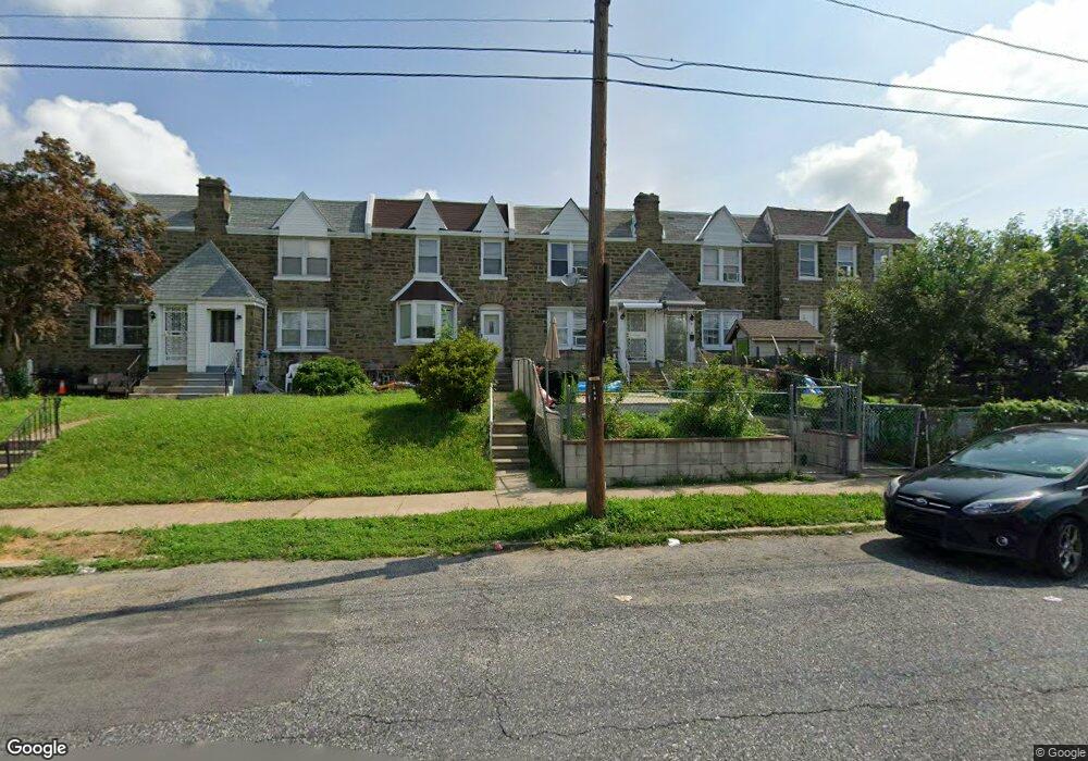
1639 Longshore Ave Philadelphia, PA 19149
Castor Gardens NeighborhoodEstimated Value: $254,000 - $267,000
4
Beds
1
Bath
1,512
Sq Ft
$172/Sq Ft
Est. Value
About This Home
This home is located at 1639 Longshore Ave, Philadelphia, PA 19149 and is currently estimated at $259,708, approximately $171 per square foot. 1639 Longshore Ave is a home located in Philadelphia County with nearby schools including Solomon Solis-Cohen School, Castor Gardens Middle School, and Northeast High School.
Ownership History
Date
Name
Owned For
Owner Type
Purchase Details
Closed on
Apr 26, 2005
Sold by
Lin Bin
Bought by
Lin Bin and Zeng Shao Hang
Current Estimated Value
Purchase Details
Closed on
Jul 28, 2004
Sold by
Collins Edward J
Bought by
Lin Bin
Home Financials for this Owner
Home Financials are based on the most recent Mortgage that was taken out on this home.
Original Mortgage
$98,800
Interest Rate
5.89%
Mortgage Type
Unknown
Purchase Details
Closed on
May 25, 1995
Sold by
Tedesco Richard Albert and Tedesco John
Bought by
Collins Edward J
Create a Home Valuation Report for This Property
The Home Valuation Report is an in-depth analysis detailing your home's value as well as a comparison with similar homes in the area
Home Values in the Area
Average Home Value in this Area
Purchase History
| Date | Buyer | Sale Price | Title Company |
|---|---|---|---|
| Lin Bin | -- | -- | |
| Lin Bin | $123,500 | First American Title Ins Co | |
| Collins Edward J | $68,000 | -- |
Source: Public Records
Mortgage History
| Date | Status | Borrower | Loan Amount |
|---|---|---|---|
| Previous Owner | Lin Bin | $98,800 |
Source: Public Records
Tax History Compared to Growth
Tax History
| Year | Tax Paid | Tax Assessment Tax Assessment Total Assessment is a certain percentage of the fair market value that is determined by local assessors to be the total taxable value of land and additions on the property. | Land | Improvement |
|---|---|---|---|---|
| 2025 | $2,832 | $246,800 | $49,360 | $197,440 |
| 2024 | $2,832 | $246,800 | $49,360 | $197,440 |
| 2023 | $2,832 | $202,300 | $40,460 | $161,840 |
| 2022 | $2,202 | $157,300 | $40,460 | $116,840 |
| 2021 | $2,073 | $0 | $0 | $0 |
| 2020 | $2,073 | $0 | $0 | $0 |
| 2019 | $1,989 | $0 | $0 | $0 |
| 2018 | $1,838 | $0 | $0 | $0 |
| 2017 | $1,838 | $0 | $0 | $0 |
| 2016 | $1,418 | $0 | $0 | $0 |
| 2015 | $1,357 | $0 | $0 | $0 |
| 2014 | -- | $131,300 | $26,140 | $105,160 |
| 2012 | -- | $15,968 | $1,922 | $14,046 |
Source: Public Records
Map
Nearby Homes
- 6946 Kindred St
- 6829 Horrocks St
- 6826 Sylvester St
- 6834 Large St
- 7028 Horrocks St
- 6900 Eastwood St
- 7034 Souder St
- 7039 Kindred St
- 6827 Lynford St
- 2011 Longshore Ave
- 7019 Rutland St
- 7035 Rutland St
- 6739 Lynford St
- 7050 Lynford St
- 7123 Souder St
- 6725 Eastwood St
- 6640 Souder St
- 2110 Longshore Ave
- 2119 Glenview St
- 7123 Castor Ave
- 1637 Longshore Ave
- 1635 Longshore Ave
- 1641 Longshore Ave
- 1633 Longshore Ave
- 1643 Longshore Ave
- 1631 Longshore Ave
- 6914 Horrocks St
- 6914 Horrocks St Unit 1
- 6915 Souder St
- 6916 Horrocks St
- 6917 Souder St
- 6918 Horrocks St
- 6919 Souder St
- 6921 Souder St
- 6922 Horrocks St
- 1629 Longshore Ave
- 6923 Souder St
- 6924 Horrocks St
- 1627 Longshore Ave
- 6925 Souder St