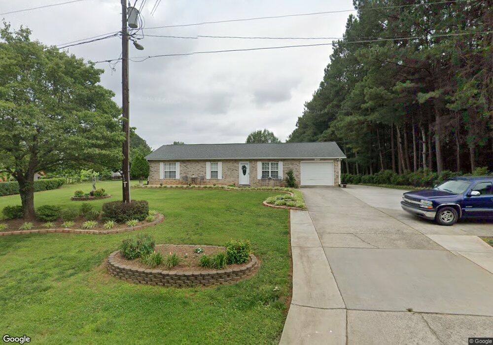
1639 Smyre Farm Rd Newton, NC 28658
Estimated Value: $239,000 - $257,000
3
Beds
2
Baths
1,196
Sq Ft
$208/Sq Ft
Est. Value
About This Home
This home is located at 1639 Smyre Farm Rd, Newton, NC 28658 and is currently estimated at $248,677, approximately $207 per square foot. 1639 Smyre Farm Rd is a home located in Catawba County with nearby schools including Maiden Elementary School, Maiden Middle School, and Maiden High School.
Ownership History
Date
Name
Owned For
Owner Type
Purchase Details
Closed on
Jul 23, 2007
Sold by
Hang Pang K
Bought by
Leon Maria Del Carmen and Paz Abel Rojo
Current Estimated Value
Home Financials for this Owner
Home Financials are based on the most recent Mortgage that was taken out on this home.
Original Mortgage
$112,500
Outstanding Balance
$71,084
Interest Rate
6.71%
Mortgage Type
Purchase Money Mortgage
Estimated Equity
$177,593
Purchase Details
Closed on
Nov 12, 2003
Purchase Details
Closed on
Feb 1, 1996
Create a Home Valuation Report for This Property
The Home Valuation Report is an in-depth analysis detailing your home's value as well as a comparison with similar homes in the area
Home Values in the Area
Average Home Value in this Area
Purchase History
| Date | Buyer | Sale Price | Title Company |
|---|---|---|---|
| Leon Maria Del Carmen | $112,500 | None Available | |
| -- | $95,000 | -- | |
| -- | $77,000 | -- |
Source: Public Records
Mortgage History
| Date | Status | Borrower | Loan Amount |
|---|---|---|---|
| Open | Leon Maria Del Carmen | $112,500 |
Source: Public Records
Tax History Compared to Growth
Tax History
| Year | Tax Paid | Tax Assessment Tax Assessment Total Assessment is a certain percentage of the fair market value that is determined by local assessors to be the total taxable value of land and additions on the property. | Land | Improvement |
|---|---|---|---|---|
| 2025 | $1,119 | $224,100 | $11,600 | $212,500 |
| 2024 | $1,119 | $224,000 | $11,500 | $212,500 |
| 2023 | $1,119 | $224,000 | $11,500 | $212,500 |
| 2022 | $919 | $126,800 | $10,000 | $116,800 |
| 2021 | $894 | $126,800 | $10,000 | $116,800 |
| 2020 | $894 | $126,800 | $10,000 | $116,800 |
| 2019 | $881 | $126,800 | $0 | $0 |
| 2018 | $696 | $100,100 | $10,000 | $90,100 |
| 2017 | $666 | $0 | $0 | $0 |
| 2016 | $666 | $0 | $0 | $0 |
| 2015 | $575 | $100,130 | $10,000 | $90,130 |
| 2014 | $575 | $95,900 | $10,100 | $85,800 |
Source: Public Records
Map
Nearby Homes
- 1585 Nathanial St
- 2107 Saint James Church Rd
- 1433 Wildflower St
- 1429 Wildflower St
- 2159 Sunflower Cir
- 2155 Sunflower Cir
- 2111 Sunflower Cir
- 2125 Sunflower Cir
- 2117 Sunflower Cir
- 2094 Sunflower Cir
- Manchester Plan at Buffalo Ridge
- Cottonwood Plan at Buffalo Ridge
- Dakota Basement Plan at Buffalo Ridge
- Dakota Plan at Buffalo Ridge
- Rockwell Plan at Buffalo Ridge
- Chatham Basement Plan at Buffalo Ridge
- Lennon Plan at Buffalo Ridge
- Edenton Plan at Buffalo Ridge
- Dallas Plan at Buffalo Ridge
- Chatham Plan at Buffalo Ridge
- 1651 Smyre Farm Rd
- 1612 Smyre Farm Rd
- 1663 Smyre Farm Rd Unit 5
- 1991 Saint James Church Rd
- 1957 Saint James Church Rd
- 1595 Smyre Farm Rd
- 2017 Saint James Church Rd
- 1955 Saint James Church Rd
- 1942 Saint James Church Rd
- 1570 Smyre Farm Rd
- 2037 Saint James Church Rd
- 1530 Carpenter St Unit 30-31
- 1530 Carpenter St Unit 30-33
- 1530 Carpenter St
- 1937 Saint James Church Rd
- 1554 Smyre Farm Rd
- 2053 Saint James Church Rd Unit 8
- 2053 Saint James Church Rd
- Lot 9-17 Pine St Unit 9-17
- 1540 Carpenter St