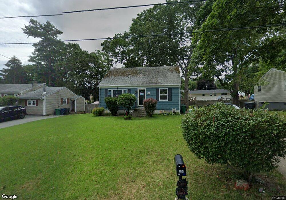
164 Boylston St Warwick, RI 02889
Rocky Point NeighborhoodEstimated Value: $392,672 - $506,000
3
Beds
2
Baths
1,344
Sq Ft
$339/Sq Ft
Est. Value
About This Home
This home is located at 164 Boylston St, Warwick, RI 02889 and is currently estimated at $455,418, approximately $338 per square foot. 164 Boylston St is a home located in Kent County with nearby schools including Saint Kevin School and Bishop Hendricken High School.
Ownership History
Date
Name
Owned For
Owner Type
Purchase Details
Closed on
Sep 17, 1992
Sold by
Fandetti Anthony V and Fandetti Donna
Bought by
Renfree Michael E
Current Estimated Value
Home Financials for this Owner
Home Financials are based on the most recent Mortgage that was taken out on this home.
Original Mortgage
$95,184
Interest Rate
8.04%
Mortgage Type
Purchase Money Mortgage
Create a Home Valuation Report for This Property
The Home Valuation Report is an in-depth analysis detailing your home's value as well as a comparison with similar homes in the area
Home Values in the Area
Average Home Value in this Area
Purchase History
| Date | Buyer | Sale Price | Title Company |
|---|---|---|---|
| Renfree Michael E | $96,000 | -- | |
| Renfree Michael E | $96,000 | -- |
Source: Public Records
Mortgage History
| Date | Status | Borrower | Loan Amount |
|---|---|---|---|
| Open | Renfree Michael E | $174,898 | |
| Closed | Renfree Michael E | $185,000 | |
| Closed | Renfree Michael E | $160,000 | |
| Closed | Renfree Michael E | $95,184 |
Source: Public Records
Tax History
| Year | Tax Paid | Tax Assessment Tax Assessment Total Assessment is a certain percentage of the fair market value that is determined by local assessors to be the total taxable value of land and additions on the property. | Land | Improvement |
|---|---|---|---|---|
| 2025 | $4,227 | $332,800 | $116,200 | $216,600 |
| 2024 | $4,308 | $297,700 | $101,000 | $196,700 |
| 2023 | $4,224 | $297,700 | $101,000 | $196,700 |
| 2022 | $4,025 | $214,900 | $64,900 | $150,000 |
| 2021 | $4,025 | $214,900 | $64,900 | $150,000 |
| 2020 | $4,025 | $214,900 | $64,900 | $150,000 |
| 2019 | $4,025 | $214,900 | $64,900 | $150,000 |
| 2018 | $3,686 | $177,200 | $64,900 | $112,300 |
| 2017 | $3,587 | $177,200 | $64,900 | $112,300 |
| 2016 | $3,587 | $177,200 | $64,900 | $112,300 |
| 2015 | $2,886 | $139,100 | $62,100 | $77,000 |
| 2014 | $2,790 | $139,100 | $62,100 | $77,000 |
| 2013 | $2,753 | $139,100 | $62,100 | $77,000 |
Source: Public Records
Map
Nearby Homes
- 170 Medford St
- 66 Medford St
- 76 Medford St
- 357 Warwick Neck Ave
- 0 Meadow View Ave
- 320 Palmer Ave
- 299 Palmer Ave
- 43 Beaver Ave
- 283 Palmer Ave
- 21 Hampton Ave
- 585 Meadow View Ave
- 132 Palmer Ave
- 34 Chapin Ave
- 00 Grove Ave
- 15 Center Ct
- 1785 W Shore Rd
- 205 Payton Ave
- 115 Samuel Gorton Ave
- 90 Huron St
- 357 Pequot Ave
- 156 Boylston St
- 170 Boylston St
- 159 Boylston St
- 167 Boylston St
- 148 Boylston St
- 177 Medford St
- 464 Warwick Neck Ave
- 151 Boylston St
- 157 Medford St
- 444 Warwick Neck Ave
- 140 Boylston St
- 474 Warwick Neck Ave
- 141 Medford St
- 143 Boylston St
- 205 Boylston St
- 166 Lewiston St
- 158 Lewiston St
- 127 Medford St
- 188 Medford St
- 150 Lewiston St
Your Personal Tour Guide
Ask me questions while you tour the home.