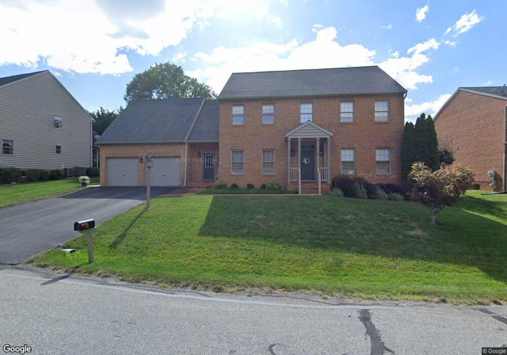
164 Stanford Rd Hagerstown, MD 21742
South End NeighborhoodEstimated Value: $414,000 - $543,000
--
Bed
3
Baths
2,788
Sq Ft
$164/Sq Ft
Est. Value
About This Home
This home is located at 164 Stanford Rd, Hagerstown, MD 21742 and is currently estimated at $457,516, approximately $164 per square foot. 164 Stanford Rd is a home located in Washington County with nearby schools including Ruth Ann Monroe Primary School, Eastern Elementary School, and E. Russell Hicks Middle School.
Ownership History
Date
Name
Owned For
Owner Type
Purchase Details
Closed on
Nov 23, 2005
Sold by
Home Construction Corporation
Bought by
Vance Joseph M and Vance Kelly L
Current Estimated Value
Create a Home Valuation Report for This Property
The Home Valuation Report is an in-depth analysis detailing your home's value as well as a comparison with similar homes in the area
Home Values in the Area
Average Home Value in this Area
Purchase History
| Date | Buyer | Sale Price | Title Company |
|---|---|---|---|
| Vance Joseph M | $292,850 | -- |
Source: Public Records
Mortgage History
| Date | Status | Borrower | Loan Amount |
|---|---|---|---|
| Closed | Vance Joseph M | -- |
Source: Public Records
Tax History Compared to Growth
Tax History
| Year | Tax Paid | Tax Assessment Tax Assessment Total Assessment is a certain percentage of the fair market value that is determined by local assessors to be the total taxable value of land and additions on the property. | Land | Improvement |
|---|---|---|---|---|
| 2025 | $3,505 | $391,133 | $0 | $0 |
| 2024 | $3,505 | $359,600 | $65,000 | $294,600 |
| 2023 | $3,331 | $336,467 | $0 | $0 |
| 2022 | $3,165 | $313,333 | $0 | $0 |
| 2021 | $3,050 | $290,200 | $65,000 | $225,200 |
| 2020 | $3,050 | $289,000 | $0 | $0 |
| 2019 | $3,051 | $287,800 | $0 | $0 |
| 2018 | $3,038 | $286,600 | $65,000 | $221,600 |
| 2017 | $2,930 | $276,400 | $0 | $0 |
| 2016 | -- | $266,200 | $0 | $0 |
| 2015 | $3,233 | $256,000 | $0 | $0 |
| 2014 | $3,233 | $256,000 | $0 | $0 |
Source: Public Records
Map
Nearby Homes
- 631 Cornell Ave
- 1230 Mount Aetna Rd
- 501 Cornell Ave
- 27 Lehigh Ave
- 134 Catawba Place
- 1 Dartmouth Dr
- 19 Catawba Place
- 21 Harvard Rd
- 1522 Dual Hwy
- 20112 Oneals Place
- 37 A & B S Colonial Dr
- 151 Brynwood St
- 190 Brynwood St
- 1619 Dual Hwy
- 1631 Edgewood Place Unit 103
- 212 Brynwood St
- 20207 Huntington Ct
- 226 Brynwood St
- 830 Westwood St
- 15 Brightwood Dr
- 160 Stanford Rd
- 168 Stanford Rd
- 159 Dartmouth Dr
- 155 Dartmouth Dr
- 169 Stanford Rd
- 163 Dartmouth Dr
- 156 Stanford Rd
- 165 Stanford Rd
- 643 Cornell Ave
- 151 Dartmouth Dr
- 173 Stanford Rd
- 161 Stanford Rd
- 177 Stanford Rd
- 147 Dartmouth Dr
- 152 Stanford Rd
- 157 Stanford Rd
- 154 Dartmouth Dr
- 181 Stanford Rd
- 644 Cornell Ave
- 640 Cornell Ave