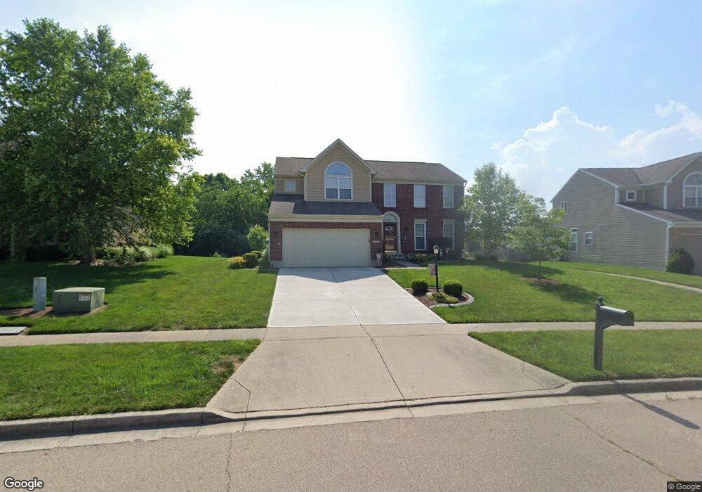
1640 Ashworth Dr Vandalia, OH 45377
Estimated Value: $404,056 - $454,000
4
Beds
3
Baths
2,640
Sq Ft
$163/Sq Ft
Est. Value
About This Home
This home is located at 1640 Ashworth Dr, Vandalia, OH 45377 and is currently estimated at $430,264, approximately $162 per square foot. 1640 Ashworth Dr is a home located in Montgomery County with nearby schools including Helke Elementary School, Morton Middle School, and Butler High School.
Ownership History
Date
Name
Owned For
Owner Type
Purchase Details
Closed on
Aug 15, 2003
Sold by
Nvr Inc
Bought by
Krimm Michael J and Krimm Susan E
Current Estimated Value
Home Financials for this Owner
Home Financials are based on the most recent Mortgage that was taken out on this home.
Original Mortgage
$218,774
Outstanding Balance
$96,339
Interest Rate
5.62%
Mortgage Type
Purchase Money Mortgage
Estimated Equity
$333,925
Purchase Details
Closed on
May 28, 2003
Sold by
Arnold Enterprises Inc
Bought by
Nvr Inc
Create a Home Valuation Report for This Property
The Home Valuation Report is an in-depth analysis detailing your home's value as well as a comparison with similar homes in the area
Home Values in the Area
Average Home Value in this Area
Purchase History
| Date | Buyer | Sale Price | Title Company |
|---|---|---|---|
| Krimm Michael J | -- | -- | |
| Nvr Inc | $43,000 | -- |
Source: Public Records
Mortgage History
| Date | Status | Borrower | Loan Amount |
|---|---|---|---|
| Open | Krimm Michael J | $218,774 |
Source: Public Records
Tax History Compared to Growth
Tax History
| Year | Tax Paid | Tax Assessment Tax Assessment Total Assessment is a certain percentage of the fair market value that is determined by local assessors to be the total taxable value of land and additions on the property. | Land | Improvement |
|---|---|---|---|---|
| 2024 | $5,776 | $110,940 | $17,640 | $93,300 |
| 2023 | $5,776 | $110,940 | $17,640 | $93,300 |
| 2022 | $5,659 | $87,920 | $14,000 | $73,920 |
| 2021 | $5,664 | $87,920 | $14,000 | $73,920 |
| 2020 | $5,647 | $87,920 | $14,000 | $73,920 |
| 2019 | $5,710 | $81,490 | $14,000 | $67,490 |
| 2018 | $5,721 | $81,490 | $14,000 | $67,490 |
| 2017 | $5,678 | $81,490 | $14,000 | $67,490 |
| 2016 | $5,133 | $72,370 | $14,000 | $58,370 |
| 2015 | $5,069 | $72,370 | $14,000 | $58,370 |
| 2014 | $5,069 | $72,370 | $14,000 | $58,370 |
| 2012 | -- | $69,970 | $17,500 | $52,470 |
Source: Public Records
Map
Nearby Homes
- 1515 Ash Ridge Ct
- 1441 S Dixie Dr
- 246 Crest Hill Ave
- 1588 Middle Park Dr
- 1052 Forest Crest Place
- 1054 Wilhelmina Dr
- 696 W Alkaline Springs Rd
- 416 Bent Twig Dr
- 917 Howard Ln
- 469 Farrell Rd
- 3518 Park Crest Ln
- 3600 Little York Rd
- 461 Poplar Grove Dr
- 1201 Greystone Cir
- 485 Pilot Point Unit 1-301
- 770 Deer Creek Dr
- 612 Bennert Dr
- Johnstown Plan at Yorkshire Reserve - The Oaks
- Newcastle Plan at Yorkshire Reserve - The Oaks
- Bellamy Plan at Yorkshire Reserve - The Oaks
- 1628 Ashworth Dr
- 1652 Ashworth Dr
- 1645 Mulberry Woods Ct
- 1616 Ashworth Dr
- 1664 Ashworth Dr
- 1665 Mulberry Woods Ct
- 1635 Ashworth Dr
- 1651 Ashworth Dr
- 1604 Ashworth Dr
- 1676 Ashworth Dr
- 1673 Ashworth Dr
- 1611 Ashworth Dr
- 1685 Mulberry Woods Ct
- 1650 Mulberry Woods Ct
- 1590 Ashworth Dr
- 1688 Ashworth Dr
- 1595 Ashworth Dr
- 1695 Ashworth Dr
- 1670 Mulberry Woods Ct
- 1642 Ashley Place