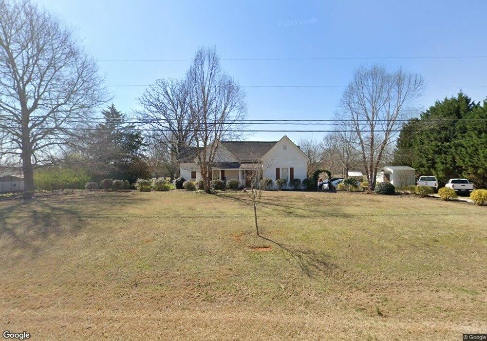
1640 Flat Rock Rd Watkinsville, GA 30677
Estimated Value: $506,000 - $607,430
2
Beds
2
Baths
2,704
Sq Ft
$201/Sq Ft
Est. Value
About This Home
This home is located at 1640 Flat Rock Rd, Watkinsville, GA 30677 and is currently estimated at $544,108, approximately $201 per square foot. 1640 Flat Rock Rd is a home located in Oconee County with nearby schools including Colham Ferry Elementary School, Oconee County Middle School, and Oconee County High School.
Ownership History
Date
Name
Owned For
Owner Type
Purchase Details
Closed on
Jan 24, 2017
Sold by
Cruce Tommy C
Bought by
Huff Charles M and Huff Karla
Current Estimated Value
Home Financials for this Owner
Home Financials are based on the most recent Mortgage that was taken out on this home.
Original Mortgage
$243,227
Interest Rate
4.32%
Mortgage Type
New Conventional
Purchase Details
Closed on
Dec 8, 2003
Sold by
Cruce Tommy C
Bought by
Tommy Cruce Construction Co Inc
Purchase Details
Closed on
Sep 6, 1994
Bought by
Athens First Bank
Create a Home Valuation Report for This Property
The Home Valuation Report is an in-depth analysis detailing your home's value as well as a comparison with similar homes in the area
Home Values in the Area
Average Home Value in this Area
Purchase History
| Date | Buyer | Sale Price | Title Company |
|---|---|---|---|
| Huff Charles M | $240,000 | -- | |
| Tommy Cruce Construction Co Inc | -- | -- | |
| Cruce Tommy C | -- | -- | |
| Athens First Bank | $84,000 | -- |
Source: Public Records
Mortgage History
| Date | Status | Borrower | Loan Amount |
|---|---|---|---|
| Closed | Huff Charles M | $243,227 |
Source: Public Records
Tax History Compared to Growth
Tax History
| Year | Tax Paid | Tax Assessment Tax Assessment Total Assessment is a certain percentage of the fair market value that is determined by local assessors to be the total taxable value of land and additions on the property. | Land | Improvement |
|---|---|---|---|---|
| 2024 | $3,815 | $206,168 | $47,884 | $158,284 |
| 2023 | $3,815 | $192,390 | $40,580 | $151,810 |
| 2022 | $3,631 | $169,223 | $33,817 | $135,406 |
| 2021 | $3,574 | $154,394 | $30,742 | $123,652 |
| 2020 | $3,422 | $147,570 | $30,140 | $117,430 |
| 2019 | $3,241 | $139,793 | $25,116 | $114,677 |
| 2018 | $2,949 | $124,501 | $21,840 | $102,661 |
| 2017 | $1,402 | $61,188 | $19,855 | $41,333 |
Source: Public Records
Map
Nearby Homes
- 1010 Bridlegate Dr Unit 25
- 1050 Pembrook Ct
- 2812 Astondale Rd
- 1100 Ryland Hills Dr
- 1200 Ryland Hills Dr
- 1081 Old Mill Dr
- 0 S Barnett Shoals Rd Unit CL336112
- 0 S Barnett Shoals Rd Unit 10579614
- 1070 Watson Ln Unit F1
- 1194 Watson Ln Unit F6
- 1094 Watson Ln Unit F2
- 1120 Watson Ln Unit F3
- 1144 Watson Ln Unit F4
- 1170 Watson Ln Unit F5
- Jasmine Plan at Wire Park - Trillium
- Laurel Plan at Wire Park - Trillium
- Azalea Plan at Wire Park - Trillium
- Dogwood Plan at Wire Park - Trillium
- Cubicasa Plan at Wire Park - The Towns
- E Building Townhome Plan at Wire Park - The Towns
- 1650 Flat Rock Rd
- 1660 Flat Rock Rd
- 1621 Flat Rock Rd
- 1560 Flat Rock Rd
- 1641 Flat Rock Rd
- 1973 McRee Gin Rd
- 1571 Flat Rock Rd
- 1681 Flat Rock Rd
- 1700 Flat Rock Rd
- 1661 Flat Rock Rd
- 1971 McRee Gin Rd
- 1711 Flat Rock Rd
- 1701 Flat Rock Rd
- 1941 McRee Gin Rd
- 1080 Ashford Rd
- 1490 Flat Rock Rd
- 1712 Flat Rock Rd
- 1130 Ashford Rd
- 1100 Ashford Rd
- 1761 Flat Rock Rd