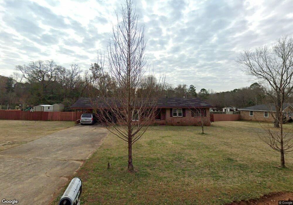
1640 Newton Bridge Rd Athens, GA 30607
Estimated Value: $246,000 - $282,557
3
Beds
2
Baths
1,375
Sq Ft
$198/Sq Ft
Est. Value
About This Home
This home is located at 1640 Newton Bridge Rd, Athens, GA 30607 and is currently estimated at $272,889, approximately $198 per square foot. 1640 Newton Bridge Rd is a home located in Clarke County with nearby schools including Fowler Drive Elementary School, Coile Middle School, and Cedar Shoals High School.
Ownership History
Date
Name
Owned For
Owner Type
Purchase Details
Closed on
Mar 31, 2008
Sold by
Riner James Grayson
Bought by
Roberts Raymond and Roberts Betty
Current Estimated Value
Home Financials for this Owner
Home Financials are based on the most recent Mortgage that was taken out on this home.
Original Mortgage
$129,972
Outstanding Balance
$83,399
Interest Rate
6.22%
Mortgage Type
FHA
Estimated Equity
$189,490
Purchase Details
Closed on
Mar 28, 2007
Sold by
Not Provided
Bought by
Roberts Raymond and Roberts
Purchase Details
Closed on
Feb 9, 1995
Sold by
Mccannon Diane M and Mccannon Darlene C
Bought by
Parks Neal and Undrell Parks
Create a Home Valuation Report for This Property
The Home Valuation Report is an in-depth analysis detailing your home's value as well as a comparison with similar homes in the area
Home Values in the Area
Average Home Value in this Area
Purchase History
| Date | Buyer | Sale Price | Title Company |
|---|---|---|---|
| Roberts Raymond | $131,000 | -- | |
| Roberts Raymond | $65,000 | -- | |
| Parks Neal | -- | -- |
Source: Public Records
Mortgage History
| Date | Status | Borrower | Loan Amount |
|---|---|---|---|
| Open | Roberts Raymond | $129,972 |
Source: Public Records
Tax History Compared to Growth
Tax History
| Year | Tax Paid | Tax Assessment Tax Assessment Total Assessment is a certain percentage of the fair market value that is determined by local assessors to be the total taxable value of land and additions on the property. | Land | Improvement |
|---|---|---|---|---|
| 2024 | $1,192 | $79,432 | $14,000 | $65,432 |
| 2023 | $74 | $74,567 | $12,000 | $62,567 |
| 2022 | $1,155 | $58,935 | $10,400 | $48,535 |
| 2021 | $1,058 | $47,278 | $8,000 | $39,278 |
| 2020 | $1,132 | $52,655 | $8,000 | $44,655 |
| 2019 | $1,055 | $46,404 | $8,000 | $38,404 |
| 2018 | $974 | $40,574 | $8,000 | $32,574 |
| 2017 | $941 | $38,218 | $8,000 | $30,218 |
| 2016 | $929 | $37,358 | $8,000 | $29,358 |
| 2015 | $888 | $36,120 | $8,000 | $28,120 |
| 2014 | $850 | $34,935 | $8,000 | $26,935 |
Source: Public Records
Map
Nearby Homes
- 2850 Commerce Rd
- 2680 Commerce Rd
- 425 Bob Holman Rd
- 170 Rocky Dr
- 221 Frederick Dr
- 256 Frederick Dr
- 224 Vineyard Dr
- The Rose Plan at Lantern Walk
- The Hudson Plan at Lantern Walk
- 105 Deupree Ct
- 607 W Vincent Dr
- 404 O'Conner Blvd
- 0 Old Commerce Rd Unit 10617666
- 70 Curry Falls Trail
- 70 Curry Falls Trail Unit Lot 1
- 2A Curry Falls Trail
- 2B Curry Falls Trail
- 21 Curry Falls Trail
- 365 Lorien Way
- 1660 Newton Bridge Rd
- 121 Scottwood Dr
- 1620 Newton Bridge Rd
- 131 Scottwood Dr
- 1680 Newton Bridge Rd
- 155 Deidre Dr
- 1590 Newton Bridge Rd
- 100 Almond Dr
- 141 Scottwood Dr
- 110 Almond Dr
- 1570 Newton Bridge Rd
- 140 Deidre Dr
- 1720 Newton Bridge Rd
- 151 Scottwood Dr
- 120 Almond Dr
- 161 Scottwood Dr
- 1550 Newton Bridge Rd
- 135 Deidre Dr
- 1750 Newton Bridge Rd
- 130 Deidre Dr