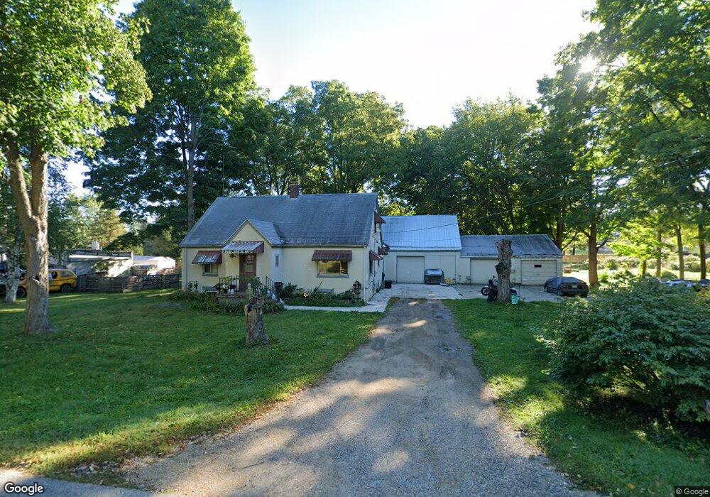
16401 Griswold Rd Lansing, MI 48906
Estimated Value: $185,000 - $202,134
2
Beds
3
Baths
1,404
Sq Ft
$138/Sq Ft
Est. Value
About This Home
This home is located at 16401 Griswold Rd, Lansing, MI 48906 and is currently estimated at $193,784, approximately $138 per square foot. 16401 Griswold Rd is a home located in Clinton County with nearby schools including Gier Park School, Pattengill Academy, and Eastern High School.
Ownership History
Date
Name
Owned For
Owner Type
Purchase Details
Closed on
Nov 1, 2018
Sold by
Webber Scott C
Bought by
Berryhill Donald L and Berryhill Brandy
Current Estimated Value
Home Financials for this Owner
Home Financials are based on the most recent Mortgage that was taken out on this home.
Original Mortgage
$70,000
Outstanding Balance
$44,095
Interest Rate
4.7%
Mortgage Type
New Conventional
Estimated Equity
$149,689
Purchase Details
Closed on
Dec 8, 2010
Sold by
Webber Robin L
Bought by
Webber Scott C
Create a Home Valuation Report for This Property
The Home Valuation Report is an in-depth analysis detailing your home's value as well as a comparison with similar homes in the area
Home Values in the Area
Average Home Value in this Area
Purchase History
| Date | Buyer | Sale Price | Title Company |
|---|---|---|---|
| Berryhill Donald L | $90,000 | Liberty Title & Escrow Co | |
| Webber Scott C | -- | Cfc Title Services Inc |
Source: Public Records
Mortgage History
| Date | Status | Borrower | Loan Amount |
|---|---|---|---|
| Open | Berryhill Donald L | $70,000 |
Source: Public Records
Tax History
| Year | Tax Paid | Tax Assessment Tax Assessment Total Assessment is a certain percentage of the fair market value that is determined by local assessors to be the total taxable value of land and additions on the property. | Land | Improvement |
|---|---|---|---|---|
| 2025 | $2,391 | $89,500 | $17,300 | $72,200 |
| 2024 | $14 | $83,300 | $16,000 | $67,300 |
| 2023 | $1,337 | $75,200 | $0 | $0 |
| 2022 | $2,392 | $64,900 | $14,200 | $50,700 |
| 2021 | $2,106 | $58,100 | $13,500 | $44,600 |
| 2020 | $2,284 | $55,900 | $12,700 | $43,200 |
| 2019 | $1,996 | $53,700 | $12,800 | $40,900 |
| 2018 | $2,003 | $49,400 | $12,200 | $37,200 |
| 2017 | $1,945 | $48,100 | $12,100 | $36,000 |
| 2016 | $1,837 | $48,200 | $12,400 | $35,800 |
| 2015 | $1,886 | $46,600 | $0 | $0 |
| 2011 | -- | $44,800 | $0 | $0 |
Source: Public Records
Map
Nearby Homes
- 1230 W Wieland Rd
- 61 Beejay Dr
- 27 Beejay Dr Unit 27
- 93 Nettie Ave Unit 93
- 92 Nettie Ave Unit 92
- 152 Donald Ave Unit 152
- 86 Nettie Ave Unit 86
- 82 Nettie Ave Unit 82
- 134 Desander Dr Unit 134
- 16550 S Us 27
- 15897 Elmira St
- 1015 Pearl St
- 3425 Turner Rd
- 310 W Frederick Ave
- 15860 Brook Rd
- E State Rd
- 16967 Jones Lake Rd
- 627 W Frederick Ave
- 714 W Sheridan Rd
- 504 W Fairfield Ave
- 1401 W Valley Rd
- 16400 Griswold Rd
- 16404 Griswold Rd
- 1481 W Valley Rd
- 16440 Griswold Rd
- 1393 W Valley Rd
- 16461 Griswold Rd
- 1383 W Valley Rd
- 1432 W Valley Rd
- 1371 W Valley Rd
- 1511 W Valley Rd
- 1470 W Valley Rd
- 16460 Griswold Rd
- 16442 Stockwell Rd
- 16430 Stockwell Rd
- 16489 Griswold Rd
- 1341 W Valley Rd
- 1380 W Valley Rd
- 16470 Griswold Rd
- 16452 Stockwell Rd
Your Personal Tour Guide
Ask me questions while you tour the home.