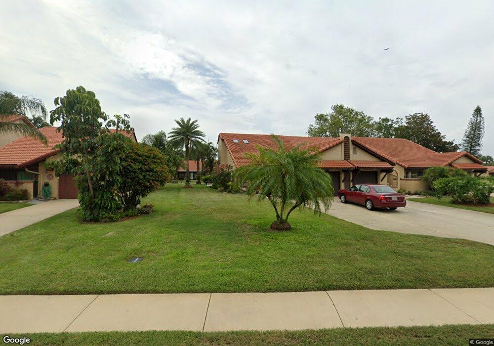
1641 Avery Rd NE Palm Bay, FL 32905
Port Malabar NeighborhoodEstimated Value: $223,982 - $265,000
3
Beds
2
Baths
1,416
Sq Ft
$171/Sq Ft
Est. Value
About This Home
This home is located at 1641 Avery Rd NE, Palm Bay, FL 32905 and is currently estimated at $241,746, approximately $170 per square foot. 1641 Avery Rd NE is a home located in Brevard County with nearby schools including Riviera Elementary School, Stone Magnet Middle School, and Palm Bay Magnet Senior High School.
Ownership History
Date
Name
Owned For
Owner Type
Purchase Details
Closed on
Nov 8, 2024
Sold by
Hans James R and Hans Jean M
Bought by
James R Hans And Jean M Hans Revocable Trust and Hans
Current Estimated Value
Purchase Details
Closed on
Jul 25, 2018
Sold by
Baker David L and Baker Kathleek A
Bought by
Hans Jean M and Hans James R
Purchase Details
Closed on
Feb 15, 2008
Sold by
Capone Joseph P and Capone Veronica M
Bought by
Baker David L and Baker Kathleen A
Purchase Details
Closed on
Mar 15, 2006
Sold by
Capone Joseph P and Capone Veronica M
Bought by
Capone Joseph P and Capone Veronica M
Purchase Details
Closed on
Nov 21, 2005
Sold by
White Robert Thomas and White Alice Joan
Bought by
Capone Joseph P and Capone Veronica M
Purchase Details
Closed on
Jan 16, 2001
Sold by
Wilson Wayne A and Wilson Ella Marie
Bought by
White Alice Joan
Create a Home Valuation Report for This Property
The Home Valuation Report is an in-depth analysis detailing your home's value as well as a comparison with similar homes in the area
Home Values in the Area
Average Home Value in this Area
Purchase History
| Date | Buyer | Sale Price | Title Company |
|---|---|---|---|
| James R Hans And Jean M Hans Revocable Trust | $100 | None Listed On Document | |
| James R Hans And Jean M Hans Revocable Trust | $100 | None Listed On Document | |
| Hans Jean M | -- | None Available | |
| Baker David L | $170,000 | Aaa Title | |
| Capone Joseph P | -- | Attorney | |
| Capone Joseph P | $200,000 | Aaa Title | |
| White Alice Joan | $87,500 | -- |
Source: Public Records
Tax History Compared to Growth
Tax History
| Year | Tax Paid | Tax Assessment Tax Assessment Total Assessment is a certain percentage of the fair market value that is determined by local assessors to be the total taxable value of land and additions on the property. | Land | Improvement |
|---|---|---|---|---|
| 2025 | $3,466 | $219,810 | -- | -- |
| 2024 | $3,325 | $193,800 | -- | -- |
| 2023 | $3,325 | $195,920 | $0 | $0 |
| 2022 | $3,055 | $183,170 | $0 | $0 |
| 2021 | $2,777 | $135,400 | $31,500 | $103,900 |
| 2020 | $2,573 | $125,590 | $26,250 | $99,340 |
| 2019 | $2,561 | $115,360 | $21,000 | $94,360 |
| 2018 | $2,565 | $116,080 | $21,000 | $95,080 |
| 2017 | $839 | $66,950 | $0 | $0 |
| 2016 | $727 | $65,580 | $10,500 | $55,080 |
| 2015 | $743 | $65,130 | $15,750 | $49,380 |
| 2014 | $750 | $64,620 | $15,750 | $48,870 |
Source: Public Records
Map
Nearby Homes
- 1647 Avery Rd NE
- 1460 Par St NE
- 815 Brae Ct NE
- 1698 Sunny Brook Ln NE Unit G203
- 1698 Sunny Brook Ln NE Unit 206
- 609 Cedar Side Cir NE
- 1573 Par St NE
- 1600 Sunny Brook Ln NE Unit F108
- 1680 Sunny Brook Ln NE Unit 103
- 950 Hooper Ave NE
- 1825 Market Cir NE
- 1624 Sunny Brook Ln NE Unit 203
- 1640 Sunny Brook Ln NE Unit A203
- 725 Port Malabar Blvd NE Unit 106
- 725 Port Malabar Blvd NE Unit 104
- 725 Port Malabar Blvd NE Unit 200
- 725 Port Malabar Blvd NE Unit 209
- 725 Port Malabar Blvd NE Unit 111
- 712 Port Malabar Blvd NE
- 1617 Sunny Brook Ln NE Unit F103
- 1635 Avery Rd NE
- 1629 Avery Rd NE
- 1653 Avery Rd NE
- 1623 Avery Rd NE
- 1619 Avery Rd NE
- 1678 Dawes Rd NE
- 1670 Dawes Rd NE
- 1686 Dawes Rd NE Unit 5
- 1662 Dawes Rd NE Unit 5
- 1662 Dawes Rd NE
- 1654 Dawes Rd NE
- 1695 Lenox Ct NE
- 1646 Dawes Rd NE Unit 1646
- 1646 Dawes Rd NE
- 1699 Dawes Rd NE
- 1665 Lenox Ct NE
- 1697 Dawes Rd NE
- 1638 Dawes Rd NE
- 1635 Lenox Ct NE
- 1691 Dawes Rd NE