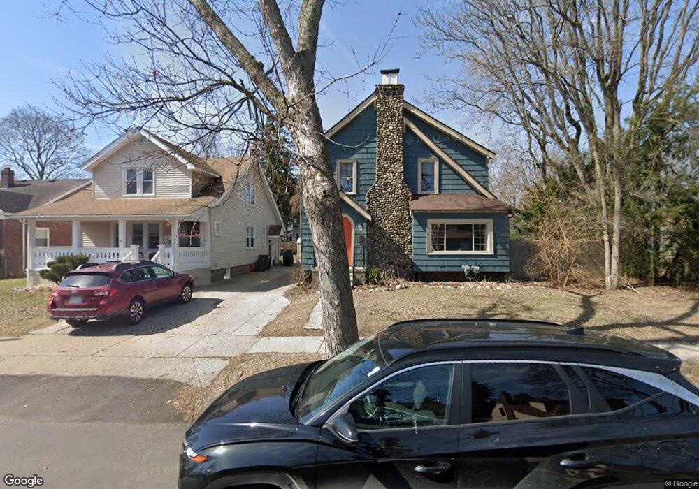
1641 Beaufield St Unit Bldg-Unit Ferndale, MI 48220
Estimated Value: $436,000 - $528,000
3
Beds
3
Baths
2,100
Sq Ft
$223/Sq Ft
Est. Value
About This Home
This home is located at 1641 Beaufield St Unit Bldg-Unit, Ferndale, MI 48220 and is currently estimated at $468,035, approximately $222 per square foot. 1641 Beaufield St Unit Bldg-Unit is a home located in Oakland County with nearby schools including Ferndale Lower Elementary Campus, Ferndale Upper Elementary Campus, and Ferndale Middle School.
Ownership History
Date
Name
Owned For
Owner Type
Purchase Details
Closed on
Apr 24, 2018
Sold by
Sherrit Keherine
Bought by
Polaski Devin and Polaski Noelle
Current Estimated Value
Purchase Details
Closed on
Jun 23, 2017
Sold by
Stokes Christine and Stokes Christopher Lee
Bought by
Sherrit Katherine
Purchase Details
Closed on
Oct 31, 2007
Sold by
Lynn Dorothy and Edwardson William
Bought by
Miller Christine Ordell and Stokes Christopher Lee
Purchase Details
Closed on
Feb 20, 2006
Sold by
Griffin May
Bought by
Griffin May and May Griffin Living Trust
Create a Home Valuation Report for This Property
The Home Valuation Report is an in-depth analysis detailing your home's value as well as a comparison with similar homes in the area
Home Values in the Area
Average Home Value in this Area
Purchase History
| Date | Buyer | Sale Price | Title Company |
|---|---|---|---|
| Polaski Devin | $324,000 | Regions Title Agency Llc | |
| Sherrit Katherine | $191,500 | Title Connect Llc | |
| Miller Christine Ordell | $150,000 | Cbs Title | |
| Griffin May | -- | None Available |
Source: Public Records
Tax History Compared to Growth
Tax History
| Year | Tax Paid | Tax Assessment Tax Assessment Total Assessment is a certain percentage of the fair market value that is determined by local assessors to be the total taxable value of land and additions on the property. | Land | Improvement |
|---|---|---|---|---|
| 2024 | $8,857 | $198,100 | $0 | $0 |
| 2023 | $8,610 | $185,280 | $0 | $0 |
| 2022 | $8,666 | $160,320 | $0 | $0 |
| 2021 | $8,765 | $156,270 | $0 | $0 |
| 2020 | $8,300 | $156,910 | $0 | $0 |
| 2019 | $8,437 | $151,040 | $0 | $0 |
| 2018 | $7,380 | $124,290 | $0 | $0 |
| 2017 | $4,932 | $104,680 | $0 | $0 |
| 2016 | $5,507 | $100,510 | $0 | $0 |
| 2015 | -- | $96,480 | $0 | $0 |
| 2014 | -- | $87,630 | $0 | $0 |
| 2011 | -- | $66,520 | $0 | $0 |
Source: Public Records
Map
Nearby Homes
- 1709 Beaufield St
- 630 W Troy St
- 619 Withington St
- 853 Leroy St
- 1924 Pinecrest Dr
- 1364 W Saratoga St
- 487 W Troy St
- 571 W Saratoga St
- 964 W Marshall St
- 629 W Lewiston Ave
- 1416 Leroy St
- 475 W Breckenridge St
- 1526 Albany St
- 367 W Cambourne St
- 1437 Pearson St
- 2015 Central St
- 1941 Hyland St
- 256 Withington St
- 324 Albany St
- 768 Pinecrest Dr
- 1641 Beaufield St
- 1631 Beaufield St
- 1655 Beaufield St
- 1621 Beaufield St
- 1703 Beaufield St
- 1638 Kenton St
- 1644 Kenton St
- 1630 Kenton St
- 1656 Kenton St
- 1615 Beaufield St
- 1624 Kenton St
- 1702 Kenton St
- 1638 Beaufield St
- 1644 Beaufield St
- 1630 Beaufield St
- 1614 Kenton St
- 1605 Beaufield St
- 1717 Beaufield St
- 1620 Beaufield St
- 1702 Beaufield St