Estimated Value: $1,231,885 - $1,549,000
4
Beds
3
Baths
4,715
Sq Ft
$293/Sq Ft
Est. Value
About This Home
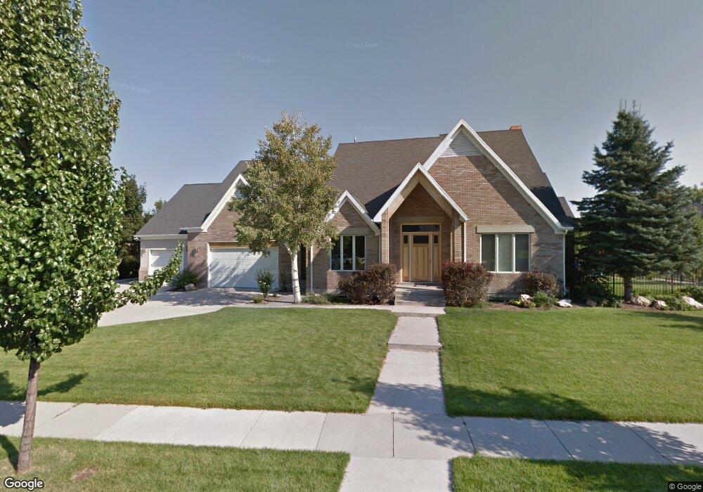
This home is located at 1641 Cotswold Cir, Sandy, UT 84093 and is currently estimated at $1,383,471, approximately $293 per square foot. 1641 Cotswold Cir is a home located in Salt Lake County with nearby schools including Oakdale School, Albion Middle School, and Brighton High School.
Ownership History
Date
Name
Owned For
Owner Type
Purchase Details
Closed on
Mar 18, 2025
Sold by
Evans Bruce L and Evans Terri W
Bought by
Agreement With The Bruce And Terri Evans Fami and Evans
Current Estimated Value
Purchase Details
Closed on
Aug 29, 2012
Sold by
Evans Bruce L and Evans Terri W
Bought by
Evans Terri W and Evans Bruce L
Home Financials for this Owner
Home Financials are based on the most recent Mortgage that was taken out on this home.
Original Mortgage
$338,400
Interest Rate
3.49%
Mortgage Type
New Conventional
Purchase Details
Closed on
Dec 6, 2004
Sold by
Dom Walter F and Dom Colleen D
Bought by
Evans Bruce L and Evans Terri W
Home Financials for this Owner
Home Financials are based on the most recent Mortgage that was taken out on this home.
Original Mortgage
$310,000
Interest Rate
5.65%
Mortgage Type
Unknown
Purchase Details
Closed on
Jan 14, 2000
Sold by
Rushton Myrna J
Bought by
Holt Matthew Jay
Create a Home Valuation Report for This Property
The Home Valuation Report is an in-depth analysis detailing your home's value as well as a comparison with similar homes in the area
Home Values in the Area
Average Home Value in this Area
Purchase History
| Date | Buyer | Sale Price | Title Company |
|---|---|---|---|
| Agreement With The Bruce And Terri Evans Fami | -- | None Listed On Document | |
| Evans Terri W | -- | Integrated Title Ins Service | |
| Evans Bruce L | -- | United Title Services | |
| Holt Matthew Jay | -- | Sutherland Title |
Source: Public Records
Mortgage History
| Date | Status | Borrower | Loan Amount |
|---|---|---|---|
| Previous Owner | Evans Terri W | $338,400 | |
| Previous Owner | Evans Bruce L | $310,000 |
Source: Public Records
Tax History
| Year | Tax Paid | Tax Assessment Tax Assessment Total Assessment is a certain percentage of the fair market value that is determined by local assessors to be the total taxable value of land and additions on the property. | Land | Improvement |
|---|---|---|---|---|
| 2025 | $4,887 | $1,014,800 | $406,500 | $608,300 |
| 2024 | $4,887 | $934,200 | $375,200 | $559,000 |
| 2023 | $4,887 | $897,500 | $360,800 | $536,700 |
| 2022 | $4,936 | $893,700 | $353,700 | $540,000 |
| 2021 | $4,502 | $696,800 | $262,000 | $434,800 |
| 2020 | $4,015 | $586,100 | $262,000 | $324,100 |
| 2019 | $4,141 | $588,900 | $257,600 | $331,300 |
| 2018 | $3,723 | $541,900 | $257,600 | $284,300 |
| 2017 | $3,536 | $501,900 | $257,600 | $244,300 |
| 2016 | $3,594 | $495,600 | $250,100 | $245,500 |
| 2015 | $3,353 | $428,200 | $221,500 | $206,700 |
| 2014 | $3,253 | $404,300 | $216,800 | $187,500 |
Source: Public Records
Map
Nearby Homes
- 1341 E Creek Rd
- 1695 E Ensign Place
- 1335 E Milne Ln
- 1354 W 7240 S
- 1325 E Milne Ln
- 1997 E Parkridge Dr
- 1228 E Waterside Cove Unit 12
- 1222 E Waterside Cove Unit 31
- 1222 E Waterside Cove Unit 10
- 1212 E Waterside Cove Unit 12
- 1212 E Waterside Cove Unit 10
- 7755 S 1130 E
- 1205 E Waterside Cove Unit 13
- 7193 S Station Creek Way Unit 9C
- 1196 E Waterside Cove Unit 22
- 7044 S 1700 E
- 1190 E Waterside Cove Unit 10
- 1920 E 7130 S
- 1091 E 7575 S
- 1938 E 7130 S
- 7630 S Keswick Rd
- 7630 Keswick Rd
- 1619 E Cotswold Cir
- 7666 Keswick Rd
- 1619 Cotswold Cir
- 7616 S Keswick Rd
- 1630 Siesta Dr
- 7616 Keswick Rd
- 1613 Cotswold Cir
- 1613 E Cotswold Cir
- 7625 Keswick Rd
- 7639 Keswick Rd
- 1618 Cotswold Cir
- 7684 Keswick Rd
- 7659 Keswick Rd
- 7684 S Keswick Rd
- 7745 Plum Creek Ln
- 1674 Siesta Dr
- 7723 S Plum Creek Ln
- 7745 S Plum Creek Ln
Your Personal Tour Guide
Ask me questions while you tour the home.