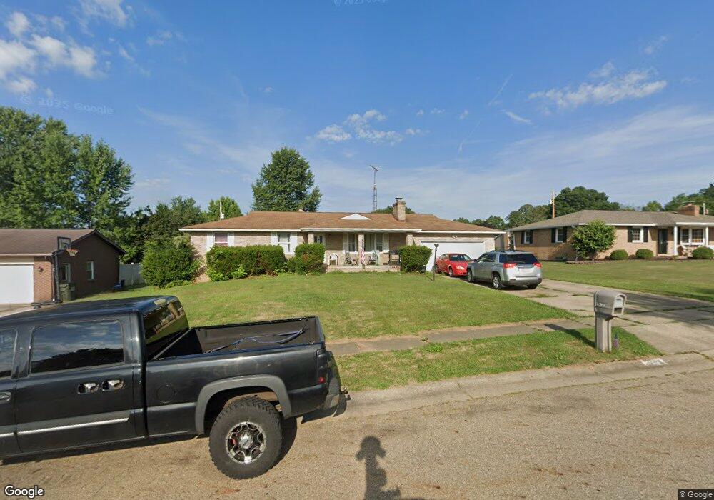
1641 Hiram St Louisville, OH 44641
Estimated Value: $213,000 - $225,000
3
Beds
2
Baths
1,344
Sq Ft
$162/Sq Ft
Est. Value
About This Home
This home is located at 1641 Hiram St, Louisville, OH 44641 and is currently estimated at $217,400, approximately $161 per square foot. 1641 Hiram St is a home located in Stark County with nearby schools including Louisville High School and St. Thomas Aquinas High School & Middle School.
Ownership History
Date
Name
Owned For
Owner Type
Purchase Details
Closed on
Oct 1, 2004
Sold by
Pastor Anna M
Bought by
Trubisky Donald C
Current Estimated Value
Home Financials for this Owner
Home Financials are based on the most recent Mortgage that was taken out on this home.
Original Mortgage
$82,000
Outstanding Balance
$41,045
Interest Rate
5.93%
Mortgage Type
Purchase Money Mortgage
Estimated Equity
$176,355
Purchase Details
Closed on
Sep 30, 2004
Sold by
Estate Of Mary C Pastor
Bought by
Pastor Anna M
Home Financials for this Owner
Home Financials are based on the most recent Mortgage that was taken out on this home.
Original Mortgage
$82,000
Outstanding Balance
$41,045
Interest Rate
5.93%
Mortgage Type
Purchase Money Mortgage
Estimated Equity
$176,355
Purchase Details
Closed on
Oct 25, 1999
Sold by
Estate Of Daniel M Paston
Bought by
Pastor Mary C
Create a Home Valuation Report for This Property
The Home Valuation Report is an in-depth analysis detailing your home's value as well as a comparison with similar homes in the area
Home Values in the Area
Average Home Value in this Area
Purchase History
| Date | Buyer | Sale Price | Title Company |
|---|---|---|---|
| Trubisky Donald C | -- | Patriot Title Agency Inc | |
| Pastor Anna M | -- | Patriot Title Agency Inc | |
| Pastor Mary C | -- | -- |
Source: Public Records
Mortgage History
| Date | Status | Borrower | Loan Amount |
|---|---|---|---|
| Open | Trubisky Donald C | $82,000 |
Source: Public Records
Tax History Compared to Growth
Tax History
| Year | Tax Paid | Tax Assessment Tax Assessment Total Assessment is a certain percentage of the fair market value that is determined by local assessors to be the total taxable value of land and additions on the property. | Land | Improvement |
|---|---|---|---|---|
| 2025 | -- | $50,370 | $17,080 | $33,290 |
| 2024 | -- | $50,370 | $17,080 | $33,290 |
| 2023 | $3,782 | $45,120 | $13,340 | $31,780 |
| 2022 | $1,945 | $45,120 | $13,340 | $31,780 |
| 2021 | $1,950 | $45,120 | $13,340 | $31,780 |
| 2020 | $1,630 | $40,960 | $12,010 | $28,950 |
| 2019 | $1,637 | $46,490 | $12,010 | $34,480 |
| 2018 | $1,850 | $46,490 | $12,010 | $34,480 |
| 2017 | $1,698 | $41,160 | $9,940 | $31,220 |
| 2016 | $1,733 | $41,160 | $9,940 | $31,220 |
| 2015 | $1,825 | $41,160 | $9,940 | $31,220 |
| 2014 | $1,723 | $37,940 | $9,170 | $28,770 |
| 2013 | $865 | $37,940 | $9,170 | $28,770 |
Source: Public Records
Map
Nearby Homes
- 1561 Noel St
- 0 Pilot Knob Ave NE
- 6285 California Ave
- 5700 Broadway Ave
- 0 Brookridge Ave
- 0 Glenbar St
- 5623 Shallow Creek Ave
- 704 Reno Dr
- 5470 Alcorn Ave
- 6083 Apple St
- 5700 Glena St
- 6395 Easton St NE
- 300 Kennedy St
- 6779 Easton St NE
- 248 Menegay Rd
- 414 Honeycrisp Dr NE
- 3047 Mcintosh Dr NE
- 2950 Mcintosh Dr NE
- 2956 Mcintosh Dr NE
- 2962 Mcintosh Dr NE