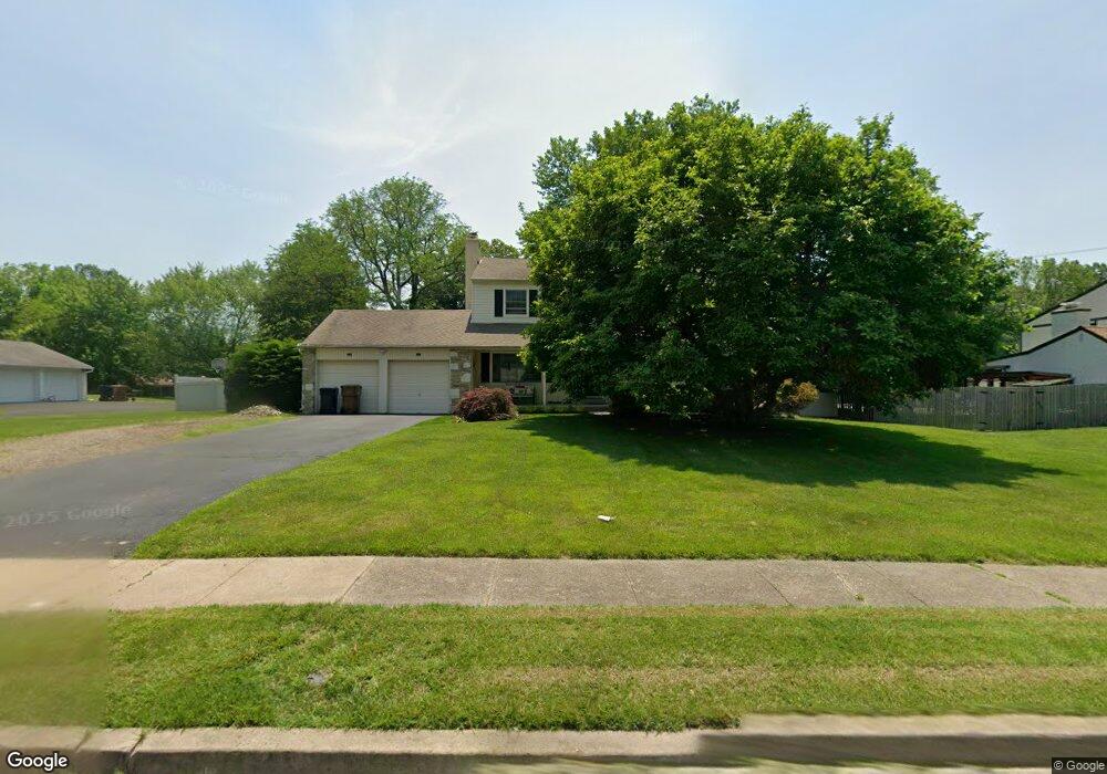
1641 Jarrettown Rd Dresher, PA 19025
Estimated Value: $551,000 - $715,280
4
Beds
3
Baths
2,280
Sq Ft
$289/Sq Ft
Est. Value
About This Home
This home is located at 1641 Jarrettown Rd, Dresher, PA 19025 and is currently estimated at $658,070, approximately $288 per square foot. 1641 Jarrettown Rd is a home located in Montgomery County with nearby schools including Jarrettown Elementary School, Sandy Run Middle School, and Upper Dublin High School.
Ownership History
Date
Name
Owned For
Owner Type
Purchase Details
Closed on
Jun 24, 2020
Sold by
Passaretti Kathleen M
Bought by
Passaretti Michael S and Passaretti Marnie E
Current Estimated Value
Home Financials for this Owner
Home Financials are based on the most recent Mortgage that was taken out on this home.
Original Mortgage
$215,000
Outstanding Balance
$190,222
Interest Rate
3.1%
Mortgage Type
New Conventional
Estimated Equity
$467,848
Purchase Details
Closed on
Jan 1, 1969
Bought by
Passaretti Joseph A and Passaretti Vera
Create a Home Valuation Report for This Property
The Home Valuation Report is an in-depth analysis detailing your home's value as well as a comparison with similar homes in the area
Home Values in the Area
Average Home Value in this Area
Purchase History
| Date | Buyer | Sale Price | Title Company |
|---|---|---|---|
| Passaretti Michael S | $300,000 | None Available | |
| Passaretti Joseph A | -- | -- |
Source: Public Records
Mortgage History
| Date | Status | Borrower | Loan Amount |
|---|---|---|---|
| Open | Passaretti Michael S | $215,000 |
Source: Public Records
Tax History Compared to Growth
Tax History
| Year | Tax Paid | Tax Assessment Tax Assessment Total Assessment is a certain percentage of the fair market value that is determined by local assessors to be the total taxable value of land and additions on the property. | Land | Improvement |
|---|---|---|---|---|
| 2025 | $9,807 | $201,110 | $72,360 | $128,750 |
| 2024 | $9,807 | $201,110 | $72,360 | $128,750 |
| 2023 | $9,577 | $201,110 | $72,360 | $128,750 |
| 2022 | $9,370 | $201,110 | $72,360 | $128,750 |
| 2021 | $9,136 | $201,110 | $72,360 | $128,750 |
| 2020 | $8,872 | $201,110 | $72,360 | $128,750 |
| 2019 | $8,724 | $201,110 | $72,360 | $128,750 |
| 2018 | $8,724 | $201,110 | $72,360 | $128,750 |
| 2017 | $8,406 | $201,110 | $72,360 | $128,750 |
| 2016 | $8,327 | $201,110 | $72,360 | $128,750 |
| 2015 | $7,866 | $201,110 | $72,360 | $128,750 |
| 2014 | $7,866 | $201,110 | $72,360 | $128,750 |
Source: Public Records
Map
Nearby Homes
- 1485 Mundock Rd
- 1525 Limekiln Pike
- 1733 Waterford Way
- 105 Magnolia St
- 1425 Welsh Rd
- 1300 Kirks Ln
- 237 Magnolia St
- 1423 Southwind Way
- 516 Galleria St
- 505 Galleria St
- 1478 Dillon Rd
- 1536 Fulton Dr
- 1404 Cinnamon Cir
- 1021 Meetinghouse Rd
- 1425 Crosby Dr
- 1354 Wentz Dr
- 1710 Twining Rd
- 6 Pheasant Run
- 105 Bolton Ct Unit 156
- 300 Witmer Rd
- 1645 Jarrettown Rd
- 1637 Jarrettown Rd
- 1614 Dublin Rd
- 1618 Dublin Rd
- 1644 Jarrettown Rd
- 1640 Jarrettown Rd
- 1648 Jarrettown Rd
- 1646 Limerick Ln
- 1622 Dublin Rd
- 1651 Jarrettown Rd
- 1615 Dublin Rd
- 1611 Dublin Rd
- 1650 Limerick Ln
- 1652 Jarrettown Rd
- 1515 Dublin Rd
- 1619 Dublin Rd
- 1611 Jarrettown Rd
- 1643 Pembrook Rd
- 1510 Dublin Rd
- 1623 Dublin Rd