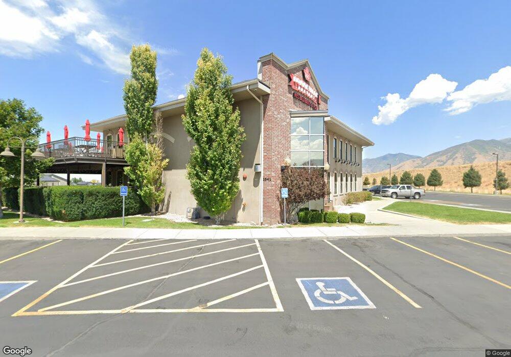
1641 N Main St Tooele, UT 84074
--
Bed
--
Bath
9,538
Sq Ft
1.82
Acres
About This Home
This home is located at 1641 N Main St, Tooele, UT 84074. 1641 N Main St is a home located in Tooele County with nearby schools including Copper Canyon Elementary School, Clarke N. Johnsen Junior High School, and Stansbury High School.
Ownership History
Date
Name
Owned For
Owner Type
Purchase Details
Closed on
Mar 29, 2012
Sold by
Mountain West Brewing Co Llc
Bought by
Black Stone Investments Holdings Llc
Purchase Details
Closed on
Apr 19, 2011
Sold by
Interim Holdings Llc
Bought by
Mountain West Brewing Company Llc
Purchase Details
Closed on
Dec 20, 2010
Sold by
Tracks Brewing Co
Bought by
Interim Holdings Llc
Purchase Details
Closed on
Sep 27, 2010
Sold by
Fairfield Land Co Llc
Bought by
Tracks Brewing Co
Purchase Details
Closed on
Dec 15, 2006
Sold by
Tracks Brewing Co
Bought by
Fairfields Land Co Llc
Create a Home Valuation Report for This Property
The Home Valuation Report is an in-depth analysis detailing your home's value as well as a comparison with similar homes in the area
Home Values in the Area
Average Home Value in this Area
Purchase History
| Date | Buyer | Sale Price | Title Company |
|---|---|---|---|
| Black Stone Investments Holdings Llc | -- | Security Title Insurance Age | |
| Mountain West Brewing Company Llc | -- | Title West Slc | |
| Interim Holdings Llc | -- | Title West Slc | |
| Tracks Brewing Co | -- | None Available | |
| Fairfields Land Co Llc | -- | Access Title Co |
Source: Public Records
Tax History Compared to Growth
Tax History
| Year | Tax Paid | Tax Assessment Tax Assessment Total Assessment is a certain percentage of the fair market value that is determined by local assessors to be the total taxable value of land and additions on the property. | Land | Improvement |
|---|---|---|---|---|
| 2025 | $27,256 | $2,273,452 | $832,650 | $1,440,802 |
| 2024 | $30,789 | $2,350,157 | $832,650 | $1,517,507 |
| 2023 | $30,789 | $2,179,597 | $828,100 | $1,351,497 |
| 2022 | $19,778 | $1,701,613 | $250,181 | $1,451,432 |
| 2021 | $23,646 | $1,701,613 | $250,181 | $1,451,432 |
| 2020 | $24,786 | $1,701,613 | $250,181 | $1,451,432 |
| 2019 | $25,196 | $1,701,613 | $250,181 | $1,451,432 |
| 2018 | $26,572 | $1,701,613 | $250,181 | $1,451,432 |
| 2017 | $22,393 | $1,701,613 | $250,181 | $1,451,432 |
| 2016 | $22,564 | $1,701,613 | $250,181 | $1,451,432 |
| 2015 | $22,564 | $1,641,002 | $0 | $0 |
| 2014 | -- | $1,440,032 | $0 | $0 |
Source: Public Records
Map
Nearby Homes
- 1789 N Aaron Dr
- 94 E Broxburn Way
- 179 Green Pines Ave
- 1545 N 210 E
- 1618 N 210 E
- 1598 N 210 E Unit 107
- 1756 N Patchwork Ave Unit 1258
- 1693 N Patchwork Ave Unit 1275
- 1705 N Patchwork Ave Unit 1272
- 1697 N Patchwork Ave Unit 1274
- 1752 N Patchwork Ave Unit 1259
- 1701 N Patchwork Ave Unit 1273
- 1737 N Patchwork Ave Unit 1266
- 61 W 1570 N
- 2232 N 400 E Unit 104
- 2046 N 400 E Unit 109
- 2252 N 400 E Unit 102
- 1206 N Berra Blvd
- 1737 N Broadway Ave
- 1833 N Blue Iris Ave Unit 1073
- 1581 N Main St Unit 128
- 210 E Allister Ct
- 201 E Allister Ct
- 208 E Allister Ct
- 1654 N Ashlin Ct
- 198 E Allister Ct
- 181 E Allister Ct Unit 134
- 1644 N Ashlin Ct
- 1644 N Ashlin Ct Unit 130
- 1664 N Ashlin Ct
- 1783 N Aaron Dr
- 1674 N Nassau Ct
- 1674 Ashlin Ct
- 1763 Aaron Dr
- 1769 Aaron Dr Unit 44
- 1627 N Ashlin Ct Unit 129
- 1627 N Ashlin Ct
- 1769 N Aaron Dr Unit 44
- 1763 N Aaron Dr Unit 45
- 1753 Aaron Dr