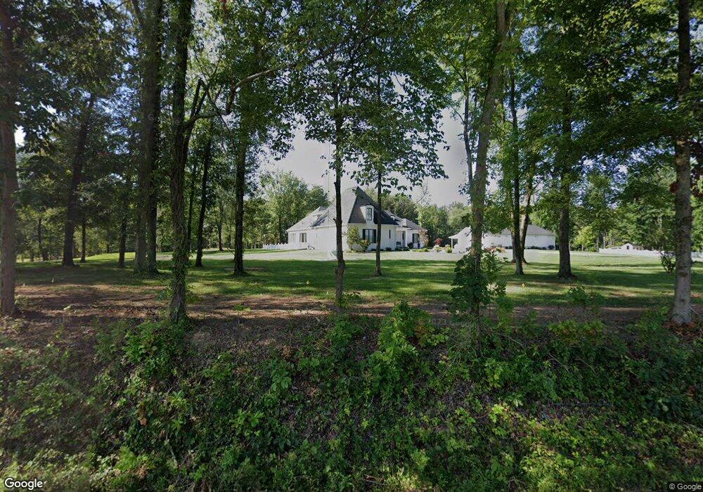
1641 S Rockport Rd Boonville, IN 47601
Estimated Value: $520,000 - $1,050,638
4
Beds
3
Baths
4,519
Sq Ft
$161/Sq Ft
Est. Value
About This Home
This home is located at 1641 S Rockport Rd, Boonville, IN 47601 and is currently estimated at $729,660, approximately $161 per square foot. 1641 S Rockport Rd is a home with nearby schools including Oakdale Elementary School, Boonville Middle School, and Boonville High School.
Ownership History
Date
Name
Owned For
Owner Type
Purchase Details
Closed on
Nov 11, 2020
Sold by
Ryan Ray R and Ryan Nancy E
Bought by
Ryan Ray R and Ryan Nancy E
Current Estimated Value
Purchase Details
Closed on
Feb 19, 2019
Sold by
Snodgrass Owen H and Snodgrass Lynnette G
Bought by
Ryan Ray R and Ryan Nancy
Home Financials for this Owner
Home Financials are based on the most recent Mortgage that was taken out on this home.
Original Mortgage
$650,000
Interest Rate
4.4%
Mortgage Type
Construction
Purchase Details
Closed on
May 12, 2010
Sold by
Snodgrass Owen Huston
Bought by
Snodgrass Owen Huston and Owen Huston Snodgrass Sr Revocable Trust
Purchase Details
Closed on
Oct 31, 2007
Sold by
Snodgrass Timothy W and Snodgrass Paula J
Bought by
Snodgrass Owen H and The Janetta A Snodgrass Family Trust
Create a Home Valuation Report for This Property
The Home Valuation Report is an in-depth analysis detailing your home's value as well as a comparison with similar homes in the area
Home Values in the Area
Average Home Value in this Area
Purchase History
| Date | Buyer | Sale Price | Title Company |
|---|---|---|---|
| Ryan Ray R | -- | None Available | |
| Ryan Ray R | -- | None Available | |
| Ryan Ray R | -- | None Available | |
| Snodgrass Owen Huston | -- | None Available | |
| Snodgrass Owen H | -- | None Available |
Source: Public Records
Mortgage History
| Date | Status | Borrower | Loan Amount |
|---|---|---|---|
| Closed | Ryan Ray R | $650,000 |
Source: Public Records
Tax History Compared to Growth
Tax History
| Year | Tax Paid | Tax Assessment Tax Assessment Total Assessment is a certain percentage of the fair market value that is determined by local assessors to be the total taxable value of land and additions on the property. | Land | Improvement |
|---|---|---|---|---|
| 2024 | $8,244 | $861,300 | $195,100 | $666,200 |
| 2023 | $8,628 | $880,300 | $195,100 | $685,200 |
| 2022 | $8,028 | $739,100 | $140,400 | $598,700 |
| 2021 | $6,795 | $591,300 | $109,700 | $481,600 |
| 2020 | $9,082 | $510,700 | $132,900 | $377,800 |
| 2019 | $1,828 | $106,100 | $75,800 | $30,300 |
| 2018 | $1,288 | $74,500 | $74,500 | $0 |
| 2017 | $1,287 | $74,500 | $74,500 | $0 |
| 2016 | $1,271 | $74,500 | $74,500 | $0 |
| 2014 | $1,264 | $74,500 | $74,500 | $0 |
| 2013 | $1,230 | $74,500 | $74,500 | $0 |
Source: Public Records
Map
Nearby Homes
- 2299 Brown Chapel Rd
- 2200 Brown Chapel Rd
- 1500 S Pelzer Rd
- 2099 S Pelzer Rd
- 1595 Victoria Woods Dr
- 2162 Victoria Woods Dr
- 1583 Victoria Woods Dr
- 1559 Victoria Woods Dr
- 1571 Victoria Woods Dr
- 4509 Fairway View Dr
- 4465 Fairway View Dr
- 4487 Fairway View Dr
- 2469 Victoria Woods Dr
- 4443 Fairway View Dr
- 1514 Mac-Ray Dr
- 322 Manger Rd
- 677 Manger Rd
- 255 Tower Dr
- 1255 Maple Grove Rd
- 902 Maxville Rd
- 1635 S Rockport Rd
- 2011 Lashbrook Rd
- 1654 S Rockport Rd
- 2099 Lashbrook Rd
- 2199 Lashbrook Rd
- 2177 Lashbrook Rd
- 2088 Bullocktown Rd
- 1900 Bullocktown Rd
- 2160 Bullocktown Rd
- 1612 S Rockport Rd
- 2211 Lashbrook Rd
- 1601 S Rockport Rd
- 1722 Bullocktown Rd
- 2188 Bullocktown Rd
- 1835 Bullocktown Rd
- 2077 Bullocktown Rd
- 2133 Bullocktown Rd
- 2311 Lashbrook Rd
- 1833 Bullocktown Rd
- 1699 Bullocktown Rd