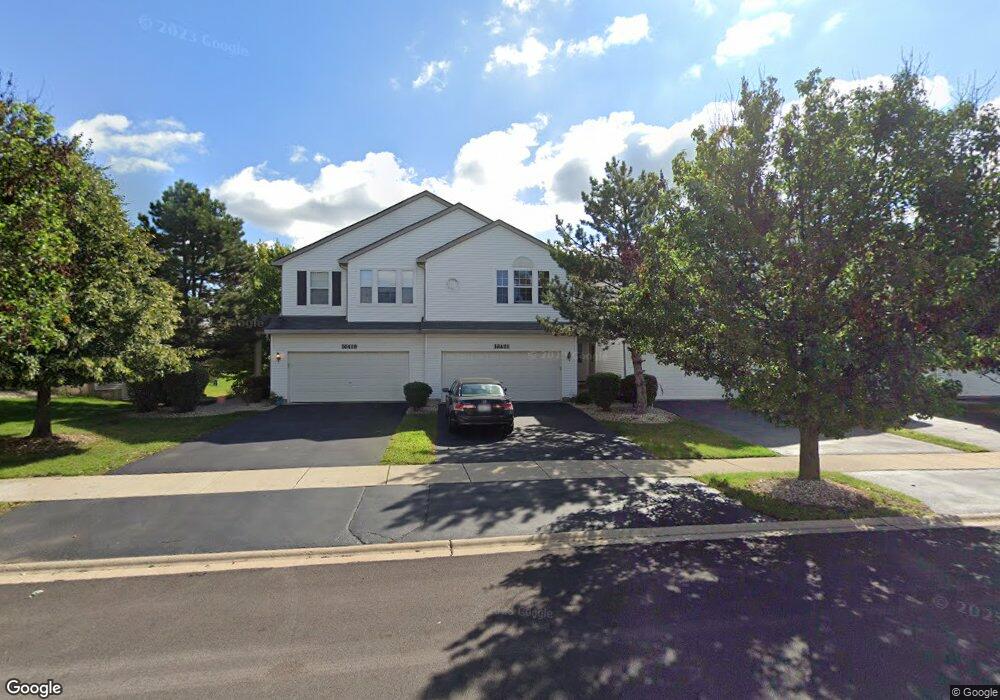
16421 Newcastle Way Unit T1892 Lockport, IL 60441
South Homer Glen NeighborhoodEstimated Value: $295,201 - $330,000
--
Bed
--
Bath
1,665
Sq Ft
$187/Sq Ft
Est. Value
About This Home
This home is located at 16421 Newcastle Way Unit T1892, Lockport, IL 60441 and is currently estimated at $310,550, approximately $186 per square foot. 16421 Newcastle Way Unit T1892 is a home located in Will County with nearby schools including William E Young School, Hadley Middle School, and Homer Jr High School.
Ownership History
Date
Name
Owned For
Owner Type
Purchase Details
Closed on
Dec 26, 2024
Sold by
Dinos Olga and Dinos Mark
Bought by
Glikis Olga
Current Estimated Value
Purchase Details
Closed on
Feb 28, 2007
Sold by
Fawcett William M
Bought by
Dinos Mark and Glikis Olga
Home Financials for this Owner
Home Financials are based on the most recent Mortgage that was taken out on this home.
Original Mortgage
$173,000
Interest Rate
6.28%
Mortgage Type
Purchase Money Mortgage
Purchase Details
Closed on
Aug 15, 2002
Sold by
Montalbano Builders Inc
Bought by
Fawcett William M
Home Financials for this Owner
Home Financials are based on the most recent Mortgage that was taken out on this home.
Original Mortgage
$172,500
Interest Rate
6.64%
Mortgage Type
FHA
Create a Home Valuation Report for This Property
The Home Valuation Report is an in-depth analysis detailing your home's value as well as a comparison with similar homes in the area
Home Values in the Area
Average Home Value in this Area
Purchase History
| Date | Buyer | Sale Price | Title Company |
|---|---|---|---|
| Glikis Olga | -- | Stewart Title | |
| Dinos Mark | $185,000 | Chicago Title Insurance Co | |
| Fawcett William M | $178,000 | First American Title |
Source: Public Records
Mortgage History
| Date | Status | Borrower | Loan Amount |
|---|---|---|---|
| Previous Owner | Dinos Mark | $173,000 | |
| Previous Owner | Fawcett William M | $172,500 |
Source: Public Records
Tax History Compared to Growth
Tax History
| Year | Tax Paid | Tax Assessment Tax Assessment Total Assessment is a certain percentage of the fair market value that is determined by local assessors to be the total taxable value of land and additions on the property. | Land | Improvement |
|---|---|---|---|---|
| 2024 | $7,017 | $88,577 | $12,038 | $76,539 |
| 2023 | $7,017 | $80,291 | $10,912 | $69,379 |
| 2022 | $6,457 | $74,969 | $10,189 | $64,780 |
| 2021 | $6,152 | $71,027 | $9,653 | $61,374 |
| 2020 | $6,118 | $68,414 | $9,298 | $59,116 |
| 2019 | $5,929 | $65,815 | $8,945 | $56,870 |
| 2018 | $5,752 | $63,423 | $8,842 | $54,581 |
| 2017 | $5,645 | $61,647 | $8,594 | $53,053 |
| 2016 | $5,512 | $59,591 | $8,307 | $51,284 |
| 2015 | $5,253 | $57,354 | $7,995 | $49,359 |
| 2014 | $5,253 | $55,152 | $7,830 | $47,322 |
| 2013 | $5,253 | $55,152 | $7,830 | $47,322 |
Source: Public Records
Map
Nearby Homes
- 14443 Etchingham Dr
- 16601 S Windsor Ln Unit T1611
- 14414 W 167th St
- 16663 S Windsor Ln Unit T1644
- 14549 W 159th St
- 15053 Sagebrush Ln Unit 1254
- 16340 S Alberta Ct
- 16515 S Farmington Ln
- 15326 W Harvest Ln
- 0B W 159th St
- 16001 S Leach Dr Unit 3
- 16609 S Silo Bend Dr
- 16860 S Ivy Ln
- 16508 S Brook Ln
- 1,2 W Rambling Rd
- 0 NW 159th Parker St Unit MRD12445910
- 14858 W Glen Crest Ln
- 15100 W 159th St
- 16604 Pine Hill Dr
- 16947 S Timber Dr
- 16419 Newcastle Way Unit T1891
- 16427 Newcastle Way Unit T1895
- 16423 Newcastle Way Unit T1893
- 16429 Newcastle Way
- 16425 Newcastle Way
- 16423 Newcastle Way Unit 1
- 16433 Newcastle Way Unit T1901
- 16433 Newcastle Way
- 16435 Newcastle Way
- 16441 Newcastle Way
- 16439 Newcastle Way
- 16437 Newcastle Way
- 16435 Newcastle Way
- 16409 Newcastle Way Unit T1882
- 16415 Newcastle Way Unit T1885
- 16411 Newcastle Way
- 16413 Newcastle Way
- 16412 Newcastle Way Unit T1806
- 16420 Newcastle Way Unit T1802
- 16416 Newcastle Way Unit 1804