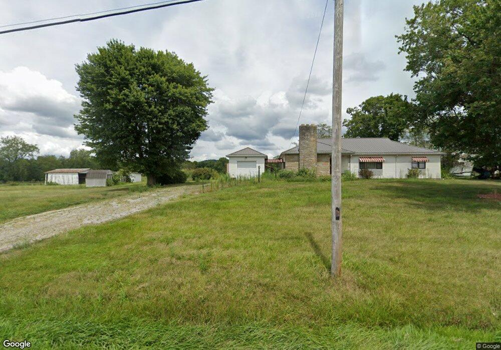
1643 Coal Dock Rd Waverly, OH 45690
Estimated Value: $257,000 - $344,000
3
Beds
1
Bath
1,815
Sq Ft
$155/Sq Ft
Est. Value
About This Home
This home is located at 1643 Coal Dock Rd, Waverly, OH 45690 and is currently estimated at $282,207, approximately $155 per square foot. 1643 Coal Dock Rd is a home located in Pike County.
Ownership History
Date
Name
Owned For
Owner Type
Purchase Details
Closed on
Jun 11, 2010
Sold by
Irvine Carl S and Cooper Nancy
Bought by
Brust Christopher J and Brust Jessica A
Current Estimated Value
Home Financials for this Owner
Home Financials are based on the most recent Mortgage that was taken out on this home.
Original Mortgage
$162,807
Interest Rate
5.05%
Mortgage Type
FHA
Create a Home Valuation Report for This Property
The Home Valuation Report is an in-depth analysis detailing your home's value as well as a comparison with similar homes in the area
Home Values in the Area
Average Home Value in this Area
Purchase History
| Date | Buyer | Sale Price | Title Company |
|---|---|---|---|
| Brust Christopher J | $165,000 | None Available |
Source: Public Records
Mortgage History
| Date | Status | Borrower | Loan Amount |
|---|---|---|---|
| Closed | Brust Christopher J | $162,807 |
Source: Public Records
Tax History Compared to Growth
Tax History
| Year | Tax Paid | Tax Assessment Tax Assessment Total Assessment is a certain percentage of the fair market value that is determined by local assessors to be the total taxable value of land and additions on the property. | Land | Improvement |
|---|---|---|---|---|
| 2024 | $1,892 | $56,820 | $15,440 | $41,380 |
| 2023 | $1,892 | $56,820 | $15,440 | $41,380 |
| 2022 | $1,424 | $41,660 | $10,240 | $31,420 |
| 2021 | $1,387 | $50,770 | $19,350 | $31,420 |
| 2020 | $1,397 | $50,770 | $19,350 | $31,420 |
| 2019 | $1,414 | $46,090 | $17,590 | $28,500 |
| 2018 | $1,222 | $41,610 | $13,110 | $28,500 |
| 2017 | $1,139 | $38,060 | $13,110 | $24,950 |
| 2016 | $1,047 | $30,850 | $5,130 | $25,720 |
| 2015 | $1,048 | $30,850 | $5,130 | $25,720 |
| 2014 | $1,068 | $30,920 | $5,120 | $25,800 |
| 2013 | $1,071 | $28,990 | $4,460 | $24,530 |
| 2012 | $1,106 | $29,060 | $4,530 | $24,530 |
Source: Public Records
Map
Nearby Homes
- 1722 Beaver Pike
- 3115 Coal Dock Rd
- 2605 Adams Rd
- 789 Moats Hollow Rd
- 2765 Bobo Rd
- 001 Ervin Hill Rd
- 01 Ervin Hill Rd
- 6183 Ohio 335
- 301 3rd St
- 874 Gravel Hill Rd
- 1490 Millers Ln
- 1112 Bailey Rd
- 300 Wadsworth Ave
- 2590 Zahns Corner Rd Unit 220562
- 967 Bobo Rd
- 2351 Beaver Creek Rd
- 0 Holbrook Rd
- 12893 Ohio 220
- 513 Posey Ridge Rd
- 441 Loop Rd
- 1588 Coal Dock Rd
- 1757 Coal Dock Rd
- 1499 Coal Dock Rd
- 1740 Coal Dock Rd
- 1859 Coal Dock Rd
- 1949 Coal Dock Rd
- 1952 Coal Dock Rd
- 0 Coal Dock Rd
- 1976 Coal Dock Rd
- 2038 Coal Dock Rd
- 2025 Coal Dock Rd
- 1974 Coal Dock Rd
- 2088 Coal Dock Rd Unit 215142
- 2123 Coal Dock Rd
- 2120 Coal Dock Rd
- 2147 Coal Dock Rd
- 920 Straight Creek Rd Unit 214840
- 406 Straight Creek Rd
- 908 Straight Creek Rd
- 1102 Coal Dock Rd