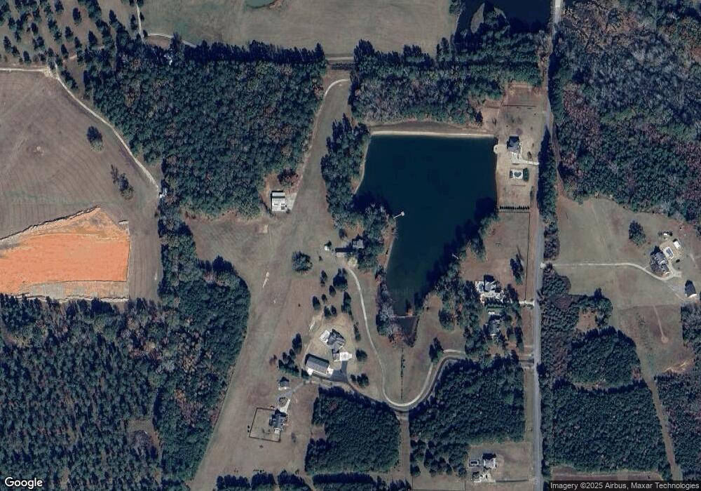
1643 Concord Rd Concord, GA 30206
Estimated Value: $487,000 - $624,000
4
Beds
4
Baths
3,661
Sq Ft
$145/Sq Ft
Est. Value
About This Home
This home is located at 1643 Concord Rd, Concord, GA 30206 and is currently estimated at $530,813, approximately $144 per square foot. 1643 Concord Rd is a home located in Pike County with nearby schools including Pike County Primary School, Pike County Elementary School, and Pike County Middle School.
Ownership History
Date
Name
Owned For
Owner Type
Purchase Details
Closed on
Oct 30, 2020
Sold by
Walker Joy S
Bought by
Roberts Jeffrey
Current Estimated Value
Purchase Details
Closed on
Nov 10, 2015
Sold by
Walker Joy S
Bought by
Walker Joy S and Potter Russell H
Purchase Details
Closed on
May 11, 2004
Sold by
Horne Robert A and Horne Christine T
Bought by
Scott Gary W and Scott Edwina J
Purchase Details
Closed on
Dec 23, 1985
Sold by
Dailey Annette Clark and Elmer Eugene
Bought by
Horne Robert A and Horne Christine T
Purchase Details
Closed on
Apr 14, 1983
Sold by
Dailey Elmer Eugene
Bought by
Dailey Annette Clark and Elmer Eugene
Purchase Details
Closed on
Apr 9, 1974
Bought by
Dailey Elmer Eugene
Create a Home Valuation Report for This Property
The Home Valuation Report is an in-depth analysis detailing your home's value as well as a comparison with similar homes in the area
Home Values in the Area
Average Home Value in this Area
Purchase History
| Date | Buyer | Sale Price | Title Company |
|---|---|---|---|
| Roberts Jeffrey | $294,510 | -- | |
| Walker Joy S | -- | -- | |
| Scott Gary W | $270,000 | -- | |
| Horne Robert A | $380,000 | -- | |
| Dailey Annette Clark | -- | -- | |
| Dailey Elmer Eugene | -- | -- |
Source: Public Records
Tax History Compared to Growth
Tax History
| Year | Tax Paid | Tax Assessment Tax Assessment Total Assessment is a certain percentage of the fair market value that is determined by local assessors to be the total taxable value of land and additions on the property. | Land | Improvement |
|---|---|---|---|---|
| 2024 | $2,841 | $114,632 | $26,123 | $88,509 |
| 2023 | $3,326 | $114,632 | $26,123 | $88,509 |
| 2022 | $2,567 | $88,465 | $26,123 | $62,342 |
| 2021 | $2,657 | $88,465 | $26,123 | $62,342 |
| 2020 | $2,688 | $88,465 | $26,123 | $62,342 |
| 2019 | $2,241 | $64,902 | $17,234 | $47,668 |
| 2018 | $2,243 | $64,902 | $17,234 | $47,668 |
| 2017 | $2,224 | $64,902 | $17,234 | $47,668 |
| 2016 | $2,064 | $64,902 | $17,234 | $47,668 |
| 2015 | $1,966 | $64,902 | $17,234 | $47,668 |
| 2014 | $1,994 | $64,902 | $17,234 | $47,668 |
| 2013 | -- | $64,902 | $17,234 | $47,668 |
Source: Public Records
Map
Nearby Homes
- 2246 Concord Rd
- LOT 11 Flint Farms Dr
- TRACT 5 Bates Rd (13 98acs)
- LOT 12 Flint Farms Dr
- 184 Flint Farms Dr
- 243 Flint Farms Dr
- 126 Flint Farms Dr
- 3.39 ACRES Caldwell Bridge Rd
- 0 West Rd Unit 10536330
- 0 West Rd Unit 10541322
- 481 Turner Rd
- 10000 Highway 18 W
- L-8 Strickland Rd
- 764 Bates Rd (228 96acs)
- TRACT 6 & 7 Bates Rd (47 4acs)
- TRACT 2 Bates Rd (56 99acs)
- 4091 Hollonville Rd
- 2310 Hollonville Rd
- 1337 Green St
- 1579 Bates Rd
- 301 Flying h Ln
- 1689 Concord Rd
- 1645 Concord Rd N
- 1649 Concord Rd
- 1641 Concord Rd
- 1817 Concord Rd
- 1535 Concord Rd
- 1547 Concord Rd Unit 6
- 1547 Concord Rd
- 1555 Concord Rd
- 1543 Concord Rd
- 1635 Concord Rd
- 1541 Concord Rd
- 1425 Concord Rd
- 1425 Conco Rd
- 1720 Concord Rd
- 1835 Concord Rd
- 1845 Concord Rd
- 1507 Concord Rd
- 1941 Bottoms Rd
