1643 Cornell Dr Unit 18C Hoffman Estates, IL 60169
South Hoffman Estates NeighborhoodEstimated Value: $197,108 - $234,000
2
Beds
--
Bath
1,000
Sq Ft
$221/Sq Ft
Est. Value
About This Home
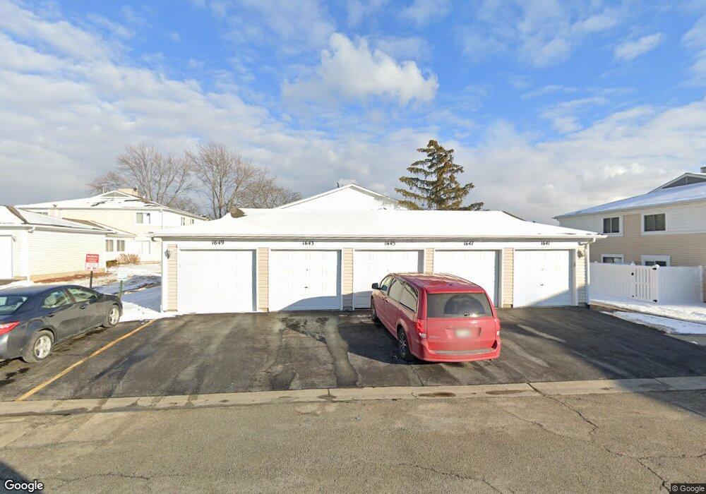
This home is located at 1643 Cornell Dr Unit 18C, Hoffman Estates, IL 60169 and is currently estimated at $220,777, approximately $220 per square foot. 1643 Cornell Dr Unit 18C is a home located in Cook County with nearby schools including Neil Armstrong Elementary School, Dwight D Eisenhower Junior High School, and Hoffman Estates High School.
Ownership History
Date
Name
Owned For
Owner Type
Purchase Details
Closed on
Feb 29, 2000
Sold by
Barot Mahesh R and Barot Mamta M
Bought by
Calinga Teofila R
Current Estimated Value
Home Financials for this Owner
Home Financials are based on the most recent Mortgage that was taken out on this home.
Original Mortgage
$79,800
Interest Rate
8.24%
Mortgage Type
Purchase Money Mortgage
Create a Home Valuation Report for This Property
The Home Valuation Report is an in-depth analysis detailing your home's value as well as a comparison with similar homes in the area
Home Values in the Area
Average Home Value in this Area
Purchase History
| Date | Buyer | Sale Price | Title Company |
|---|---|---|---|
| Calinga Teofila R | $84,000 | Professional National Title |
Source: Public Records
Mortgage History
| Date | Status | Borrower | Loan Amount |
|---|---|---|---|
| Previous Owner | Calinga Teofila R | $79,800 |
Source: Public Records
Tax History
| Year | Tax Paid | Tax Assessment Tax Assessment Total Assessment is a certain percentage of the fair market value that is determined by local assessors to be the total taxable value of land and additions on the property. | Land | Improvement |
|---|---|---|---|---|
| 2025 | $2,529 | $20,113 | $4,492 | $15,621 |
| 2024 | $2,529 | $14,210 | $4,083 | $10,127 |
| 2023 | $2,392 | $14,210 | $4,083 | $10,127 |
| 2022 | $2,392 | $14,210 | $4,083 | $10,127 |
| 2021 | $1,628 | $10,853 | $6,431 | $4,422 |
| 2020 | $1,724 | $10,853 | $6,431 | $4,422 |
| 2019 | $1,741 | $12,121 | $6,431 | $5,690 |
| 2018 | $825 | $8,715 | $5,614 | $3,101 |
| 2017 | $2,791 | $8,715 | $5,614 | $3,101 |
| 2016 | $2,596 | $8,715 | $5,614 | $3,101 |
| 2015 | $1,826 | $5,684 | $4,899 | $785 |
| 2014 | $1,793 | $5,684 | $4,899 | $785 |
| 2013 | $1,747 | $5,684 | $4,899 | $785 |
Source: Public Records
Map
Nearby Homes
- 1587 Brookside Dr
- 1792 Williamsburg Dr
- 2222 Seaver Ln
- 1576 Poplar Creek Dr
- 1797 Queensbury Cir Unit 5764
- 2080 Sutherland Place Unit 1
- 1500 Robin Cir Unit 314
- 1776 Bristol Walk Unit 1776
- 1760 Bristol Walk Unit F
- 1840 Huntington Blvd Unit BW511
- 1840 Huntington Blvd Unit 203
- 1836 Stockton Dr Unit 3312
- 1722 Fayette Walk Unit E
- 1769 Sessions Walk Unit C
- 1800 Monterey Ct
- 2051 Kettering Rd Unit 2
- 2021 Kensington Ln Unit 3004
- 2027 Kensington Ln Unit 3001
- 2025 Kensington Ln Unit 3002
- 2023 Kensington Ln Unit 3003
- 1643 Cornell Dr Unit 20B
- 1643 Cornell Dr Unit 29B
- 1649 Cornell Dr Unit 20A
- 1641 Cornell Dr Unit 194
- 1647 Cornell Dr Unit 20D
- 1597 Cornell Place Unit 15B
- 1595 Cornell Place Unit 15A
- 1601 Cornell Place Unit 16A
- 1603 Cornell Place Unit 16B
- 1593 Cornell Place
- 1659 Cornell Dr Unit 21A
- 1607 Cornell Place Unit 16D
- 1651 Cornell Dr Unit 21
- 1591 Cornell Place Unit 15C
- 1591 Cornell Place
- 1653 Cornell Dr Unit 21B
- 1605 Cornell Place Unit 16C
- 1655 Cornell Dr Unit 21C
- 1655 Cornell Dr
- 1657 Cornell Dr Unit 21D
Your Personal Tour Guide
Ask me questions while you tour the home.