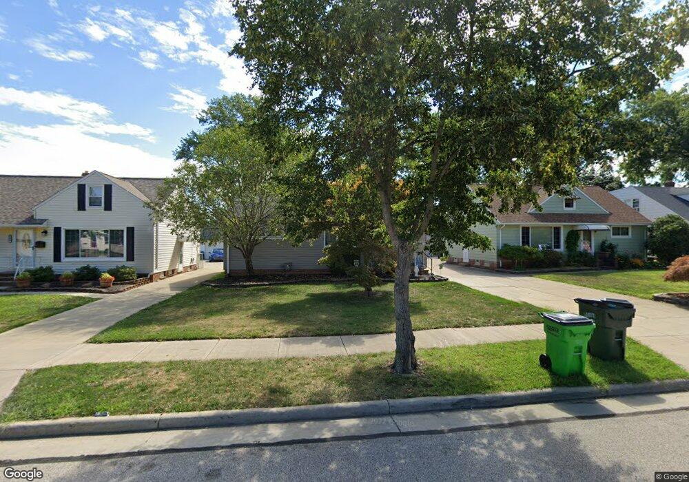
1643 Empire Rd Wickliffe, OH 44092
Estimated Value: $176,000 - $192,000
2
Beds
1
Bath
1,010
Sq Ft
$181/Sq Ft
Est. Value
About This Home
This home is located at 1643 Empire Rd, Wickliffe, OH 44092 and is currently estimated at $183,158, approximately $181 per square foot. 1643 Empire Rd is a home located in Lake County with nearby schools including Wickliffe Elementary School, Wickliffe Middle School, and Wickliffe High School.
Ownership History
Date
Name
Owned For
Owner Type
Purchase Details
Closed on
Nov 17, 1999
Sold by
Mccoy Robert P and Mc Coy Donna M
Bought by
Thompson Jeffrey and Thompson Lisa
Current Estimated Value
Home Financials for this Owner
Home Financials are based on the most recent Mortgage that was taken out on this home.
Original Mortgage
$103,500
Outstanding Balance
$30,324
Interest Rate
7.9%
Estimated Equity
$152,834
Purchase Details
Closed on
Jun 2, 1989
Bought by
Mccoy Robert P
Create a Home Valuation Report for This Property
The Home Valuation Report is an in-depth analysis detailing your home's value as well as a comparison with similar homes in the area
Home Values in the Area
Average Home Value in this Area
Purchase History
| Date | Buyer | Sale Price | Title Company |
|---|---|---|---|
| Thompson Jeffrey | $115,000 | Real Estate Title | |
| Mccoy Robert P | $64,000 | -- |
Source: Public Records
Mortgage History
| Date | Status | Borrower | Loan Amount |
|---|---|---|---|
| Open | Thompson Jeffrey | $103,500 |
Source: Public Records
Tax History
| Year | Tax Paid | Tax Assessment Tax Assessment Total Assessment is a certain percentage of the fair market value that is determined by local assessors to be the total taxable value of land and additions on the property. | Land | Improvement |
|---|---|---|---|---|
| 2025 | -- | $52,000 | $18,100 | $33,900 |
| 2024 | -- | $52,000 | $18,100 | $33,900 |
| 2023 | $4,933 | $40,110 | $15,640 | $24,470 |
| 2022 | $3,265 | $40,110 | $15,640 | $24,470 |
| 2021 | $3,230 | $40,110 | $15,640 | $24,470 |
| 2020 | $2,985 | $32,090 | $12,510 | $19,580 |
| 2019 | $2,719 | $32,090 | $12,510 | $19,580 |
| 2018 | $2,595 | $32,280 | $13,860 | $18,420 |
| 2017 | $2,480 | $32,280 | $13,860 | $18,420 |
| 2016 | $2,566 | $32,280 | $13,860 | $18,420 |
| 2015 | $2,222 | $32,280 | $13,860 | $18,420 |
| 2014 | $1,958 | $32,280 | $13,860 | $18,420 |
| 2013 | $1,957 | $32,280 | $13,860 | $18,420 |
Source: Public Records
Map
Nearby Homes
- 1677 Mapledale Rd
- 1648 Douglas Rd
- 30530 Grant St
- 1522 Mapledale Rd
- 34345 Giovanni Ave
- 30335 Euclid Ave Unit 40 and 20
- 5481 Millwood Ln Unit C
- 1842 Eldon Dr
- 5642 Grand Place
- 5095 Shepherds Glen
- 5084 Shepherds Glen
- 1597 Lee Terrace Dr Unit F11
- 5093 Shepherds Glen
- 5091 Shepherds Glen
- 5082 Shepherds Glen
- 5089 Shepherds Glen
- 261 Chelsea Dr
- 5085 Shepherds Glen
- 5076 Shepherds Glen
- 5083 Shepherds Glen
- 1637 Empire Rd
- 1649 Empire Rd
- 1633 Empire Rd
- 1655 Empire Rd
- 1661 Empire Rd
- 1627 Empire Rd
- 1886 Harding Dr
- 1880 Harding Dr
- 1870 Harding Dr
- 1644 Empire Rd
- 1623 Empire Rd
- 1667 Empire Rd
- 1890 Harding Dr
- 1638 Empire Rd
- 1650 Empire Rd
- 1634 Empire Rd
- 1854 Harding Dr
- 1656 Empire Rd
- 1894 Harding Dr
- 1628 Empire Rd
Your Personal Tour Guide
Ask me questions while you tour the home.