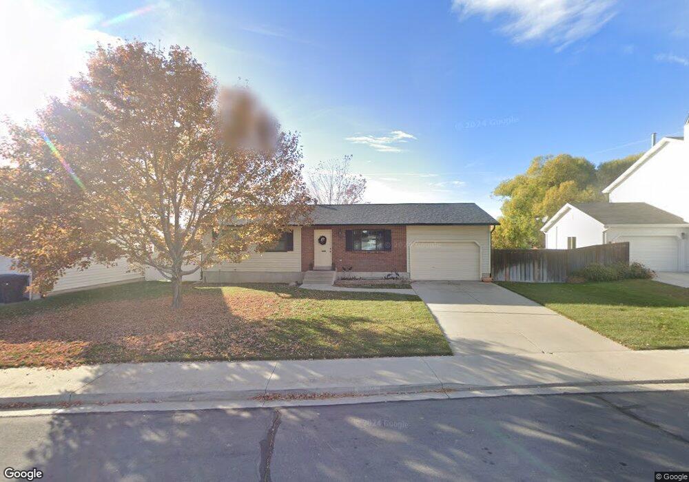
1643 N 110 W Orem, UT 84057
Northridge NeighborhoodEstimated Value: $448,000 - $494,000
3
Beds
1
Bath
988
Sq Ft
$472/Sq Ft
Est. Value
About This Home
This home is located at 1643 N 110 W, Orem, UT 84057 and is currently estimated at $466,514, approximately $472 per square foot. 1643 N 110 W is a home located in Utah County with nearby schools including Northridge Elementary School, Oak Canyon Junior High School, and Timpanogos High School.
Ownership History
Date
Name
Owned For
Owner Type
Purchase Details
Closed on
Jun 30, 2006
Sold by
Glenn Leslie F and Blewett Robert
Bought by
Kirkham Karen
Current Estimated Value
Home Financials for this Owner
Home Financials are based on the most recent Mortgage that was taken out on this home.
Original Mortgage
$31,600
Interest Rate
6.66%
Mortgage Type
Stand Alone Second
Purchase Details
Closed on
Nov 1, 2004
Sold by
Glenn Leslie F and Glenn Leslie Federick
Bought by
Glenn Leslie F and Blewett Robert
Create a Home Valuation Report for This Property
The Home Valuation Report is an in-depth analysis detailing your home's value as well as a comparison with similar homes in the area
Home Values in the Area
Average Home Value in this Area
Purchase History
| Date | Buyer | Sale Price | Title Company |
|---|---|---|---|
| Kirkham Karen | -- | Union Title | |
| Glenn Leslie F | -- | -- |
Source: Public Records
Mortgage History
| Date | Status | Borrower | Loan Amount |
|---|---|---|---|
| Closed | Kirkham Karen | $31,600 | |
| Open | Kirkham Karen | $126,400 |
Source: Public Records
Tax History
| Year | Tax Paid | Tax Assessment Tax Assessment Total Assessment is a certain percentage of the fair market value that is determined by local assessors to be the total taxable value of land and additions on the property. | Land | Improvement |
|---|---|---|---|---|
| 2025 | $1,862 | $234,740 | -- | -- |
| 2024 | $1,862 | $227,700 | $0 | $0 |
| 2023 | $1,750 | $230,010 | $0 | $0 |
| 2022 | $1,766 | $224,895 | $0 | $0 |
| 2021 | $1,490 | $287,400 | $150,000 | $137,400 |
| 2020 | $1,344 | $254,700 | $120,000 | $134,700 |
| 2019 | $1,203 | $237,100 | $120,000 | $117,100 |
| 2018 | $1,222 | $230,200 | $113,100 | $117,100 |
| 2017 | $1,069 | $107,800 | $0 | $0 |
| 2016 | $1,035 | $96,305 | $0 | $0 |
| 2015 | $1,059 | $93,170 | $0 | $0 |
| 2014 | $1,051 | $92,015 | $0 | $0 |
Source: Public Records
Map
Nearby Homes
- 87 W 1525 N
- 1547 N 275 West St Unit 5
- 332 W Amiron Way Unit D
- 1461 N Amiron Way Unit D
- 1461 N Amiron Way Unit B
- 193 E 1570 N
- 1545 N State St Unit 1
- 1987 N 400 W
- 363 E 1395 N Unit 22
- 442 W 1950 North St
- 531 W 1350 N
- 1371 N 330 E Unit 8
- 127 S 400 E
- 582 W 1300 N
- 651 W 1800 N
- 1050 N 100 W
- 545 W 1240 N
- 686 W 1870 N Unit 12
- 538 W 1120 N
- 1405 N 770 W
Your Personal Tour Guide
Ask me questions while you tour the home.