Estimated Value: $667,000 - $728,000
2
Beds
4
Baths
3,466
Sq Ft
$203/Sq Ft
Est. Value
About This Home
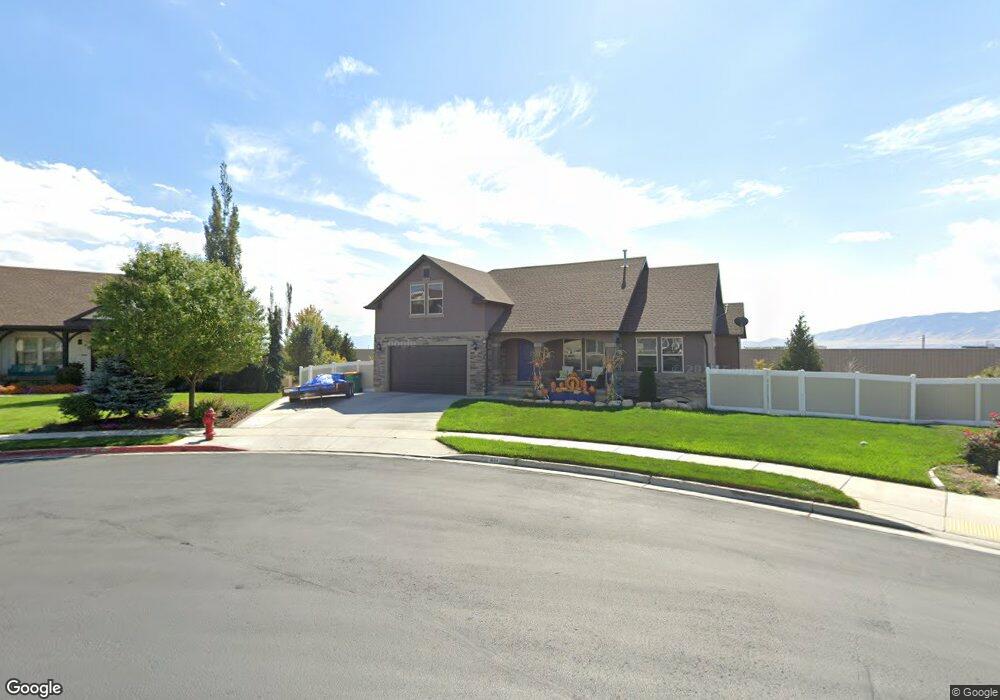
This home is located at 1644 E 280 N Unit 6, Lehi, UT 84043 and is currently estimated at $704,745, approximately $203 per square foot. 1644 E 280 N Unit 6 is a home located in Utah County with nearby schools including Sego Lily Elementary School, Lehi Junior High School, and Skyridge High School.
Ownership History
Date
Name
Owned For
Owner Type
Purchase Details
Closed on
Dec 30, 2022
Sold by
Simpson Tia A
Bought by
Tia A Simpson Trust
Current Estimated Value
Purchase Details
Closed on
May 2, 2013
Sold by
Bd Homes Lehi Llc
Bought by
Simpson Tia A
Home Financials for this Owner
Home Financials are based on the most recent Mortgage that was taken out on this home.
Original Mortgage
$250,299
Interest Rate
3.51%
Mortgage Type
New Conventional
Purchase Details
Closed on
Oct 26, 2012
Sold by
Wsum Llc
Bought by
Bd Homes Lehi Llc
Create a Home Valuation Report for This Property
The Home Valuation Report is an in-depth analysis detailing your home's value as well as a comparison with similar homes in the area
Home Values in the Area
Average Home Value in this Area
Purchase History
| Date | Buyer | Sale Price | Title Company |
|---|---|---|---|
| Tia A Simpson Trust | -- | -- | |
| Simpson Tia A | -- | Affiliated First Title Compa | |
| Bd Homes Lehi Llc | -- | Affiliated First Title Compa |
Source: Public Records
Mortgage History
| Date | Status | Borrower | Loan Amount |
|---|---|---|---|
| Previous Owner | Simpson Tia A | $250,299 |
Source: Public Records
Tax History
| Year | Tax Paid | Tax Assessment Tax Assessment Total Assessment is a certain percentage of the fair market value that is determined by local assessors to be the total taxable value of land and additions on the property. | Land | Improvement |
|---|---|---|---|---|
| 2025 | $2,975 | $387,860 | -- | -- |
| 2024 | $2,975 | $348,150 | $0 | $0 |
| 2023 | $2,751 | $349,525 | $0 | $0 |
| 2022 | $3,030 | $373,285 | $0 | $0 |
| 2021 | $2,690 | $500,900 | $171,800 | $329,100 |
| 2020 | $2,535 | $466,700 | $159,100 | $307,600 |
| 2019 | $2,346 | $448,900 | $159,100 | $289,800 |
| 2018 | $2,225 | $402,600 | $140,600 | $262,000 |
| 2017 | $2,302 | $221,430 | $0 | $0 |
| 2016 | $2,174 | $194,040 | $0 | $0 |
| 2015 | $2,275 | $192,720 | $0 | $0 |
| 2014 | $2,168 | $182,545 | $0 | $0 |
Source: Public Records
Map
Nearby Homes
- 499 N 1520 E
- 822 W 800 St N Unit LOT319
- 822 N 860 W Unit 317
- 484 N 950 W Unit 7
- 414 N 1322 E
- 556 N 1440 E
- 764 W 880 North St Unit 308
- 777 W State Rd
- 672 W 900 N
- 831 N 600 W
- 3947 W 1000 N Unit 439
- 3971 W 1000 N Unit 441
- 3959 W 1000 N
- 3995 W 1000 N
- 893 N 1580 E
- 589 W 480 N
- 599 W 860 N
- 414 N 580 W
- 423 W 700 North St
- 1175 E 900 N
- 282 N 1650 E
- 1622 E 280 N Unit 5
- 1635 E 280 N
- 1596 E 280 N Unit 4
- 1596 E 280 N
- 296 N 1650 E
- 1601 E 280 N Unit 13
- 301 N 1650 E Unit 15
- 1564 E 280 N Unit 3
- 302 N 1650 E
- 1579 E 280 N Unit 12
- 731 N 900 W
- 715 N 900 W
- 1604 E 330 N
- 1559 E 280 N
- 1552 E 280 N Unit 2
- 995 W 750 N
- 973 W 750 N
- 1578 E 330 N
- 1556 E 330 N
Your Personal Tour Guide
Ask me questions while you tour the home.