Estimated Value: $198,000 - $210,000
3
Beds
1
Bath
1,017
Sq Ft
$200/Sq Ft
Est. Value
About This Home
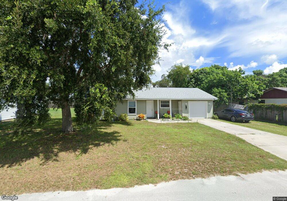
This home is located at 1644 Fay St, Cocoa, FL 32926 and is currently estimated at $203,459, approximately $200 per square foot. 1644 Fay St is a home located in Brevard County with nearby schools including Cambridge Elementary Magnet School, Cocoa High School, and Emma Jewel Charter Academy.
Ownership History
Date
Name
Owned For
Owner Type
Purchase Details
Closed on
Aug 10, 2018
Sold by
Pendleton Shaleetta
Bought by
Habitat For Humanity Of Brevard County I
Current Estimated Value
Purchase Details
Closed on
Jan 4, 2001
Sold by
Rowe Janice A and Ferguson Stanley
Bought by
Habitat For Humanity Of Brevard County I
Purchase Details
Closed on
Feb 10, 1999
Sold by
Space Coast Habitat For Humanity Inc
Bought by
Ferguson Ernestine
Home Financials for this Owner
Home Financials are based on the most recent Mortgage that was taken out on this home.
Original Mortgage
$38,500
Interest Rate
6.84%
Purchase Details
Closed on
May 19, 1998
Sold by
Space Coast Habitat For Humanity Inc
Bought by
Space Coast Habitat For Humanity Inc
Purchase Details
Closed on
Apr 28, 1998
Sold by
Space Coast Habitat Humanity Inc
Bought by
Space Coast Habitat Humanity Inc
Create a Home Valuation Report for This Property
The Home Valuation Report is an in-depth analysis detailing your home's value as well as a comparison with similar homes in the area
Home Values in the Area
Average Home Value in this Area
Purchase History
| Date | Buyer | Sale Price | Title Company |
|---|---|---|---|
| Habitat For Humanity Of Brevard County I | $57,500 | Prestige Title Of Brevard Ll | |
| Habitat For Humanity Of Brevard County I | -- | None Available | |
| Ferguson Ernestine | $38,500 | -- | |
| Space Coast Habitat For Humanity Inc | -- | -- | |
| Space Coast Habitat Humanity Inc | -- | -- |
Source: Public Records
Mortgage History
| Date | Status | Borrower | Loan Amount |
|---|---|---|---|
| Previous Owner | Ferguson Ernestine | $38,500 |
Source: Public Records
Tax History Compared to Growth
Tax History
| Year | Tax Paid | Tax Assessment Tax Assessment Total Assessment is a certain percentage of the fair market value that is determined by local assessors to be the total taxable value of land and additions on the property. | Land | Improvement |
|---|---|---|---|---|
| 2025 | $1,291 | $105,120 | -- | -- |
| 2024 | $1,259 | $102,160 | -- | -- |
| 2023 | $1,259 | $99,190 | $0 | $0 |
| 2022 | $1,167 | $96,310 | $0 | $0 |
| 2021 | $1,168 | $93,510 | $0 | $0 |
| 2020 | $1,130 | $92,220 | $0 | $0 |
| 2019 | $1,080 | $91,120 | $12,750 | $78,370 |
| 2018 | $364 | $72,330 | $12,750 | $59,580 |
| 2017 | $355 | $67,120 | $12,750 | $54,370 |
| 2016 | $1,285 | $62,390 | $12,750 | $49,640 |
| 2015 | $1,205 | $54,170 | $12,750 | $41,420 |
| 2014 | $897 | $51,710 | $12,750 | $38,960 |
Source: Public Records
Map
Nearby Homes
- 1523 Furnari St
- 1509 Tate St
- 0 University Ln
- 1740 Rosa St
- 1515 Furnari St
- 1735 Minnie St
- 1484 Furnari St
- 1485 Furnari St
- 1464 Furnari St
- 1417 Walter St
- 1436 Melrose St
- 1444 Furnari St
- 1445 Furnari St
- 1424 Furnari St
- 1425 Furnari St
- 1514 Furnari St
- 1465 Furnari St
- 1425 Unknown St
- 1514 Clearlake Rd Unit 45
- 1523 Clearlake Ct