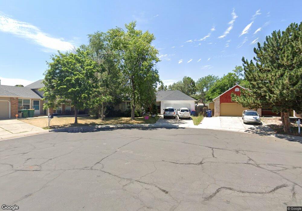
16440 E Center Dr Aurora, CO 80017
Centre Pointe NeighborhoodEstimated Value: $434,000 - $466,000
3
Beds
3
Baths
1,091
Sq Ft
$412/Sq Ft
Est. Value
About This Home
This home is located at 16440 E Center Dr, Aurora, CO 80017 and is currently estimated at $449,183, approximately $411 per square foot. 16440 E Center Dr is a home located in Arapahoe County with nearby schools including Tollgate Elementary School of Expeditionary Learning, Mrachek Middle School, and Gateway High School.
Ownership History
Date
Name
Owned For
Owner Type
Purchase Details
Closed on
Aug 31, 1999
Sold by
Thompson Mickie K
Bought by
Evans Mark O and Evans Lisa M
Current Estimated Value
Home Financials for this Owner
Home Financials are based on the most recent Mortgage that was taken out on this home.
Original Mortgage
$145,924
Outstanding Balance
$40,488
Interest Rate
7.68%
Mortgage Type
FHA
Estimated Equity
$408,695
Purchase Details
Closed on
Aug 27, 1998
Sold by
Thompson Dale and Thompson Mickie K
Bought by
Thompson Mickie K
Purchase Details
Closed on
Jan 21, 1989
Sold by
Conversion Arapco
Bought by
Thompson Dale Thompson Mickie K Thompson To
Purchase Details
Closed on
May 1, 1983
Sold by
Conversion Arapco
Bought by
Conversion Arapco
Purchase Details
Closed on
Dec 16, 1982
Bought by
Conversion Arapco
Create a Home Valuation Report for This Property
The Home Valuation Report is an in-depth analysis detailing your home's value as well as a comparison with similar homes in the area
Home Values in the Area
Average Home Value in this Area
Purchase History
| Date | Buyer | Sale Price | Title Company |
|---|---|---|---|
| Evans Mark O | $146,900 | Stewart Title | |
| Thompson Mickie K | -- | -- | |
| Thompson Dale Thompson Mickie K Thompson To | -- | -- | |
| Conversion Arapco | -- | -- | |
| Conversion Arapco | -- | -- |
Source: Public Records
Mortgage History
| Date | Status | Borrower | Loan Amount |
|---|---|---|---|
| Open | Evans Mark O | $145,924 |
Source: Public Records
Tax History
| Year | Tax Paid | Tax Assessment Tax Assessment Total Assessment is a certain percentage of the fair market value that is determined by local assessors to be the total taxable value of land and additions on the property. | Land | Improvement |
|---|---|---|---|---|
| 2025 | $2,893 | $28,219 | -- | -- |
| 2024 | $2,805 | $30,184 | -- | -- |
| 2023 | $2,805 | $30,184 | $0 | $0 |
| 2022 | $2,466 | $24,561 | $0 | $0 |
| 2021 | $2,546 | $24,561 | $0 | $0 |
| 2020 | $2,428 | $23,323 | $0 | $0 |
| 2019 | $2,415 | $23,323 | $0 | $0 |
| 2018 | $1,855 | $17,539 | $0 | $0 |
| 2017 | $1,613 | $17,539 | $0 | $0 |
| 2016 | $1,799 | $19,152 | $0 | $0 |
| 2015 | $1,737 | $19,152 | $0 | $0 |
| 2014 | -- | $12,975 | $0 | $0 |
| 2013 | -- | $12,180 | $0 | $0 |
Source: Public Records
Map
Nearby Homes
- 619 S Norfolk Way
- 588 S Mobile Place
- 16064 E Exposition Dr
- 16255 E Alaska Place Unit 1
- 648 S Kalispell Way
- 477 S Memphis Way Unit 11
- 467 S Memphis Way Unit 17
- 15875 E Custer Dr
- 844 S Joplin Cir
- 16001 E Alaska Place Unit 7
- 16001 E Alaska Place Unit 1
- 491 S Kalispell Way Unit 305
- 471 S Kalispell Way Unit 101
- 16201 E Dakota Place Unit H
- 1024 S Mobile St
- 17095 E Alameda Pkwy
- 17054 E Virginia Ave
- 17543 E Virginia Ave
- 17155 E Alameda Pkwy
- 17125 E Alameda Pkwy
- 16430 E Center Dr
- 16312 E Exposition Dr
- 16450 E Center Dr
- 16310 E Exposition Dr
- 16314 E Exposition Dr
- 16308 E Exposition Dr
- 16410 E Center Dr
- 16449 E Center Dr
- 16306 E Exposition Dr
- 16316 E Exposition Dr
- 16429 E Center Dr
- 16439 E Center Dr
- 16419 E Center Dr
- 16313 E Exposition Dr
- 16409 E Center Dr
- 16311 E Exposition Dr
- 16397 E Center Dr
- 16387 E Center Dr
- 16309 E Exposition Dr
- 16315 E Exposition Dr
Your Personal Tour Guide
Ask me questions while you tour the home.