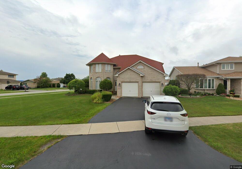
16448 Morgan Ln Orland Hills, IL 60487
Estimated Value: $490,000 - $542,000
4
Beds
3
Baths
3,010
Sq Ft
$171/Sq Ft
Est. Value
About This Home
This home is located at 16448 Morgan Ln, Orland Hills, IL 60487 and is currently estimated at $515,679, approximately $171 per square foot. 16448 Morgan Ln is a home located in Cook County with nearby schools including Fernway Park Elementary School, Prairie View Middle School, and Victor J Andrew High School.
Ownership History
Date
Name
Owned For
Owner Type
Purchase Details
Closed on
Mar 11, 2002
Sold by
Standard Bank & Trust Company
Bought by
Kareem Abdulateef O
Current Estimated Value
Home Financials for this Owner
Home Financials are based on the most recent Mortgage that was taken out on this home.
Original Mortgage
$297,700
Outstanding Balance
$123,219
Interest Rate
6.93%
Estimated Equity
$392,460
Create a Home Valuation Report for This Property
The Home Valuation Report is an in-depth analysis detailing your home's value as well as a comparison with similar homes in the area
Home Values in the Area
Average Home Value in this Area
Purchase History
| Date | Buyer | Sale Price | Title Company |
|---|---|---|---|
| Kareem Abdulateef O | $331,000 | -- |
Source: Public Records
Mortgage History
| Date | Status | Borrower | Loan Amount |
|---|---|---|---|
| Open | Kareem Abdulateef O | $297,700 |
Source: Public Records
Tax History Compared to Growth
Tax History
| Year | Tax Paid | Tax Assessment Tax Assessment Total Assessment is a certain percentage of the fair market value that is determined by local assessors to be the total taxable value of land and additions on the property. | Land | Improvement |
|---|---|---|---|---|
| 2024 | $11,631 | $45,000 | $6,397 | $38,603 |
| 2023 | $9,954 | $45,000 | $6,397 | $38,603 |
| 2022 | $9,954 | $31,144 | $5,212 | $25,932 |
| 2021 | $9,514 | $31,143 | $5,212 | $25,931 |
| 2020 | $9,211 | $31,143 | $5,212 | $25,931 |
| 2019 | $10,091 | $35,108 | $4,738 | $30,370 |
| 2018 | $9,775 | $35,108 | $4,738 | $30,370 |
| 2017 | $9,448 | $35,108 | $4,738 | $30,370 |
| 2016 | $9,042 | $30,975 | $4,264 | $26,711 |
| 2015 | $8,909 | $30,975 | $4,264 | $26,711 |
| 2014 | $8,822 | $30,975 | $4,264 | $26,711 |
| 2013 | $9,503 | $35,669 | $4,264 | $31,405 |
Source: Public Records
Map
Nearby Homes
- 9300 Park Place
- 9338 Meadowview Dr Unit 9338
- 16701 Highview Ave
- 16656 Beacon Ln
- 9225 162nd St
- 16662 Seton Place Unit 16662
- 9404 Lindsay St
- 8901 Leslie Dr
- 16753 91st Ave
- 16779 92nd Ave
- 16515 S La Grange Rd
- 16121 S 94th Ave
- 9411 Albany Ct
- 16805 Hilltop Ave
- 8801 Chadbourn Dr
- 16040 Boardwalk Ln Unit 4A
- 16313 Bob White Cir
- 16328 Bob White Cir
- 16651 S 88th Ave
- 15963 91st Ave
- 16442 Morgan Ln
- 16436 Morgan Ln
- 9230 Pepperwood Dr
- 16459 Haven Ave
- 16455 Haven Ave
- 9236 Pepperwood Dr
- 16443 Morgan Ln
- 16433 Morgan Ln
- 16501 Haven Ave
- 16451 Haven Ave
- 16430 Morgan Ln
- 16460 Haven Ave
- 9242 Pepperwood Dr
- 16507 Haven Ave
- 16449 Haven Ave
- 16427 Morgan Ln
- 16424 Morgan Ln
- 16454 Haven Ave
- 9248 Pepperwood Dr
- 9207 Cardinal Cir