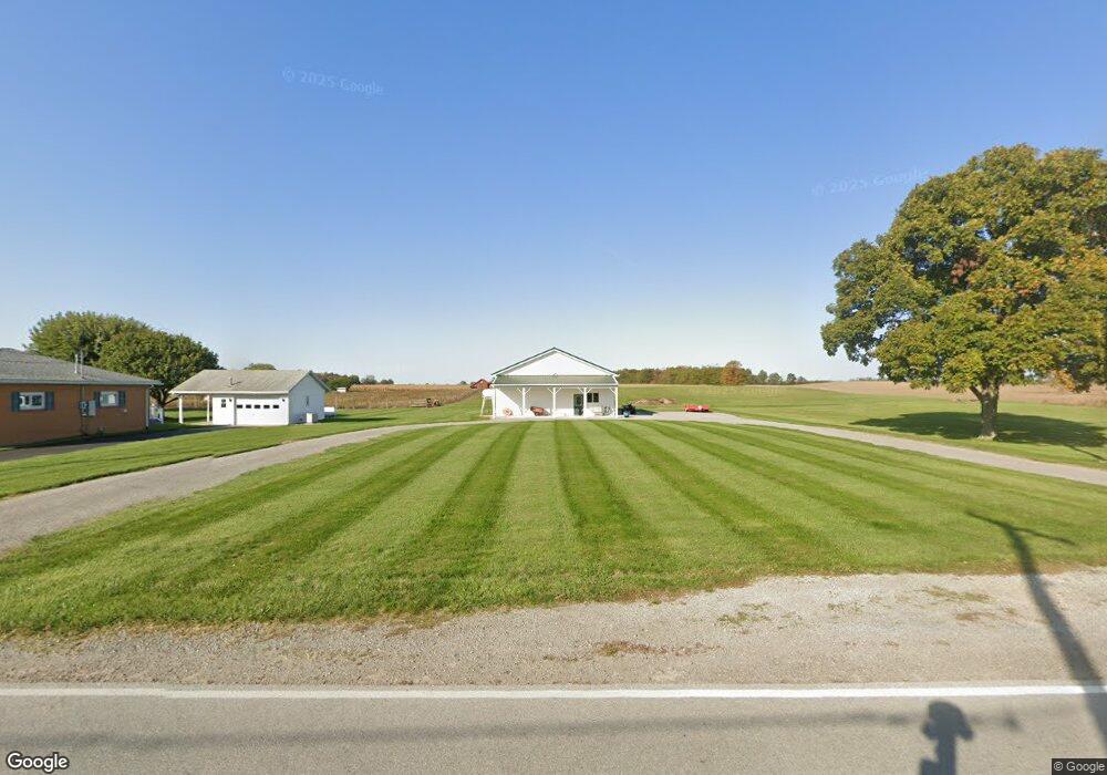
16449 Waynesfield Rd Waynesfield, OH 45896
Estimated Value: $76,070 - $186,000
--
Bed
--
Bath
--
Sq Ft
0.58
Acres
About This Home
This home is located at 16449 Waynesfield Rd, Waynesfield, OH 45896 and is currently estimated at $135,023. 16449 Waynesfield Rd is a home located in Auglaize County with nearby schools including Waynesfield-Goshen Local Elementary School and Waynesfield-Goshen Local High School.
Ownership History
Date
Name
Owned For
Owner Type
Purchase Details
Closed on
Apr 7, 2005
Sold by
Dawson Dwayne
Bought by
Tuttle Roger and Tuttle Joyce
Current Estimated Value
Home Financials for this Owner
Home Financials are based on the most recent Mortgage that was taken out on this home.
Original Mortgage
$24,000
Interest Rate
6.05%
Mortgage Type
Future Advance Clause Open End Mortgage
Purchase Details
Closed on
Jul 19, 1991
Sold by
Dawson Darrell
Bought by
Dawson Cecile O
Create a Home Valuation Report for This Property
The Home Valuation Report is an in-depth analysis detailing your home's value as well as a comparison with similar homes in the area
Home Values in the Area
Average Home Value in this Area
Purchase History
| Date | Buyer | Sale Price | Title Company |
|---|---|---|---|
| Tuttle Roger | -- | None Available | |
| Dawson Cecile O | -- | -- |
Source: Public Records
Mortgage History
| Date | Status | Borrower | Loan Amount |
|---|---|---|---|
| Previous Owner | Tuttle Roger | $24,000 |
Source: Public Records
Tax History Compared to Growth
Tax History
| Year | Tax Paid | Tax Assessment Tax Assessment Total Assessment is a certain percentage of the fair market value that is determined by local assessors to be the total taxable value of land and additions on the property. | Land | Improvement |
|---|---|---|---|---|
| 2024 | $584 | $9,290 | $5,570 | $3,720 |
| 2023 | $331 | $9,290 | $5,570 | $3,720 |
| 2022 | $502 | $7,850 | $5,060 | $2,790 |
| 2021 | $327 | $7,850 | $5,060 | $2,790 |
| 2020 | $322 | $7,855 | $5,065 | $2,790 |
| 2019 | $261 | $6,545 | $4,221 | $2,324 |
| 2018 | $256 | $6,545 | $4,221 | $2,324 |
| 2017 | $255 | $6,545 | $4,221 | $2,324 |
| 2016 | $227 | $6,003 | $4,022 | $1,981 |
| 2015 | $114 | $6,003 | $4,022 | $1,981 |
| 2014 | $227 | $6,003 | $4,022 | $1,981 |
| 2013 | $127 | $6,003 | $4,022 | $1,981 |
Source: Public Records
Map
Nearby Homes
- 25836 Ohio 67
- 202 W Mulberry St
- 105 Guthrie St
- 18544 Santa Fe Line Rd
- 22275 Buckland Holden Rd
- 8150 Amherst Rd
- 20630 State Route 67
- 5065 Amherst Rd
- 17 E Walnut St
- 37 N Main St
- 0 Ohio 67
- 11352 N Township Road 88
- 12102 Shannon Dr Unit 89
- 12015 Holly Dr
- 11579 Cooper Ave
- 4111 S Phillips Rd
- 11161 Macalpine Way
- 11385 Horseshoe Channel Dr
- 11546 Horseshoe Channel Dr
- 11526 Horseshoe Channel Dr
- 16431 Waynesfield Rd
- 16477 Waynesfield Rd
- 16470 Waynesfield Rd
- 16379 Waynesfield Rd
- 16450 Waynesfield Rd
- 16357 Waynesfield Rd
- 16390 Waynesfield Rd
- 16379 State Route 196
- 16381 Waynesfield Rd
- 16375 State Route 196
- 16538 Waynesfield Rd
- 16330 Waynesfield Rd
- 16215 Waynesfield Rd
- 27251 Waynesfield Rd
- 29965 Waynesfield Rd
- 26101 Waynesfield Rd
- 29988 Waynesfield Rd
- 19930 Waynesfield Rd