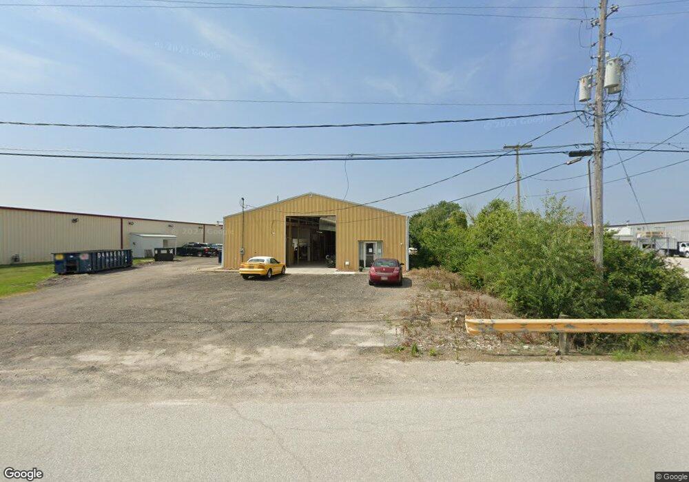
1645 Cascade Dr Marion, OH 43302
Estimated Value: $63,284
Studio
--
Bath
5,250
Sq Ft
$12/Sq Ft
Est. Value
About This Home
This home is located at 1645 Cascade Dr, Marion, OH 43302 and is currently priced at $63,284, approximately $12 per square foot. 1645 Cascade Dr is a home located in Marion County with nearby schools including River Valley High School, Marion Preparatory Academy, and Rushmore Academy.
Ownership History
Date
Name
Owned For
Owner Type
Purchase Details
Closed on
Oct 14, 2022
Sold by
Luxury Coach Sales/ & Service Llc
Bought by
Marke Lyon Commercial Property Llc
Current Estimated Value
Purchase Details
Closed on
Jun 8, 2018
Sold by
Sccsandridge Holdings Llc
Bought by
Luxury Coach Sales Sales & Services Llc
Purchase Details
Closed on
Jul 30, 2004
Bought by
Sccsandridge Holdings Llc
Create a Home Valuation Report for This Property
The Home Valuation Report is an in-depth analysis detailing your home's value as well as a comparison with similar homes in the area
Home Values in the Area
Average Home Value in this Area
Purchase History
| Date | Buyer | Sale Price | Title Company |
|---|---|---|---|
| Marke Lyon Commercial Property Llc | -- | -- | |
| Luxury Coach Sales Sales & Services Llc | $44,000 | None Available | |
| Sccsandridge Holdings Llc | $100,000 | -- |
Source: Public Records
Tax History
| Year | Tax Paid | Tax Assessment Tax Assessment Total Assessment is a certain percentage of the fair market value that is determined by local assessors to be the total taxable value of land and additions on the property. | Land | Improvement |
|---|---|---|---|---|
| 2025 | $1,859 | $32,950 | $6,130 | $26,820 |
| 2024 | $1,859 | $33,220 | $6,130 | $27,090 |
| 2023 | $1,859 | $33,220 | $6,130 | $27,090 |
| 2022 | $1,933 | $33,220 | $6,130 | $27,090 |
| 2021 | $1,951 | $33,220 | $6,130 | $27,090 |
| 2020 | $1,991 | $33,220 | $6,130 | $27,090 |
| 2019 | $1,987 | $33,220 | $6,130 | $27,090 |
| 2018 | $1,791 | $32,950 | $6,130 | $26,820 |
| 2017 | $1,805 | $32,950 | $6,130 | $26,820 |
| 2016 | $1,806 | $32,950 | $6,130 | $26,820 |
| 2015 | $1,813 | $32,950 | $6,130 | $26,820 |
| 2014 | $1,810 | $32,950 | $6,130 | $26,820 |
| 2012 | $1,917 | $35,650 | $4,630 | $31,020 |
Source: Public Records
Map
Nearby Homes
- 0 Marion-Williamsport Rd E Unit 225016219
- 0 Marion-Williamsport Rd E Unit 226002543
- 1269 Bermuda Dr
- 668 Easy St
- 0 Pole Lane Rd Unit 226000425
- 607 Easy St
- 2515 Mercer Dr
- 530 Littleton St
- 0 Denning Ave
- 537 Fair Park Ave
- 405 Fairview St
- 516 Polk St
- 1225 Ackerman Ave
- 197 Franconia Ave
- 500 Linda Mel Dr
- 194 Chicago Ave
- 645 Augusta Dr
- 457 New Park Dr
- 250 N Grand Ave
- 151 Barnhart St
- 1623 Cascade Dr
- 0 Cascade Dr
- 1569 Cascade Dr
- 1435 Boise Rd
- 1455 Boise Rd
- 1485 Boise Rd
- 1511 Marion Williamsport Rd E
- 1535 Marion Williamsport Rd E
- 1565 Marion Williamsport Rd E
- 1661 Marion Williamsport Rd E
- 1701 Marion Williamsport Rd E
- 1920 Victory Rd Unit 230
- 1920 Victory Rd Unit Lot 213
- 1920 Victory Rd Unit 234
- 1920 Victory Rd
- 1731 Marion-Williamsport Rd E
- 1805 Marion-Williamsport Rd E
- 0 Marion Williamsport Rd Unit 2756308
- 0 Marion Williamsport Rd Unit 2541108
- 0 Marion Williamsport Rd Unit 2321680
Your Personal Tour Guide
Ask me questions while you tour the home.