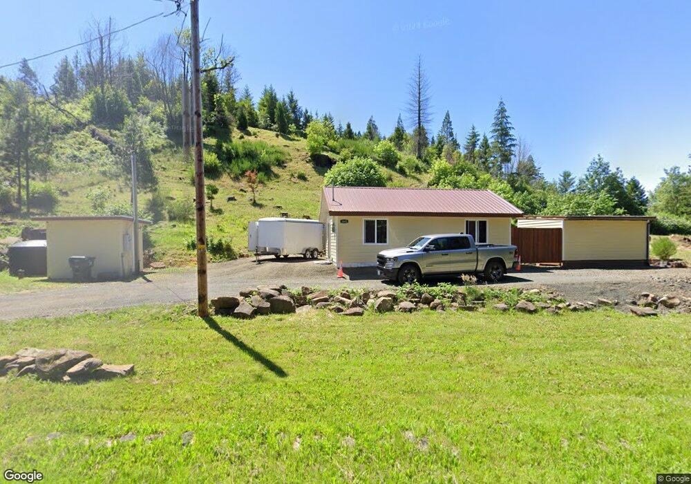
1645 Lone Rock Rd Glide, OR 97443
Glide NeighborhoodEstimated Value: $173,000 - $227,072
1
Bed
1
Bath
540
Sq Ft
$366/Sq Ft
Est. Value
About This Home
This home is located at 1645 Lone Rock Rd, Glide, OR 97443 and is currently estimated at $197,768, approximately $366 per square foot. 1645 Lone Rock Rd is a home with nearby schools including Glide Elementary School, Glide Middle School, and Glide High School.
Ownership History
Date
Name
Owned For
Owner Type
Purchase Details
Closed on
Nov 2, 2016
Sold by
Lane Neoma
Bought by
Herrig Donald Ray
Current Estimated Value
Purchase Details
Closed on
Nov 10, 2015
Sold by
Mcjunkin Erik Floyd and Mc Junkin Freedom L
Bought by
Lane Neoma
Home Financials for this Owner
Home Financials are based on the most recent Mortgage that was taken out on this home.
Original Mortgage
$27,000
Interest Rate
3.8%
Mortgage Type
Purchase Money Mortgage
Purchase Details
Closed on
Nov 2, 2015
Sold by
Martin J Floyd and Martin Cloma J
Bought by
Mcjunkin Erik Floyd and Mc Junkin Freedom L
Home Financials for this Owner
Home Financials are based on the most recent Mortgage that was taken out on this home.
Original Mortgage
$27,000
Interest Rate
3.8%
Mortgage Type
Purchase Money Mortgage
Purchase Details
Closed on
Sep 3, 2013
Sold by
Martin Floyd and Martin Cloma J
Bought by
Mcjunkin Erik Floyd and Mc Junkin Freedom L
Create a Home Valuation Report for This Property
The Home Valuation Report is an in-depth analysis detailing your home's value as well as a comparison with similar homes in the area
Home Values in the Area
Average Home Value in this Area
Purchase History
| Date | Buyer | Sale Price | Title Company |
|---|---|---|---|
| Herrig Donald Ray | -- | None Available | |
| Lane Neoma | $45,000 | Amerititle | |
| Mcjunkin Erik Floyd | -- | Amerititle | |
| Mcjunkin Erik Floyd | -- | None Available |
Source: Public Records
Mortgage History
| Date | Status | Borrower | Loan Amount |
|---|---|---|---|
| Previous Owner | Lane Neoma | $27,000 |
Source: Public Records
Tax History
| Year | Tax Paid | Tax Assessment Tax Assessment Total Assessment is a certain percentage of the fair market value that is determined by local assessors to be the total taxable value of land and additions on the property. | Land | Improvement |
|---|---|---|---|---|
| 2025 | $1,072 | $110,763 | -- | -- |
| 2024 | $1,029 | $107,537 | -- | -- |
| 2023 | $1,006 | $104,405 | $0 | $0 |
| 2022 | $751 | $78,013 | $0 | $0 |
| 2021 | $749 | $75,741 | $0 | $0 |
| 2020 | $457 | $42,984 | $0 | $0 |
| 2019 | $266 | $21,885 | $0 | $0 |
| 2018 | $260 | $21,248 | $0 | $0 |
| 2017 | $223 | $20,630 | $0 | $0 |
| 2013 | -- | $18,332 | $0 | $0 |
Source: Public Records
Map
Nearby Homes
- 175 Doe Rd
- 283 Upper Terrace Ln
- 0 Park St
- 485 Brown St
- 267 Mountain View
- 123 Mountain View
- 1070 Mystic Mountain Ln
- 3413 Wild River Dr
- 369 Upper Camp Loop Rd
- 225 Doraleen Ln
- 2373 Wild River Dr
- 900 Old Cabin Dr
- 121 Wild Goose Ln
- 0 Evergreen Ln Unit 444914498
- 400 Newbridge Rd
- 14115 N Bank Rd
- 413 Goodreau Ln
- 13767 N Bank Rd
- 230 Anderson Ln
- 2665 Whistlers Park Rd
- 1590 Lone Rock Rd
- 1655 Lone Rock Rd
- 1592 Lone Rock Rd
- 1492 Lone Rock Rd
- 1710 Lone Rock Rd
- 1605 Lone Rock Rd
- 1474 Lone Rock Rd
- 1466 Lone Rock Rd
- 22099 N Umpqua Hwy
- 22125 N Umpqua Hwy
- 22147 N Umpqua Hwy
- 22167 N Umpqua Hwy
- 21500 N Umpqua Hwy
- 21608 N Umpqua Hwy
- 22187 N Umpqua Hwy
- 21766 N Umpqua (Vrm) Hwy
- 22020 N Umpqua Hwy
- 22191 N Umpqua Hwy
- 1916 Lone Rock Rd
- 1479 Lone Rock Rd
Your Personal Tour Guide
Ask me questions while you tour the home.