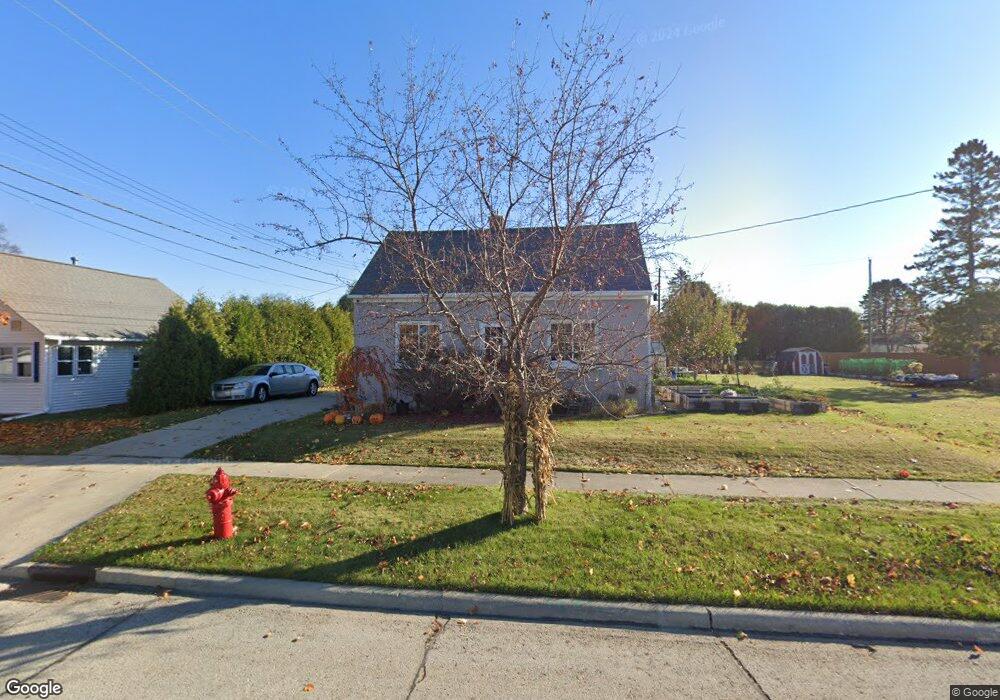
1645 Mirro Dr Manitowoc, WI 54220
Estimated Value: $186,832 - $188,000
--
Bed
--
Bath
1,152
Sq Ft
$163/Sq Ft
Est. Value
About This Home
This home is located at 1645 Mirro Dr, Manitowoc, WI 54220 and is currently estimated at $187,416, approximately $162 per square foot. 1645 Mirro Dr is a home located in Manitowoc County with nearby schools including Riverview Elementary School, Wilson Middle School, and Lincoln High School.
Ownership History
Date
Name
Owned For
Owner Type
Purchase Details
Closed on
May 12, 2005
Sold by
Collins Deana M and Waara Deana M
Bought by
Froelich Jason L and Froelich Rose M
Current Estimated Value
Home Financials for this Owner
Home Financials are based on the most recent Mortgage that was taken out on this home.
Original Mortgage
$90,029
Outstanding Balance
$47,813
Interest Rate
6.13%
Mortgage Type
FHA
Estimated Equity
$139,603
Create a Home Valuation Report for This Property
The Home Valuation Report is an in-depth analysis detailing your home's value as well as a comparison with similar homes in the area
Home Values in the Area
Average Home Value in this Area
Purchase History
| Date | Buyer | Sale Price | Title Company |
|---|---|---|---|
| Froelich Jason L | $90,900 | None Available |
Source: Public Records
Mortgage History
| Date | Status | Borrower | Loan Amount |
|---|---|---|---|
| Open | Froelich Jason L | $90,029 |
Source: Public Records
Tax History Compared to Growth
Tax History
| Year | Tax Paid | Tax Assessment Tax Assessment Total Assessment is a certain percentage of the fair market value that is determined by local assessors to be the total taxable value of land and additions on the property. | Land | Improvement |
|---|---|---|---|---|
| 2024 | $2,193 | $138,500 | $21,200 | $117,300 |
| 2023 | $2,004 | $138,500 | $21,200 | $117,300 |
| 2022 | $1,750 | $100,400 | $21,200 | $79,200 |
| 2021 | $1,735 | $100,400 | $21,200 | $79,200 |
| 2020 | $1,687 | $88,200 | $21,200 | $67,000 |
| 2019 | $1,655 | $88,200 | $21,200 | $67,000 |
| 2018 | $1,633 | $88,200 | $21,200 | $67,000 |
| 2017 | $1,628 | $88,200 | $21,200 | $67,000 |
| 2016 | $1,687 | $88,200 | $21,200 | $67,000 |
| 2015 | $1,741 | $88,200 | $21,200 | $67,000 |
| 2014 | -- | $88,200 | $21,200 | $67,000 |
| 2013 | $1,720 | $88,200 | $21,200 | $67,000 |
Source: Public Records
Map
Nearby Homes
- 1750 Mirro Dr
- 1621 Galax Dr
- 1616 Fern Dr
- 743 Memorial Dr Unit E
- 315 E Magnolia Ave
- 2722 Woodland Dr
- 4220 Memorial Dr
- 1335 Lynx Ln
- 1339 Wolf Run
- Lt99 Davis St
- 1925 Creekwood Ct
- 2101 Hunters Ridge Ct
- Lot24 Mosie Ct
- LT0 Mosie Ct
- 901 Hawthorne Ct
- 916 Hawthorne Ct
- 318 Fenway Terrace
- 923 N 6th St
- 2510 Stoney Brook Ct
- 2508 Stoney Brook Ct