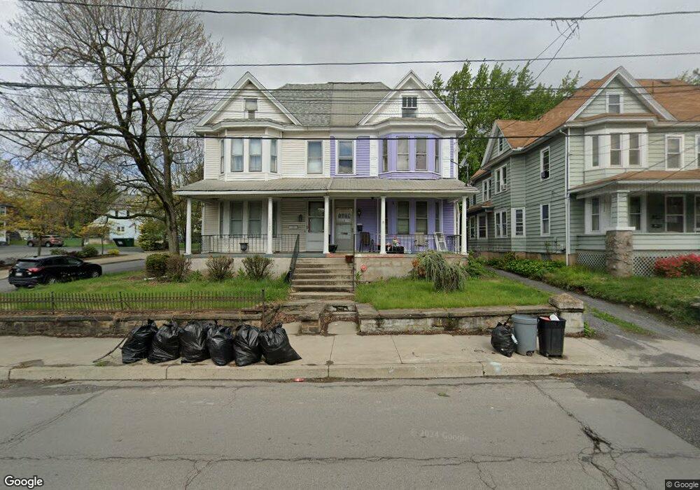
1645 N Main Ave Scranton, PA 18508
Tripp's Park NeighborhoodEstimated Value: $104,498 - $260,000
6
Beds
2
Baths
2,660
Sq Ft
$70/Sq Ft
Est. Value
About This Home
This home is located at 1645 N Main Ave, Scranton, PA 18508 and is currently estimated at $185,375, approximately $69 per square foot. 1645 N Main Ave is a home located in Lackawanna County with nearby schools including Neil Armstrong Elementary School, Pinchbeck Elementary School, and Pemberton Elementary School.
Ownership History
Date
Name
Owned For
Owner Type
Purchase Details
Closed on
Apr 19, 2019
Sold by
Cousin Brigitte Jean and Cousin Bessie L
Bought by
Cousin Bessie L
Current Estimated Value
Purchase Details
Closed on
Aug 30, 2006
Sold by
Snyder Marie E and Kranick Carl J
Bought by
Mccarty Kevin
Home Financials for this Owner
Home Financials are based on the most recent Mortgage that was taken out on this home.
Original Mortgage
$50,850
Outstanding Balance
$39,290
Interest Rate
12.9%
Mortgage Type
Adjustable Rate Mortgage/ARM
Estimated Equity
$146,085
Create a Home Valuation Report for This Property
The Home Valuation Report is an in-depth analysis detailing your home's value as well as a comparison with similar homes in the area
Home Values in the Area
Average Home Value in this Area
Purchase History
| Date | Buyer | Sale Price | Title Company |
|---|---|---|---|
| Cousin Bessie L | -- | None Available | |
| Mccarty Kevin | $56,500 | None Available |
Source: Public Records
Mortgage History
| Date | Status | Borrower | Loan Amount |
|---|---|---|---|
| Open | Mccarty Kevin | $50,850 |
Source: Public Records
Tax History Compared to Growth
Tax History
| Year | Tax Paid | Tax Assessment Tax Assessment Total Assessment is a certain percentage of the fair market value that is determined by local assessors to be the total taxable value of land and additions on the property. | Land | Improvement |
|---|---|---|---|---|
| 2025 | $2,752 | $7,548 | $2,848 | $4,700 |
| 2024 | $2,537 | $7,548 | $2,848 | $4,700 |
| 2023 | $2,537 | $7,548 | $2,848 | $4,700 |
| 2022 | $2,482 | $7,548 | $2,848 | $4,700 |
| 2021 | $2,482 | $7,548 | $2,848 | $4,700 |
| 2020 | $2,441 | $7,548 | $2,848 | $4,700 |
| 2019 | $2,303 | $7,548 | $2,848 | $4,700 |
| 2018 | $2,303 | $7,548 | $2,848 | $4,700 |
| 2017 | $2,268 | $7,548 | $2,848 | $4,700 |
| 2016 | $900 | $7,548 | $2,848 | $4,700 |
| 2015 | $1,432 | $7,548 | $2,848 | $4,700 |
| 2014 | -- | $7,548 | $2,848 | $4,700 |
Source: Public Records
Map
Nearby Homes
- 117 Ferdinand St
- 231 Putnam St
- 1711 N Sumner Ave
- 18 Green Ridge St
- 1436 Church Ave
- 1729 Wayne Ave
- 1430 N Main Ave
- 314 W Market St
- 401 Putnam St
- 1402 N Rebecca Ave
- 1515-1517 Brick Ave
- 1311 Short Ave
- 0 Philo St Unit GSBSC4763
- 656 Philo St
- 1513 Meylert Ave
- 337 Spring St
- 416 Electric St
- 2040 Margaret Ave Unit 2042
- 2040 Edna Ave
- 1227 Providence Rd
- 1643 N Main Ave
- 1651 N Main Ave
- 1653 N Main Ave
- 1646 N Main Ave
- 115 Ferdinand St
- 1655 N Main Ave
- 118 Ferdinand St
- 111 Putnam St
- 113 Putnam St
- 1648 N Main Ave
- 1657 N Main Ave
- 1690 Church Ave
- 119 Ferdinand St
- 120 Ferdinand St
- 1650 N Main Ave
- 1636 N Main Ave Unit 1638
- 115 Putnam St
- 1640 N Main Ave
- 121 Ferdinand St
- 1632 Church Ave Unit L11