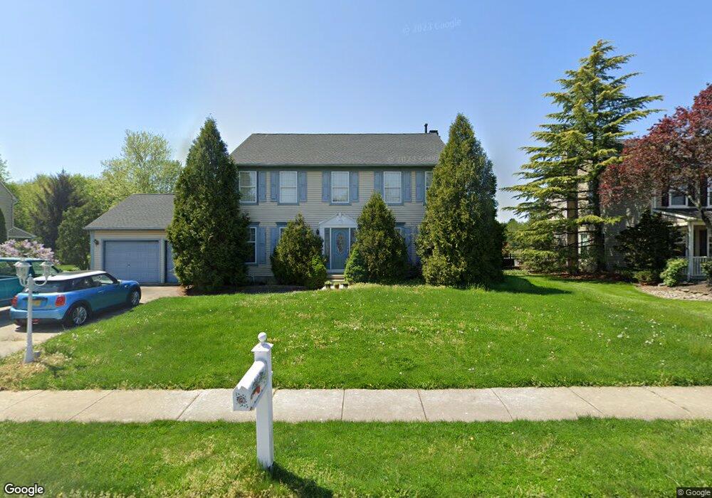
1645 Pennfield Dr West Deptford, NJ 08086
West Deptford Township NeighborhoodEstimated Value: $448,000 - $600,000
--
Bed
--
Bath
2,508
Sq Ft
$213/Sq Ft
Est. Value
About This Home
This home is located at 1645 Pennfield Dr, West Deptford, NJ 08086 and is currently estimated at $533,796, approximately $212 per square foot. 1645 Pennfield Dr is a home located in Gloucester County with nearby schools including Green-Fields Elementary School, Red Bank Elementary School, and Oakview Elementary School.
Ownership History
Date
Name
Owned For
Owner Type
Purchase Details
Closed on
Nov 30, 1999
Sold by
Zook John M and Zook Susan C
Bought by
Pilla Carolann M
Current Estimated Value
Home Financials for this Owner
Home Financials are based on the most recent Mortgage that was taken out on this home.
Original Mortgage
$177,350
Outstanding Balance
$54,974
Interest Rate
7.73%
Estimated Equity
$478,822
Create a Home Valuation Report for This Property
The Home Valuation Report is an in-depth analysis detailing your home's value as well as a comparison with similar homes in the area
Home Values in the Area
Average Home Value in this Area
Purchase History
| Date | Buyer | Sale Price | Title Company |
|---|---|---|---|
| Pilla Carolann M | $236,500 | -- |
Source: Public Records
Mortgage History
| Date | Status | Borrower | Loan Amount |
|---|---|---|---|
| Open | Pilla Carolann M | $177,350 |
Source: Public Records
Tax History Compared to Growth
Tax History
| Year | Tax Paid | Tax Assessment Tax Assessment Total Assessment is a certain percentage of the fair market value that is determined by local assessors to be the total taxable value of land and additions on the property. | Land | Improvement |
|---|---|---|---|---|
| 2025 | $10,434 | $298,800 | $69,800 | $229,000 |
| 2024 | $10,300 | $298,800 | $69,800 | $229,000 |
| 2023 | $10,300 | $298,800 | $69,800 | $229,000 |
| 2022 | $10,252 | $298,800 | $69,800 | $229,000 |
| 2021 | $10,216 | $298,800 | $69,800 | $229,000 |
| 2020 | $10,192 | $298,800 | $69,800 | $229,000 |
| 2019 | $9,908 | $298,800 | $69,800 | $229,000 |
| 2018 | $9,639 | $298,800 | $69,800 | $229,000 |
| 2017 | $9,415 | $298,800 | $69,800 | $229,000 |
| 2016 | $9,152 | $298,800 | $69,800 | $229,000 |
| 2015 | $8,719 | $298,800 | $69,800 | $229,000 |
| 2014 | $8,286 | $298,800 | $69,800 | $229,000 |
Source: Public Records
Map
Nearby Homes
- 1810 Fernwood Dr
- 740 Carter Hill Dr
- 1311 Barnesdale Rd
- 4 Saint Emilion Ct
- 1102 Barnesdale Rd
- 64 Tilden Rd
- 863 Doncaster Dr
- 433 Crown Point Rd
- 1220 Royal Ln
- 640 Worcester Dr
- 87 Woodway Dr Unit 87
- 439 Crown Point Rd
- 97 Church St
- 121 Cape May Ave
- 558 Prince St
- 266 Passaic Ave
- 10 Kennedy Ct
- 344 S Girard St
- 247 Crown Point Rd
- 107 Audubon Ave
- 1647 Pennfield Dr
- 1643 Pennfield Dr
- 1649 Pennfield Dr
- 1644 Pennfield Dr
- 1641 Pennfield Dr
- 1646 Pennfield Dr
- 1640 Pennfield Dr
- 1651 Pennfield Dr
- 1648 Pennfield Dr
- 1639 Pennfield Dr
- 1650 Pennfield Dr
- 1630 Pennfield Dr
- 1634 Pennfield Dr
- 1628 Pennfield Dr
- 1653 Pennfield Dr
- 1405 Weatherly Ct
- 1407 Weatherly Ct
- 1626 Pennfield Dr
- 1403 Weatherly Ct
- 1652 Pennfield Dr