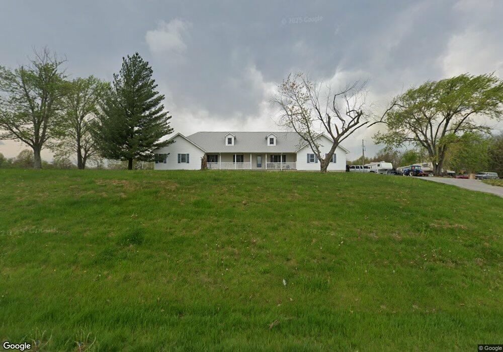
16453 State Route 242 Mc Leansboro, IL 62859
Estimated Value: $53,000 - $259,504
--
Bed
--
Bath
--
Sq Ft
1
Acres
About This Home
This home is located at 16453 State Route 242, Mc Leansboro, IL 62859 and is currently estimated at $145,168. 16453 State Route 242 is a home with nearby schools including Hamilton County Junior/Senior High School.
Ownership History
Date
Name
Owned For
Owner Type
Purchase Details
Closed on
Aug 31, 2005
Sold by
Rubenacker Virginia L
Bought by
Rubenacker Troy D and Rubenacker Gara L
Current Estimated Value
Home Financials for this Owner
Home Financials are based on the most recent Mortgage that was taken out on this home.
Original Mortgage
$151,834
Outstanding Balance
$81,130
Interest Rate
5.83%
Mortgage Type
Purchase Money Mortgage
Estimated Equity
$64,039
Create a Home Valuation Report for This Property
The Home Valuation Report is an in-depth analysis detailing your home's value as well as a comparison with similar homes in the area
Home Values in the Area
Average Home Value in this Area
Purchase History
| Date | Buyer | Sale Price | Title Company |
|---|---|---|---|
| Rubenacker Troy D | $25,000 | None Available |
Source: Public Records
Mortgage History
| Date | Status | Borrower | Loan Amount |
|---|---|---|---|
| Open | Rubenacker Troy D | $151,834 |
Source: Public Records
Tax History Compared to Growth
Tax History
| Year | Tax Paid | Tax Assessment Tax Assessment Total Assessment is a certain percentage of the fair market value that is determined by local assessors to be the total taxable value of land and additions on the property. | Land | Improvement |
|---|---|---|---|---|
| 2024 | $3,582 | $66,979 | $1,930 | $65,049 |
| 2023 | $3,582 | $69,051 | $1,990 | $67,061 |
| 2022 | $3,430 | $59,745 | $1,865 | $57,880 |
| 2021 | $3,291 | $57,452 | $1,793 | $55,659 |
| 2020 | $3,336 | $54,093 | $1,688 | $52,405 |
| 2019 | $3,354 | $54,093 | $1,688 | $52,405 |
| 2018 | $3,405 | $48,093 | $1,688 | $46,405 |
| 2017 | $3,454 | $48,093 | $1,688 | $46,405 |
| 2015 | $3,469 | $48,445 | $1,699 | $46,746 |
| 2014 | $3,289 | $52,518 | $1,639 | $50,879 |
| 2013 | -- | $50,988 | $1,591 | $49,397 |
| 2012 | -- | $43,580 | $1,360 | $42,220 |
Source: Public Records
Map
Nearby Homes
- 000 E Maple St
- 708 E Foote St
- 210 N Virginia St
- 201 N Washington St
- 16128 Cr 1030 N
- 312 E Randolph St
- 1010 E Randolph St
- 54 Meadow Hills Ln
- 000 Memory Ln
- 000 Eric Ln
- 0 County Road 1000 N Unit Lot WP001
- 000 County Road 1000
- 12324 Rd
- 000 Jacob St
- 954 County Road 100 N
- 602 S 4th St
- 0 County Road 900 N
- 0000 Campbell's Corner Rd
- 0 County Road 750 N Unit RMAEB457700
- 722 W Main St
- 16257 State Route 242
- 16208 State Route 242
- 8877 Blooming Grove Rd
- 8979 Blooming Grove Rd
- 9501 County Road 1650 N
- 8565 Blooming Grove Rd
- 15822 Illinois 242
- 15822 State Route 242
- 18197 County Road 600 E
- 18013 County Road 600 E
- 9027 County Road 1575 N
- 9022 County Road 1575 N
- 9292 County Road 1575 N
- 000 County Road 1575 N
- 8852 County Road 1550 N