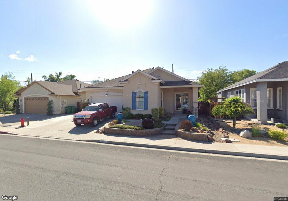
1647 Commonwealth Cir Reno, NV 89503
West University NeighborhoodEstimated Value: $549,000 - $660,000
5
Beds
2
Baths
2,178
Sq Ft
$288/Sq Ft
Est. Value
About This Home
This home is located at 1647 Commonwealth Cir, Reno, NV 89503 and is currently estimated at $627,329, approximately $288 per square foot. 1647 Commonwealth Cir is a home located in Washoe County with nearby schools including Peavine Elementary School, Archie Clayton Pre-AP Academy, and Reno High School.
Ownership History
Date
Name
Owned For
Owner Type
Purchase Details
Closed on
Oct 27, 2004
Sold by
Mackenzie L Elaine
Bought by
Mackenzie L Elaine and The L Elaine Mackenzie 1990 Trust
Current Estimated Value
Purchase Details
Closed on
Mar 25, 2003
Sold by
Sdc At Park Place Ltd
Bought by
Mackenzie L Elaine
Home Financials for this Owner
Home Financials are based on the most recent Mortgage that was taken out on this home.
Original Mortgage
$42,000
Interest Rate
5.79%
Create a Home Valuation Report for This Property
The Home Valuation Report is an in-depth analysis detailing your home's value as well as a comparison with similar homes in the area
Home Values in the Area
Average Home Value in this Area
Purchase History
| Date | Buyer | Sale Price | Title Company |
|---|---|---|---|
| Mackenzie L Elaine | -- | -- | |
| Mackenzie L Elaine | $269,660 | First American Title |
Source: Public Records
Mortgage History
| Date | Status | Borrower | Loan Amount |
|---|---|---|---|
| Closed | Mackenzie L Elaine | $42,000 | |
| Closed | Mackenzie L Elaine | $98,150 |
Source: Public Records
Tax History Compared to Growth
Tax History
| Year | Tax Paid | Tax Assessment Tax Assessment Total Assessment is a certain percentage of the fair market value that is determined by local assessors to be the total taxable value of land and additions on the property. | Land | Improvement |
|---|---|---|---|---|
| 2025 | $3,595 | $135,917 | $47,985 | $87,932 |
| 2024 | $3,490 | $132,580 | $43,960 | $88,620 |
| 2023 | $3,490 | $128,539 | $44,590 | $83,949 |
| 2022 | $3,388 | $108,977 | $39,165 | $69,812 |
| 2021 | $3,290 | $97,306 | $27,860 | $69,446 |
| 2020 | $3,193 | $95,477 | $25,900 | $69,577 |
| 2019 | $3,100 | $91,875 | $24,500 | $67,375 |
| 2018 | $2,950 | $83,453 | $19,075 | $64,378 |
| 2017 | $2,865 | $83,478 | $19,040 | $64,438 |
| 2016 | $2,793 | $82,923 | $17,115 | $65,808 |
| 2015 | $701 | $80,317 | $14,770 | $65,547 |
| 2014 | $2,706 | $75,930 | $12,915 | $63,015 |
| 2013 | -- | $71,628 | $9,660 | $61,968 |
Source: Public Records
Map
Nearby Homes
- 1516 Coleman Dr
- 2120 Keystone Ave
- 1835 Marlette Ave
- 1935 Marlette Ave
- 1702 Grandview Ave
- 1480 Grandview Ave
- 1535 Van Ness Ave
- 1835 Van Ness Ave
- 1375 Wesley Dr
- 1540 King Edward Dr
- 1415 Kings Row
- 1275 Washington St
- 840 Brookfield Dr
- 1155 Wesley Dr
- 850 W 11th St
- 535 Citadel Rd
- 1217 Keystone Ave
- 1510 Majestic Dr Unit one
- 1600 Majestic Dr
- 1670 Majestic Dr
- 1655 Commonwealth Cir
- 1639 Commonwealth Cir
- 1663 Commonwealth Cir
- 1805 Simpson Ave
- 1800 Lassen Dr
- 1638 Commonwealth Cir
- 1630 Commonwealth Cir
- 1671 Commonwealth Cir
- 1646 Commonwealth Cir
- 1622 Commonwealth Cir
- 1825 Simpson Ave
- 1654 Commonwealth Cir
- 1614 Commonwealth Cir
- 1830 Lassen Dr
- 1800 Simpson Ave
- 1679 Commonwealth Cir
- 1662 Commonwealth Cir
- 1880 Coleman Dr
- 1845 Simpson Ave
- 1606 Commonwealth Cir