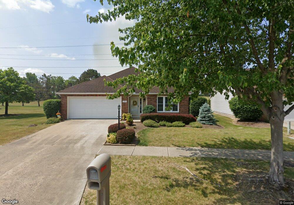
16474 N Laguardia Pkwy Strongsville, OH 44136
Estimated Value: $276,663 - $306,000
2
Beds
2
Baths
1,477
Sq Ft
$194/Sq Ft
Est. Value
About This Home
This home is located at 16474 N Laguardia Pkwy, Strongsville, OH 44136 and is currently estimated at $286,416, approximately $193 per square foot. 16474 N Laguardia Pkwy is a home located in Cuyahoga County with nearby schools including Strongsville High School, Sts Joseph & John Interparochial School, and Royal Redeemer Lutheran School.
Ownership History
Date
Name
Owned For
Owner Type
Purchase Details
Closed on
Aug 20, 2015
Sold by
May Robinette L
Bought by
Muran Edward E
Current Estimated Value
Home Financials for this Owner
Home Financials are based on the most recent Mortgage that was taken out on this home.
Original Mortgage
$119,200
Outstanding Balance
$93,750
Interest Rate
4.03%
Mortgage Type
New Conventional
Estimated Equity
$192,666
Purchase Details
Closed on
Apr 8, 1998
Sold by
Byers Charles E
Bought by
May Richard H and May Robinette L
Home Financials for this Owner
Home Financials are based on the most recent Mortgage that was taken out on this home.
Original Mortgage
$94,000
Interest Rate
7.19%
Purchase Details
Closed on
Dec 22, 1992
Bought by
Byers Charles E
Purchase Details
Closed on
Jan 1, 1991
Bought by
Bruscino Homes Corp.
Create a Home Valuation Report for This Property
The Home Valuation Report is an in-depth analysis detailing your home's value as well as a comparison with similar homes in the area
Home Values in the Area
Average Home Value in this Area
Purchase History
| Date | Buyer | Sale Price | Title Company |
|---|---|---|---|
| Muran Edward E | $149,000 | Ohio Real Title | |
| May Richard H | $144,000 | Midland Title Security Inc | |
| Byers Charles E | $122,200 | -- | |
| Bruscino Homes Corp. | -- | -- |
Source: Public Records
Mortgage History
| Date | Status | Borrower | Loan Amount |
|---|---|---|---|
| Open | Muran Edward E | $119,200 | |
| Previous Owner | May Richard H | $94,000 |
Source: Public Records
Tax History Compared to Growth
Tax History
| Year | Tax Paid | Tax Assessment Tax Assessment Total Assessment is a certain percentage of the fair market value that is determined by local assessors to be the total taxable value of land and additions on the property. | Land | Improvement |
|---|---|---|---|---|
| 2024 | $3,771 | $90,125 | $19,740 | $70,385 |
| 2023 | $4,326 | $69,090 | $17,290 | $51,800 |
| 2022 | $4,295 | $69,090 | $17,290 | $51,800 |
| 2021 | $4,261 | $69,090 | $17,290 | $51,800 |
| 2020 | $4,153 | $59,570 | $14,910 | $44,660 |
| 2019 | $4,031 | $170,200 | $42,600 | $127,600 |
| 2018 | $3,258 | $59,570 | $14,910 | $44,660 |
| 2017 | $3,492 | $52,640 | $11,340 | $41,300 |
| 2016 | $3,464 | $52,640 | $11,340 | $41,300 |
| 2015 | $2,827 | $52,640 | $11,340 | $41,300 |
| 2014 | $2,827 | $51,110 | $11,030 | $40,080 |
Source: Public Records
Map
Nearby Homes
- 10369 Council Bluff
- 16519 Albion Rd
- 9945 Twelve Oaks Cir
- 15485 Albion Rd
- 9890 Webster Rd
- 10010 Chevy Chase
- 0 Webster Rd
- 9129 Tahoe Cir
- 12101 The Bluffs
- 11650 River Moss Rd
- 17945 Cliffside Dr
- 14069 Basswood Cir
- 14298 Calderdale Ln
- 17809 Cliffside Dr Unit 4926
- 9531 Nicole Cir
- 18433 Whitney Rd
- 18336 Falling Water Rd
- 14584 Baywood Ln
- 14557 Baywood Ln
- 18203 Broxton Dr
- 16474 N Laguardia Pkwy Unit 16474
- 16458 N Laguardia Pkwy
- 16442 N Laguardia Pkwy
- 16449 N Laguardia Pkwy
- 16430 N Laguardia Pkwy Unit 18
- 16417 N Laguardia Pkwy
- 10640 Carmel Oval
- 10554 Decatur Dr Unit 52A
- 10662 Carmel Oval
- 10526 Decatur Dr
- 16418 Logan Ct
- 10684 Carmel Oval
- 10684 Carmel Oval Unit 55-A
- 16385 N Laguardia Pkwy Unit 24
- 10468 Decatur Dr
- 10706 Carmel Oval
- 16406 Logan Ct
- 16406 Logan Ct Unit 16
- 10442 Decatur Dr
- 16353 N Laguardia Pkwy