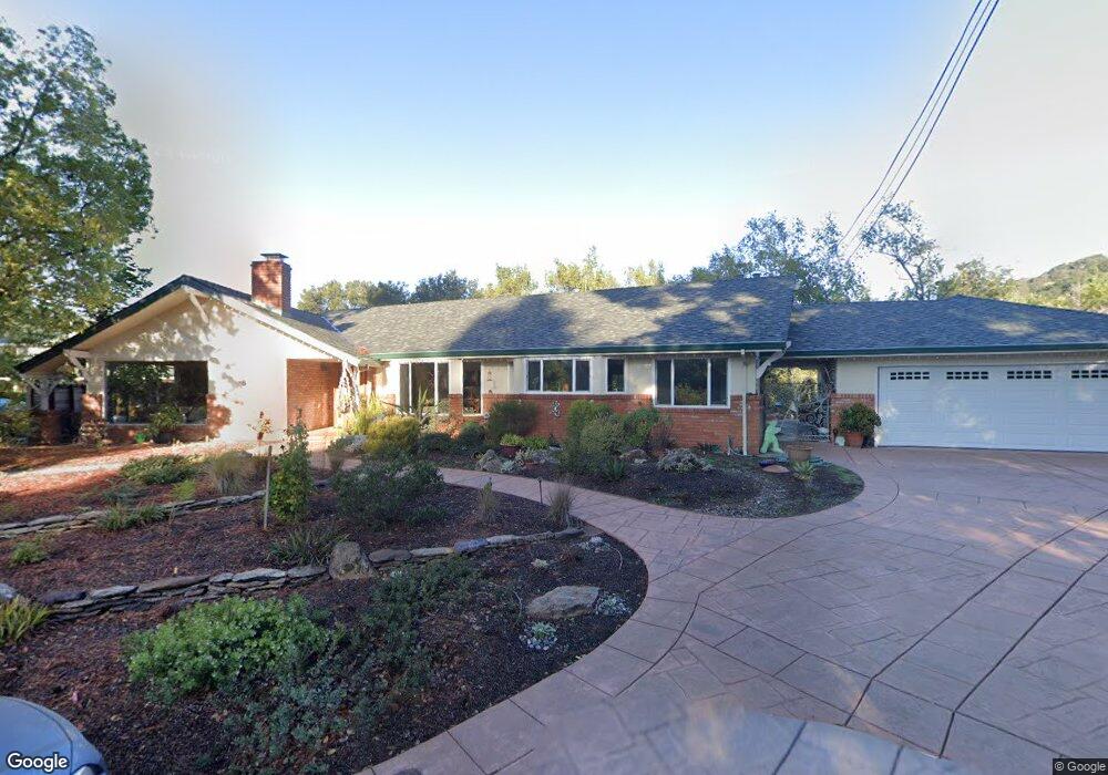
1648 Daniels Dr San Leandro, CA 94577
Bay-O-Vista NeighborhoodEstimated Value: $1,394,000 - $2,070,176
3
Beds
4
Baths
3,814
Sq Ft
$442/Sq Ft
Est. Value
About This Home
This home is located at 1648 Daniels Dr, San Leandro, CA 94577 and is currently estimated at $1,685,044, approximately $441 per square foot. 1648 Daniels Dr is a home located in Alameda County with nearby schools including Roosevelt Elementary School, Bancroft Middle School, and San Leandro High School.
Ownership History
Date
Name
Owned For
Owner Type
Purchase Details
Closed on
Dec 18, 2019
Sold by
Gregory Dale Lynne and Gregory Dale Martin
Bought by
Gregory Dale Martin and Gregory Michael John
Current Estimated Value
Purchase Details
Closed on
Nov 15, 2001
Sold by
Martin Kenneth S
Bought by
Gregory Dale Lynne
Purchase Details
Closed on
May 1, 2000
Sold by
Surber Timothy and Surber Lynn L
Bought by
Martin Kenneth S
Purchase Details
Closed on
Sep 25, 1996
Sold by
Bevilacqua Florence
Bought by
Surber Timothy and Surber Lynn L
Create a Home Valuation Report for This Property
The Home Valuation Report is an in-depth analysis detailing your home's value as well as a comparison with similar homes in the area
Home Values in the Area
Average Home Value in this Area
Purchase History
We collect this data history from publicly available records. To have your information removed, we recommend requesting removal directly through your county’s website.
| Date | Buyer | Sale Price | Title Company |
|---|---|---|---|
| Gregory Dale Martin | -- | None Available | |
| Gregory Dale Lynne | -- | -- | |
| Martin Kenneth S | $755,000 | Chicago Title Co | |
| Surber Timothy | $220,000 | Commonwealth Land Title Co |
Source: Public Records
Tax History
| Year | Tax Paid | Tax Assessment Tax Assessment Total Assessment is a certain percentage of the fair market value that is determined by local assessors to be the total taxable value of land and additions on the property. | Land | Improvement |
|---|---|---|---|---|
| 2025 | $18,242 | $1,443,655 | $400,790 | $1,049,865 |
| 2024 | $18,242 | $1,415,214 | $392,932 | $1,029,282 |
| 2023 | $18,180 | $1,394,333 | $385,229 | $1,009,104 |
| 2022 | $17,673 | $1,359,998 | $377,677 | $989,321 |
| 2021 | $17,169 | $1,333,197 | $370,272 | $969,925 |
| 2020 | $16,762 | $1,326,458 | $366,476 | $959,982 |
| 2019 | $16,257 | $1,300,454 | $359,291 | $941,163 |
| 2018 | $15,878 | $1,274,960 | $352,247 | $922,713 |
| 2017 | $15,528 | $1,249,967 | $345,342 | $904,625 |
| 2016 | $14,703 | $1,225,464 | $338,572 | $886,892 |
| 2015 | $14,443 | $1,207,066 | $333,489 | $873,577 |
| 2014 | $14,337 | $1,183,429 | $326,959 | $856,470 |
Source: Public Records
Map
Nearby Homes
- 1573 Daniels Dr
- 3056 Roxbury Ave
- 1449 Sandelin Ave
- 3086 Middleton St
- 1003 Greenbrier Ct
- 543 Fortuna Ave
- 970 Joaquin Ave Unit U7
- 960 Joaquin Ave
- 1468 Grand Ave Unit 39
- 1686 Grand Ave
- 1961 Marineview Dr
- 928 Evergreen Ave
- 1233 Benedict Ct
- 1902 Evergreen Ave
- 11275 Kerrigan Dr
- 670 Estudillo Ave
- 11330 Lochard St
- 6 Turner Ct
- 0 Montrose Dr
- 310 Melven Ct
- 1642 Daniels Dr
- 1700 Daniels Dr
- 1630 Daniels Dr
- 1622 Daniels Dr
- 1636 Daniels Dr
- 1616 Daniels Dr
- 1121 Brookvale Dr
- 1645 Daniels Dr
- 1604 Daniels Dr
- 1633 Daniels Dr
- 1621 Daniels Dr
- 1129 Brookvale Dr
- 3340 Revere Ave
- 3330 Revere Ave
- 1135 Brookvale Dr
- 3318 Revere Ave
- 3358 Revere Ave
- 3350 Revere Ave
- 3366 Revere Ave
- 3378 Revere Ave
Your Personal Tour Guide
Ask me questions while you tour the home.