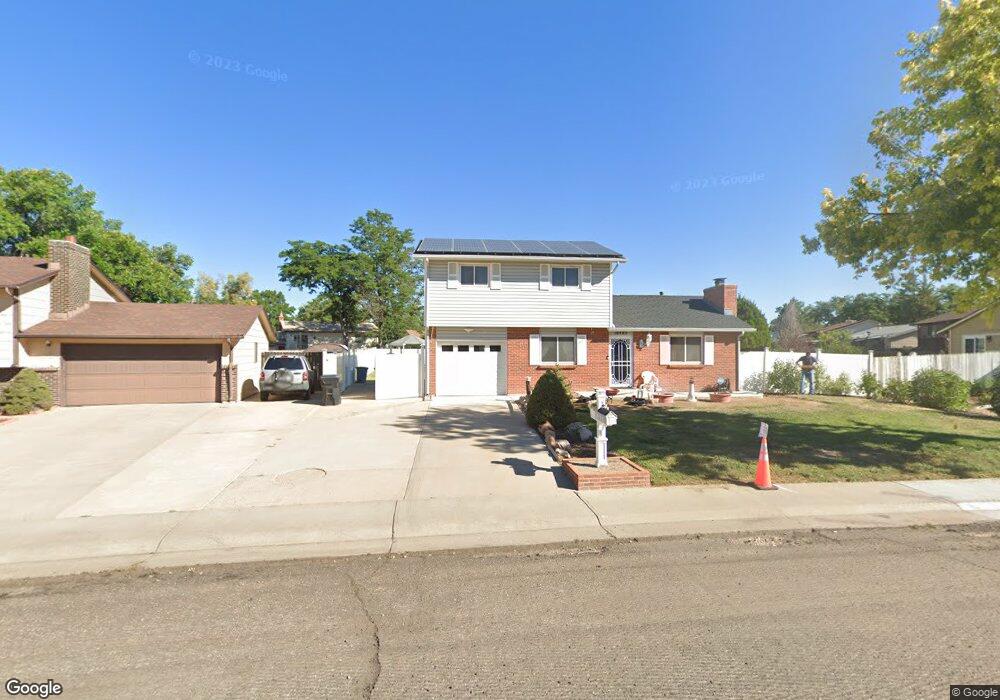
16485 E 7th Ave Aurora, CO 80011
Laredo Highline NeighborhoodEstimated Value: $417,000 - $502,000
3
Beds
1
Bath
1,623
Sq Ft
$276/Sq Ft
Est. Value
About This Home
This home is located at 16485 E 7th Ave, Aurora, CO 80011 and is currently estimated at $447,194, approximately $275 per square foot. 16485 E 7th Ave is a home located in Arapahoe County with nearby schools including Laredo Elementary School, East Middle School, and Hinkley High School.
Ownership History
Date
Name
Owned For
Owner Type
Purchase Details
Closed on
Jun 25, 2003
Sold by
Kellner Donald E and Kellner Phyllis Joan
Bought by
Larkin Randy Scott and Larkin Mary E
Current Estimated Value
Home Financials for this Owner
Home Financials are based on the most recent Mortgage that was taken out on this home.
Original Mortgage
$188,049
Interest Rate
5.24%
Mortgage Type
FHA
Purchase Details
Closed on
May 1, 1979
Sold by
Conversion Arapco
Bought by
Conversion Arapco
Purchase Details
Closed on
Jul 4, 1776
Bought by
Conversion Arapco
Create a Home Valuation Report for This Property
The Home Valuation Report is an in-depth analysis detailing your home's value as well as a comparison with similar homes in the area
Home Values in the Area
Average Home Value in this Area
Purchase History
| Date | Buyer | Sale Price | Title Company |
|---|---|---|---|
| Larkin Randy Scott | $191,000 | -- | |
| Conversion Arapco | -- | -- | |
| Conversion Arapco | -- | -- |
Source: Public Records
Mortgage History
| Date | Status | Borrower | Loan Amount |
|---|---|---|---|
| Previous Owner | Larkin Randy Scott | $188,049 |
Source: Public Records
Tax History
| Year | Tax Paid | Tax Assessment Tax Assessment Total Assessment is a certain percentage of the fair market value that is determined by local assessors to be the total taxable value of land and additions on the property. | Land | Improvement |
|---|---|---|---|---|
| 2025 | $2,090 | $26,113 | -- | -- |
| 2024 | $2,027 | $28,509 | -- | -- |
| 2023 | $2,027 | $28,509 | $0 | $0 |
| 2022 | $1,741 | $24,291 | $0 | $0 |
| 2021 | $1,797 | $24,291 | $0 | $0 |
| 2020 | $1,535 | $21,894 | $0 | $0 |
| 2019 | $1,527 | $21,894 | $0 | $0 |
| 2018 | $1,104 | $17,640 | $0 | $0 |
| 2017 | $1,623 | $17,640 | $0 | $0 |
| 2016 | $1,342 | $14,280 | $0 | $0 |
| 2015 | $1,295 | $14,280 | $0 | $0 |
| 2014 | -- | $9,727 | $0 | $0 |
| 2013 | -- | $12,780 | $0 | $0 |
Source: Public Records
Map
Nearby Homes
- 745 Mobile St
- 757 Norfolk Way
- 752 Lewiston St
- 803 Nucla St
- 666 Kittredge St
- 15863 E 7th Ave
- 15950 E 6th Ave
- 16010 E 11th Ave
- 1074 N Joplin St Unit 5
- 808 Idalia St
- 1053 N Joplin St Unit 1
- 1063 N Joplin St Unit 2
- 1313 Laredo St
- 1280 Airport Blvd
- 1064 Chambers Ct Unit 108
- 15703 E 13th Place Unit 1A
- 15771 E 13th Place Unit C34
- 681 Fraser St
- 15814 E Colfax Ave Unit 21
- 337 Ivory Cir
- 16475 E 7th Ave
- 16495 E 7th Ave
- 717 Norfolk Way
- 736 Mobile St
- 746 Mobile St
- 727 Norfolk Way
- 16465 E 7th Ave
- 756 Mobile St
- 16474 E 7th Ave
- 16494 E 7th Ave
- 716 Mobile St
- 737 Norfolk Way
- 16455 E 7th Ave
- 766 Mobile St
- 16454 E 7th Ave
- 706 Mobile St
- 747 Norfolk Way
- 735 Mobile St
- 708 Norfolk Way
- 675 Norfolk Way
Your Personal Tour Guide
Ask me questions while you tour the home.