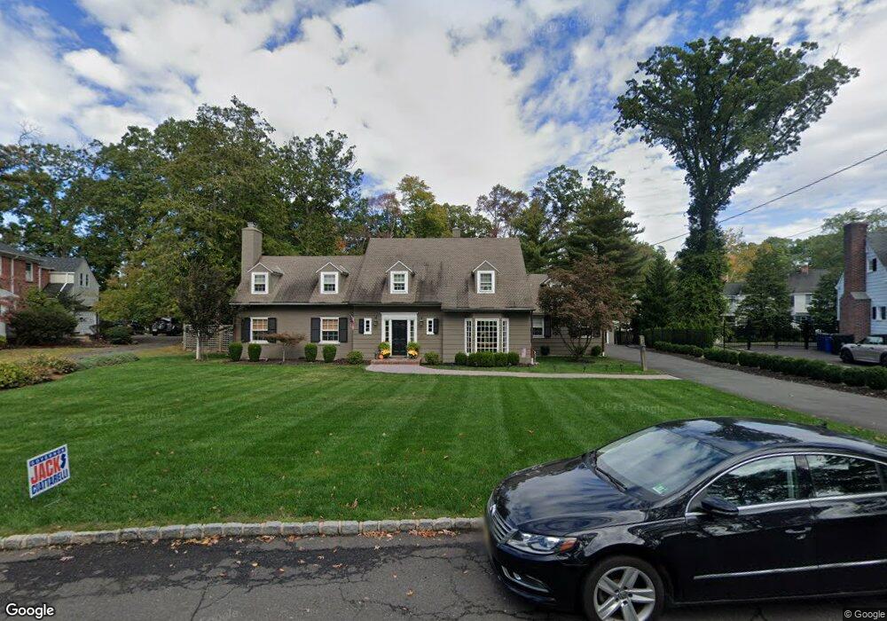
1649 Forest Hill Rd Unit 55 Plainfield, NJ 07060
Estimated Value: $913,000 - $1,133,000
--
Bed
--
Bath
3,905
Sq Ft
$257/Sq Ft
Est. Value
About This Home
This home is located at 1649 Forest Hill Rd Unit 55, Plainfield, NJ 07060 and is currently estimated at $1,003,208, approximately $256 per square foot. 1649 Forest Hill Rd Unit 55 is a home located in Union County with nearby schools including Charles and Anna Booker School, Maxson Middle School, and Plainfield High School.
Ownership History
Date
Name
Owned For
Owner Type
Purchase Details
Closed on
Jun 29, 2010
Sold by
Terwelp Richard M and Terwelp Kathy L
Bought by
Smith James Bayard and Smith Leah
Current Estimated Value
Purchase Details
Closed on
Oct 2, 1995
Sold by
Burger F Gregg
Bought by
Terwelp Richard M and Terwelp Kathy L
Purchase Details
Closed on
Sep 22, 1995
Sold by
Burger Euphemia B and Gregg Burger F
Bought by
Burger F Gregg
Create a Home Valuation Report for This Property
The Home Valuation Report is an in-depth analysis detailing your home's value as well as a comparison with similar homes in the area
Home Values in the Area
Average Home Value in this Area
Purchase History
| Date | Buyer | Sale Price | Title Company |
|---|---|---|---|
| Smith James Bayard | $597,500 | Chicago Title Insurance Co | |
| Terwelp Richard M | $275,000 | -- | |
| Burger F Gregg | -- | -- |
Source: Public Records
Tax History Compared to Growth
Tax History
| Year | Tax Paid | Tax Assessment Tax Assessment Total Assessment is a certain percentage of the fair market value that is determined by local assessors to be the total taxable value of land and additions on the property. | Land | Improvement |
|---|---|---|---|---|
| 2025 | $20,477 | $234,500 | $103,500 | $131,000 |
| 2024 | $20,275 | $234,500 | $103,500 | $131,000 |
| 2023 | $20,275 | $234,500 | $103,500 | $131,000 |
| 2022 | $19,836 | $234,500 | $103,500 | $131,000 |
| 2021 | $19,663 | $234,500 | $103,500 | $131,000 |
| 2020 | $19,607 | $234,500 | $103,500 | $131,000 |
| 2019 | $19,607 | $234,500 | $103,500 | $131,000 |
| 2018 | $19,196 | $234,500 | $103,500 | $131,000 |
| 2017 | $18,727 | $234,500 | $103,500 | $131,000 |
| 2016 | $18,345 | $234,500 | $103,500 | $131,000 |
| 2015 | $17,803 | $234,500 | $103,500 | $131,000 |
| 2014 | $17,320 | $234,500 | $103,500 | $131,000 |
Source: Public Records
Map
Nearby Homes
- 771 Ravine Rd
- 767 Ravine Rd Unit 73
- 714 Dixie Ln
- 1009 Mayfair Way
- 1505 Charlotte Rd
- 1343 Putnam Ave Unit 45
- 1627 Prospect Ave Unit 47
- 1158 Woodmere Place
- 633 Woodland Ave Unit 37
- 1342 Lake St
- 1305 Sunnyside Place Unit 9
- 842 Berkeley Ave
- 810 Leland Ave Unit 14
- 724 Central St
- 1224 Sunnyfield Ln
- 1138-40 Gresham Rd
- 1232 Sunnyfield Ln
- 774 Webster Place
- 1213 Putnam Ave Unit 15
- 1231 Rahway Rd
- 1641 Forest Hill Rd Unit 47
- 1657 Forest Hill Rd Unit 63
- 1657-63 Forest Hill Rd
- 1025 Oak Ln Unit 29
- 1031 Oak Ln Unit 35
- 1033 Oak Ln
- 1640 Forest Hill Rd Unit 60
- 1650 Forest Hill Rd
- 1037 Oak Ln Unit 41
- 1019 Oak Ln Unit 23
- 1021 Oak Ln
- 1633 Forest Hill Rd Unit 39
- 1331-39 Denmark Rd
- 1345 Denmark Rd
- 1341 Denmark Rd Unit 49
- 1331 Denmark Rd Unit 39
- 1665 Forest Hill Rd Unit 71
- 1043 Oak Ln Unit 47
- 1013 Oak Ln Unit 17
- 1623 Forest Hill Rd Unit 31