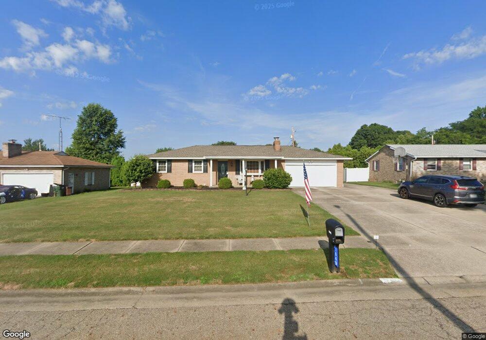
1649 Hiram St Louisville, OH 44641
Estimated Value: $228,000 - $250,000
3
Beds
3
Baths
1,176
Sq Ft
$201/Sq Ft
Est. Value
About This Home
This home is located at 1649 Hiram St, Louisville, OH 44641 and is currently estimated at $235,905, approximately $200 per square foot. 1649 Hiram St is a home located in Stark County with nearby schools including Louisville High School and St. Thomas Aquinas High School & Middle School.
Ownership History
Date
Name
Owned For
Owner Type
Purchase Details
Closed on
Apr 26, 2006
Sold by
Fosnaught Nancy
Bought by
Koren David B and Koren Kimberly A
Current Estimated Value
Home Financials for this Owner
Home Financials are based on the most recent Mortgage that was taken out on this home.
Original Mortgage
$97,500
Outstanding Balance
$56,532
Interest Rate
6.42%
Mortgage Type
Fannie Mae Freddie Mac
Estimated Equity
$179,373
Purchase Details
Closed on
Apr 4, 2003
Sold by
Parke Florence C and Parke Richard L
Bought by
Fosnaught Nancy
Purchase Details
Closed on
Sep 26, 1991
Create a Home Valuation Report for This Property
The Home Valuation Report is an in-depth analysis detailing your home's value as well as a comparison with similar homes in the area
Home Values in the Area
Average Home Value in this Area
Purchase History
| Date | Buyer | Sale Price | Title Company |
|---|---|---|---|
| Koren David B | -- | None Available | |
| Fosnaught Nancy | $130,000 | -- | |
| -- | -- | -- |
Source: Public Records
Mortgage History
| Date | Status | Borrower | Loan Amount |
|---|---|---|---|
| Open | Koren David B | $97,500 |
Source: Public Records
Tax History Compared to Growth
Tax History
| Year | Tax Paid | Tax Assessment Tax Assessment Total Assessment is a certain percentage of the fair market value that is determined by local assessors to be the total taxable value of land and additions on the property. | Land | Improvement |
|---|---|---|---|---|
| 2025 | -- | $66,050 | $17,080 | $48,970 |
| 2024 | -- | $66,050 | $17,080 | $48,970 |
| 2023 | $2,257 | $52,510 | $13,340 | $39,170 |
| 2022 | $2,262 | $52,510 | $13,340 | $39,170 |
| 2021 | $2,269 | $52,510 | $13,340 | $39,170 |
| 2020 | $1,886 | $47,400 | $12,010 | $35,390 |
| 2019 | $1,894 | $47,400 | $12,010 | $35,390 |
| 2018 | $1,886 | $47,400 | $12,010 | $35,390 |
| 2017 | $1,714 | $41,550 | $9,940 | $31,610 |
| 2016 | $1,749 | $41,550 | $9,940 | $31,610 |
| 2015 | $1,754 | $41,550 | $9,940 | $31,610 |
| 2014 | $1,739 | $38,290 | $9,170 | $29,120 |
| 2013 | $873 | $38,290 | $9,170 | $29,120 |
Source: Public Records
Map
Nearby Homes
- 1561 Noel St
- 0 Pilot Knob Ave NE
- 6285 California Ave
- 5700 Broadway Ave
- 0 Brookridge Ave
- 0 Glenbar St
- 5623 Shallow Creek Ave
- 704 Reno Dr
- 5470 Alcorn Ave
- 6083 Apple St
- 5700 Glena St
- 6395 Easton St NE
- 300 Kennedy St
- 6779 Easton St NE
- 248 Menegay Rd
- 414 Honeycrisp Dr NE
- 3047 Mcintosh Dr NE
- 2950 Mcintosh Dr NE
- 2956 Mcintosh Dr NE
- 2962 Mcintosh Dr NE