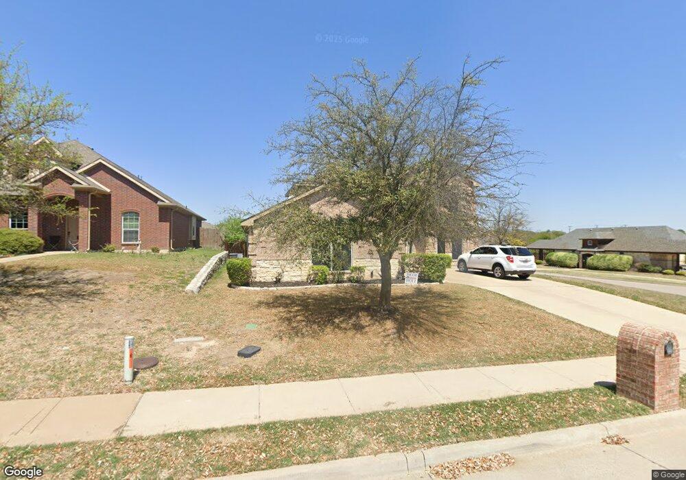
1649 Silverstone Dr Weatherford, TX 76087
Estimated Value: $381,763 - $447,000
--
Bed
--
Bath
2,970
Sq Ft
$139/Sq Ft
Est. Value
About This Home
This home is located at 1649 Silverstone Dr, Weatherford, TX 76087 and is currently estimated at $412,191, approximately $138 per square foot. 1649 Silverstone Dr is a home located in Parker County with nearby schools including Martin Elementary School, Tison Middle School, and Weatherford High School.
Ownership History
Date
Name
Owned For
Owner Type
Purchase Details
Closed on
Aug 24, 2005
Sold by
Classic Century Homes Inc
Bought by
Catuto Robert F and Catuto Patricia L
Current Estimated Value
Home Financials for this Owner
Home Financials are based on the most recent Mortgage that was taken out on this home.
Original Mortgage
$124,000
Outstanding Balance
$64,929
Interest Rate
5.61%
Mortgage Type
New Conventional
Estimated Equity
$347,262
Create a Home Valuation Report for This Property
The Home Valuation Report is an in-depth analysis detailing your home's value as well as a comparison with similar homes in the area
Home Values in the Area
Average Home Value in this Area
Purchase History
| Date | Buyer | Sale Price | Title Company |
|---|---|---|---|
| Catuto Robert F | -- | None Available |
Source: Public Records
Mortgage History
| Date | Status | Borrower | Loan Amount |
|---|---|---|---|
| Open | Catuto Robert F | $124,000 |
Source: Public Records
Tax History Compared to Growth
Tax History
| Year | Tax Paid | Tax Assessment Tax Assessment Total Assessment is a certain percentage of the fair market value that is determined by local assessors to be the total taxable value of land and additions on the property. | Land | Improvement |
|---|---|---|---|---|
| 2025 | $5,926 | $397,316 | -- | -- |
| 2024 | $5,926 | $361,196 | -- | -- |
| 2023 | $5,926 | $328,360 | $0 | $0 |
| 2022 | $6,621 | $298,510 | $35,000 | $263,510 |
| 2021 | $7,026 | $298,510 | $35,000 | $263,510 |
| 2020 | $6,427 | $265,980 | $30,000 | $235,980 |
| 2019 | $6,792 | $265,980 | $30,000 | $235,980 |
| 2018 | $6,253 | $243,760 | $30,000 | $213,760 |
| 2017 | $5,947 | $243,760 | $30,000 | $213,760 |
| 2016 | $5,406 | $205,460 | $30,000 | $175,460 |
| 2015 | $4,925 | $205,460 | $30,000 | $175,460 |
| 2014 | -- | $191,120 | $30,000 | $161,120 |
Source: Public Records
Map
Nearby Homes
- 1629 Silverstone Dr
- 1624 Sandle Wood Dr
- 1605 Stanchion Way
- 1553 Salado Trail
- 1541 Stanchion Way
- 2712 Sonora Canyon Rd
- 705 N Oakridge Dr
- 1636 Salado Trail
- 1529 Sidewinder Trail
- 1520 Sidewinder Trail
- 1525 Sand Dollar Trail
- 116 Sandstone Ln
- 106 Rambling Trail
- 2517 Hayley Dr
- 408 Sandridge Dr
- 2321 Shamrock Ln
- 2317 Shamrock Ln
- 2313 Shamrock Ln
- 302 Red Eagle Trail
- 1201 Azle Hwy
- 1645 Silverstone Dr
- 733 Saddle Ridge Trail
- 733 Saddle Ridge Trail Unit TRAIL
- 1652 Signature Dr
- 1641 Silverstone Dr
- 1648 Signature Dr
- 1644 Signature Dr
- 732 Sage Brush Dr
- 1701 Sorrel Ct
- 729 Saddle Ridge Trail
- 1637 Silverstone Dr
- 1640 Signature Dr
- 808 Saddle Ridge Tr
- 728 Sage Brush Dr
- 1705 Sorrel Ct
- 1653 Signature Dr
- 812 Saddle Ridge Trail
- 1702 Sorrel Ct
- 1633 Silverstone Dr
- 1636 Signature Dr