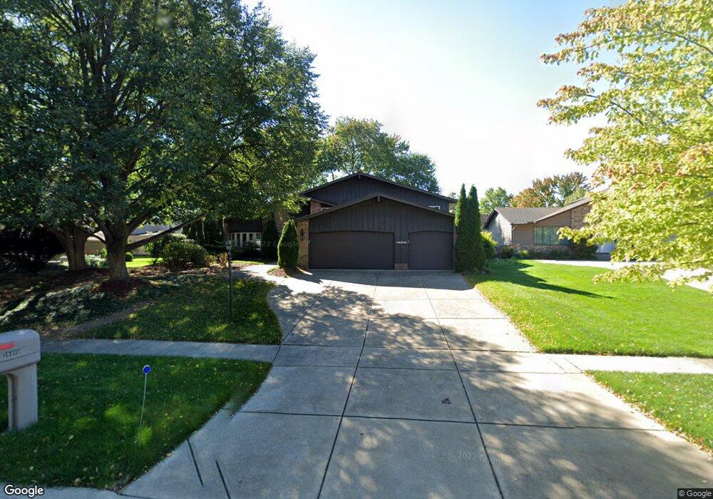
16495 N Red Rock Dr Strongsville, OH 44136
Estimated Value: $405,620 - $435,000
5
Beds
5
Baths
3,007
Sq Ft
$139/Sq Ft
Est. Value
About This Home
This home is located at 16495 N Red Rock Dr, Strongsville, OH 44136 and is currently estimated at $417,655, approximately $138 per square foot. 16495 N Red Rock Dr is a home located in Cuyahoga County with nearby schools including Strongsville High School.
Ownership History
Date
Name
Owned For
Owner Type
Purchase Details
Closed on
Jul 17, 2003
Sold by
Agnew Robert and Agnew Irma
Bought by
Agnew Robert J and Agnew Irma J
Current Estimated Value
Purchase Details
Closed on
Jul 28, 1998
Sold by
Morris Robert J and Morris Elizabeth D
Bought by
Agnew Robert and Agnew Irma
Home Financials for this Owner
Home Financials are based on the most recent Mortgage that was taken out on this home.
Original Mortgage
$120,000
Outstanding Balance
$25,274
Interest Rate
7.03%
Estimated Equity
$392,381
Purchase Details
Closed on
Apr 19, 1993
Sold by
Pine Claude T
Bought by
Morris Robert J
Purchase Details
Closed on
Oct 16, 1986
Sold by
Dufresne George P
Bought by
Pine Claude T
Purchase Details
Closed on
Apr 19, 1978
Bought by
Dufresne George P
Purchase Details
Closed on
Jan 1, 1977
Bought by
Chestnut Homes
Create a Home Valuation Report for This Property
The Home Valuation Report is an in-depth analysis detailing your home's value as well as a comparison with similar homes in the area
Home Values in the Area
Average Home Value in this Area
Purchase History
| Date | Buyer | Sale Price | Title Company |
|---|---|---|---|
| Agnew Robert J | -- | -- | |
| Agnew Robert | $189,000 | Rockwell Title Agency Inc | |
| Morris Robert J | $148,400 | -- | |
| Pine Claude T | $115,000 | -- | |
| Dufresne George P | $95,000 | -- | |
| Chestnut Homes | -- | -- |
Source: Public Records
Mortgage History
| Date | Status | Borrower | Loan Amount |
|---|---|---|---|
| Open | Agnew Robert | $120,000 |
Source: Public Records
Tax History Compared to Growth
Tax History
| Year | Tax Paid | Tax Assessment Tax Assessment Total Assessment is a certain percentage of the fair market value that is determined by local assessors to be the total taxable value of land and additions on the property. | Land | Improvement |
|---|---|---|---|---|
| 2024 | $4,649 | $108,815 | $22,015 | $86,800 |
| 2023 | $4,967 | $88,490 | $22,300 | $66,190 |
| 2022 | $4,957 | $88,480 | $22,300 | $66,190 |
| 2021 | $4,918 | $88,480 | $22,300 | $66,190 |
| 2020 | $4,445 | $72,520 | $18,270 | $54,250 |
| 2019 | $4,315 | $207,200 | $52,200 | $155,000 |
| 2018 | $2,095 | $72,520 | $18,270 | $54,250 |
| 2017 | $3,887 | $67,350 | $14,460 | $52,890 |
| 2016 | $3,856 | $67,350 | $14,460 | $52,890 |
| 2015 | $3,910 | $67,350 | $14,460 | $52,890 |
| 2014 | $3,910 | $67,350 | $14,460 | $52,890 |
Source: Public Records
Map
Nearby Homes
- 16486 S Red Rock Dr
- 17159 Turkey Meadow Ln
- 17130 Golden Star Dr
- 18229 Howe Rd
- 16650 Lanier Ave
- 17682 Drake Rd
- 17024 Bear Creek Ln
- 16711 Beech Cir
- 16450 Howe Rd
- 18294 Drake Rd
- 17934 Cambridge Oval
- 18411 Yorktown Oval
- 17069 Partridge Dr
- 14985 Camden Cir
- 3550 Boston Rd
- 18987 Laurell Cir
- 19694 Benbow Rd
- 15604-REAR Boston Rd
- 15639 Indianhead Ln
- 19740 Benbow Rd
- 16499 N Red Rock Dr
- 17144 Misty Lake Dr
- 17148 Misty Lake Dr
- 16503 N Red Rock Dr
- 16528 S Red Rock Dr
- 16532 S Red Rock Dr
- 17152 Misty Lake Dr
- 16507 N Red Rock Dr
- 16536 S Red Rock Dr
- 16494 N Red Rock Dr
- 16498 N Red Rock Dr
- 16490 N Red Rock Dr
- 16502 N Red Rock Dr
- 16540 S Red Rock Dr
- 16511 N Red Rock Dr
- 16506 N Red Rock Dr
- 17145 Misty Lake Dr
- 17147 Misty Lake Dr
- 17143 Misty Lake Dr
- 17149 Misty Lake Dr