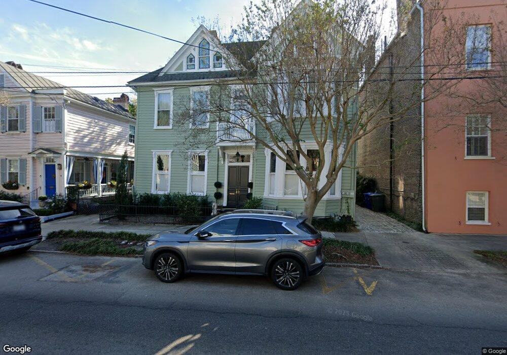
165 Broad St Unit B Charleston, SC 29401
South of Broad NeighborhoodEstimated Value: $1,113,000 - $1,597,846
3
Beds
2
Baths
2,500
Sq Ft
$556/Sq Ft
Est. Value
About This Home
This home is located at 165 Broad St Unit B, Charleston, SC 29401 and is currently estimated at $1,388,962, approximately $555 per square foot. 165 Broad St Unit B is a home located in Charleston County with nearby schools including Memminger Elementary School, Simmons Pinckney Middle, and Burke High School.
Ownership History
Date
Name
Owned For
Owner Type
Purchase Details
Closed on
Mar 15, 2022
Sold by
Patterson Lisa S
Bought by
Rhsc Llc
Current Estimated Value
Purchase Details
Closed on
Mar 27, 2015
Sold by
Hessert Marcia A
Bought by
Patterson Lisa S
Home Financials for this Owner
Home Financials are based on the most recent Mortgage that was taken out on this home.
Original Mortgage
$417,000
Interest Rate
3.79%
Mortgage Type
New Conventional
Create a Home Valuation Report for This Property
The Home Valuation Report is an in-depth analysis detailing your home's value as well as a comparison with similar homes in the area
Home Values in the Area
Average Home Value in this Area
Purchase History
| Date | Buyer | Sale Price | Title Company |
|---|---|---|---|
| Rhsc Llc | $1,250,000 | None Listed On Document | |
| Patterson Lisa S | $525,000 | -- |
Source: Public Records
Mortgage History
| Date | Status | Borrower | Loan Amount |
|---|---|---|---|
| Previous Owner | Patterson Lisa S | $417,000 | |
| Previous Owner | Patterson Lisa S | $53,000 |
Source: Public Records
Tax History Compared to Growth
Tax History
| Year | Tax Paid | Tax Assessment Tax Assessment Total Assessment is a certain percentage of the fair market value that is determined by local assessors to be the total taxable value of land and additions on the property. | Land | Improvement |
|---|---|---|---|---|
| 2024 | $22,118 | $75,000 | $0 | $0 |
| 2023 | $21,420 | $50,000 | $0 | $0 |
| 2022 | $2,704 | $22,240 | $0 | $0 |
| 2021 | $2,838 | $22,240 | $0 | $0 |
| 2020 | $2,943 | $22,240 | $0 | $0 |
| 2019 | $2,832 | $21,000 | $0 | $0 |
| 2017 | $2,732 | $21,000 | $0 | $0 |
| 2016 | $2,617 | $21,000 | $0 | $0 |
| 2015 | $1,986 | $17,200 | $0 | $0 |
| 2014 | -- | $0 | $0 | $0 |
| 2011 | -- | $0 | $0 | $0 |
Source: Public Records
Map
Nearby Homes
- 176 Broad St
- 4 Trapman St Unit B
- 4 Trapman St Unit A
- 13 Trumbo St
- 16 Trumbo St
- 6 Rutledge Ave
- 146 Broad St Unit B
- 156 Tradd St Unit E
- 143 Broad St
- 155 Queen St Unit A
- 155 Queen St Unit B
- 7 Logan St Unit F
- 153 Queen St
- 172 Tradd St
- 173 Tradd St
- 67 Legare St Unit 307
- 54 Gibbes St
- 14 Limehouse St
- 41 Legare St Unit B
- 125 Tradd St
- 165 Broad St Unit A1
- 165 Broad St Unit A2
- 165 Broad St
- 165 Broad St Unit A
- 165 Broad St Unit Aii
- 165 1/2 Broad St Unit B
- 163 Broad St
- 167 1/2 Broad St
- 167 Broad St
- 167 Broad St Unit 1/2
- 161 Broad St
- 31 Savage St
- 169 Broad St
- 159 Broad St
- 35 Savage St
- 29 Savage St
- 29 Savage St Unit A & B
- 27 Savage St
- 157 Broad St Unit A
- 157 Broad St