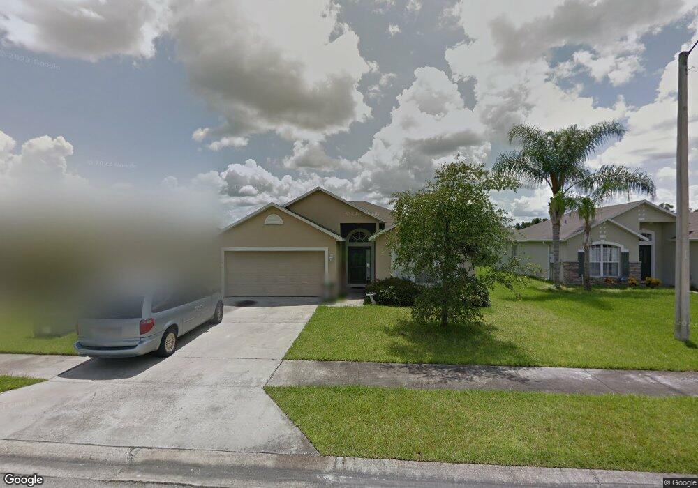
165 Cedar Ridge Ln Sanford, FL 32771
Estimated Value: $316,000 - $368,000
3
Beds
3
Baths
1,874
Sq Ft
$180/Sq Ft
Est. Value
About This Home
This home is located at 165 Cedar Ridge Ln, Sanford, FL 32771 and is currently estimated at $337,834, approximately $180 per square foot. 165 Cedar Ridge Ln is a home located in Seminole County with nearby schools including Hamilton Elementary School, Midway Elementary School, and Pine Crest Elementary School.
Ownership History
Date
Name
Owned For
Owner Type
Purchase Details
Closed on
Jan 14, 2005
Sold by
Maronda Homes Inc Of Florida
Bought by
Hamilton Timothy L and Hamilton Flor Marina
Current Estimated Value
Home Financials for this Owner
Home Financials are based on the most recent Mortgage that was taken out on this home.
Original Mortgage
$138,279
Outstanding Balance
$69,168
Interest Rate
5.61%
Mortgage Type
FHA
Estimated Equity
$268,666
Purchase Details
Closed on
Jul 1, 2004
Bought by
Hamilton Timothy L and Hamilton Flor M
Create a Home Valuation Report for This Property
The Home Valuation Report is an in-depth analysis detailing your home's value as well as a comparison with similar homes in the area
Home Values in the Area
Average Home Value in this Area
Purchase History
| Date | Buyer | Sale Price | Title Company |
|---|---|---|---|
| Hamilton Timothy L | -- | Kampf Title & Guaranty Corp | |
| Hamilton Timothy L | $567,300 | -- |
Source: Public Records
Mortgage History
| Date | Status | Borrower | Loan Amount |
|---|---|---|---|
| Open | Hamilton Timothy L | $138,279 |
Source: Public Records
Tax History Compared to Growth
Tax History
| Year | Tax Paid | Tax Assessment Tax Assessment Total Assessment is a certain percentage of the fair market value that is determined by local assessors to be the total taxable value of land and additions on the property. | Land | Improvement |
|---|---|---|---|---|
| 2024 | $1,158 | $108,094 | -- | -- |
| 2023 | $1,110 | $104,946 | $0 | $0 |
| 2021 | $1,038 | $98,921 | $0 | $0 |
| 2020 | $1,022 | $97,555 | $0 | $0 |
| 2019 | $996 | $95,362 | $0 | $0 |
| 2018 | $976 | $93,584 | $0 | $0 |
| 2017 | $957 | $91,659 | $0 | $0 |
| 2016 | $986 | $90,402 | $0 | $0 |
| 2015 | $963 | $89,150 | $0 | $0 |
| 2014 | $963 | $88,442 | $0 | $0 |
Source: Public Records
Map
Nearby Homes
- 2408 Decottes Ave
- 104 Hughes Ave
- 1401 Forest Dr
- 2414 S Summerlin Ave
- 1315 E 24th St
- 1771 Roseberry Ln
- 1815 S Summerlin Ave
- 2041 S Mellonville Ave
- 1496 Effra Way
- 366 Fairfield Dr
- 1520 Effra Way
- Voyager Plan at Belair Place
- Discovery Plan at Belair Place
- Endeavor Plan at Belair Place
- Hawking Plan at Belair Place
- Beacon Plan at Belair Place
- Glimmer Plan at Belair Place
- Polaris Plan at Belair Place
- Equinox Plan at Belair Place
- Larissa Plan at Belair Place
- 169 Cedar Ridge Ln
- 161 Cedar Ridge Ln
- 297 Mckay Blvd
- 157 Cedar Ridge Ln
- 173 Cedar Ridge Ln
- 301 Mckay Blvd
- 293 Mckay Blvd
- 166 Cedar Ridge Ln
- 162 Cedar Ridge Ln
- 289 Mckay Blvd
- 305 Mckay Blvd
- 170 Cedar Ridge Ln
- 177 Cedar Ridge Ln
- 153 Cedar Ridge Ln
- 158 Cedar Ridge Ln
- 174 Cedar Ridge Ln
- 309 Mckay Blvd
- 285 Mckay Blvd
- 154 Cedar Ridge Ln
- 149 Lane